Verlot, Washington
Looking for the best hiking in Verlot? We've got you covered with the top trails, trips, hiking, backpacking, camping and more around Verlot. The detailed guides, photos, and reviews are all submitted by the Outbound community.
Top Hiking Spots in and near Verlot
-
Skykomish, Washington
Hike to Josephine Lake
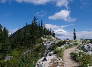
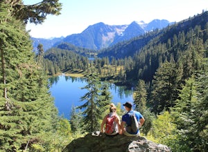
10.4 mi / 2100 ft gainStarting in the parking lot at Steven's Pass Ski Resort (roughly 4,062 feet in elevation; I recommend parking in E lot), start by walking between the two main lodges towards the ski lifts. You'll see a trail on the northwest-facing slope that switches back across the mountain - this is the PCT. O...Read more -
Skykomish, Washington
Snowshoe Lake Valhalla
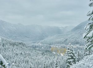
11.6 mi / 1500 ft gainYou start out at Stevens Pass just across the street from the lodge. The trailhead is slightly hidden but it is located to the left of the substation. Parking is plenty before ski-season. Once you are all geared up, you wanna hit the trail running cause this is a long one to snowshoe. With short...Read more -
Issaquah, Washington
West Tiger #3 (Cable Line Trail)
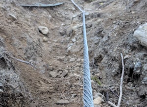
4.76 mi / 2051 ft gainIf you're looking for something with low-grade steepness, you're not going to find it here. Gaining over 2,000' in under 2 miles to the summit, this isn't for the faint of heart. The trail exists because of a buried cable, which has since been exposed and which you can see near the top of the t...Read more -
Leavenworth, Washington
Hike to the Summit of Mt. McCausland
8 mi / 1800 ft gainBegin by driving a fairly smooth Forest Road 6700 for 2.5 miles to the Smith Brook Trailhead and park in the space on the left. Much of the signage has been taken down along the trail, so it may be helpful to bring some written directions with you. The hike begins by keeping close to the road, me...Read more -
Skykomish, Washington
Pacific Crest Trail's Section J: Stevens Pass to Snoqualmie Pass
70.27 mi / 14911 ft gainThis is the Section J hike of the Pacific Crest Trail between Stevens and Snoqualmie Pass. It is about a 70 mile hike, and I started near Stevens Pass heading South. The PCT starts at the Stevens Pass Ski Resort off of Highway 2. The trail starts out under chairlifts and through ski runs – I chos...Read more -
Skykomish, Washington
Climb Slippery Slab Tower
13 mi / 4200 ft gainStart out at the Tunnel Creek trailhead. You will follow the trail for about 1.6 miles until you reach Hope Lake and the PCT. From here, you want to travel south along the PCT.For the next 3/4 of a mile, you will hike up switchbacks until you reach the saddle, where it will start to level out a b...Read more -
Snoqualmie, Washington
Rattlesnake Mountain Trail
4.010.54 mi / 2664 ft gainThe Rattlesnake Mountain Trail is often associated with Rattlesnake Ledge, one of the busiest hiking destinations around. But most people don't know that you can continue on from Rattlesnake Ledge another 10 miles to Snoqualmie Point Park. Using the Snoqualmie Point Trailhead, this hike is a wo...Read more -
Skykomish, Washington
Hike Mount Sawyer
8 mi / 1200 ft gainThis trail starts off going through the forest of fir and hemlock for the first mile. Once you reach the top of the first hill, you will get a glimpse of all the views you will have the opportunity to enjoy later on. As you descend, the trees will start to thin out. The trail follows the ridge l...Read more -
Marblemount, Washington
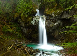
Hike Lazy Bear Falls
3.0To get to Lazy Bear Falls, take Bacon Creek Road off the North Cascade Highway for 5 miles. At the 3-way fork, take the left road, which will lead you down and over a bridge crossing Bacon Creek. From here, the road will require 4x4 and high clearance.From here, continue up the road for about 0.5...Read more -
Marblemount, Washington
Climb Eldorado Peak via the East Ridge
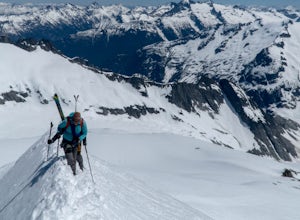
8 mi / 6800 ft gainStanding on the knife edge summit, the terrain around you plummets steeply into glacier-filled basins that trickle into turquoise alpine lakes. Serrated snowy peaks give way to forest covered valleys below that craft a rugged landscape. Eldorado Peak delivers you atop this wild and mountainous wo...Read more -
Concrete, Washington
Anderson and Watson Lake
5.68 mi / 1165 ft gainThe drive up to the starting point of the trail to Anderson and Watson Lake was easy, but at the end it gets a little tricky - the service road is sharp gravel and runs for about 10 miles to the trailhead. Some spots are steep and there are large potholes, but slow and steady wins the race. There...Read more -
Issaquah, Washington
Poo Poo Point
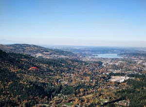
4.46.57 mi / 1880 ft gainThe Poo Poo Point trail is a great option for beautiful forest and great views only about 20 minutes outside of Seattle. The longer and less steep of the two routes to Poo Poo Point, this trail leaves from the Issaquah High School (the shorter and steeper Chirico Trail leaves from the paragliding...Read more -
Bellevue, Washington
Anti-Aircraft Peak Loop
4.53.53 mi / 436 ft gainHead up the road about .75 miles and take a left onto the Klondike Swamp Trail (well-singed). Stay on Klondike for a mile before taking a left onto Lost Beagle Trail. From here the trail climbs uphill and wraps around the edge of the park, offering views of the surrounding area. Hop on Shangri-La...Read more -
Seattle, Washington
Discovery Park Beach
4.32.39 mi / 535 ft gainDiscovery Park and its beach area great for walking, running, photography, and taking in a sunset. If you want to put your feet in the sand, head down to the western most part of the park. This beach is a sand beach with an iconic lighthouse at the end. Dirftwood also washes up on the beach provi...Read more -
North Bend, Washington
Little Si
3.64.01 mi / 1250 ft gainLittle Si, neighbor to the bigger Mount Si is a decent hike for beginners and families with younger children. It is 4.7 miles round trip (including Boulder Garden Loop - 1.5 miles) gaining 1300ft in elevation - Discover Pass required. This trail is very popular, so if you want seclusion avoid thi...Read more -
Bellevue, Washington
Coal Creek Trail
4.05.55 mi / 545 ft gainThis trail takes you through Coal Creek park and follows the creek along the trail with minimal elevation gain. This trail can also be accessed from the northern end of the park if that's a more convenient drive. For the lower parking lot, park at the Red Town lot (exit 13 off I-90) and cross the...Read more

