Verlot, Washington
Looking for the best hiking in Verlot? We've got you covered with the top trails, trips, hiking, backpacking, camping and more around Verlot. The detailed guides, photos, and reviews are all submitted by the Outbound community.
Top Hiking Spots in and near Verlot
-
Granite Falls, Washington
Foggy Lake via Gothic Basin
4.59.78 mi / 3179 ft gainDrive the Mountain Loop Highway to Barlow Pass and park at the pass using your Northwest Forest Pass. (In early or late season, be aware of snow conditions at the pass and, more importantly, along the trail up to Gothic Basin.) From Barlow Pass, start hiking south past the trail gate and in the ...Read more -
Gold Bar, Washington
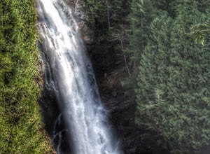
Wallace Falls
4.65.01 mi / 1404 ft gainThe trailhead is located at the far end of the parking lot, next to the info kiosk and bathrooms. It starts out in a wide-open area that shortly leads to stunning views of Mt. Index and Baring Mountain. The trail turns to the left and you're greeted by a beautiful Wordsworth quote carved into a t...Read more -
Gold Bar, Washington
Hike to Wallace Lake via Greg Ball Trail
4.58.2 mi / 1500 ft gainAn alluring State Park for its massive waterfall display, Wallace Falls is a high traffic destination along Highway 2, but don't overlook Wallace Lake as the falls steal the limelight. Head East on Highway 2, once you enter the town of Gold Bar keep on the lookout for the State Park signs and tu...Read more -
Darrington, Washington
Camp at Goat Lake
4.310.4 mi / 1400 ft gainIf you just loved your day hike to Goat Lake so much that you want to return and spend some more time, you're in luck - the lake offers a camping area that holds at least 15 campsites and even comes with a pit latrine. This is a great overnight option if you aren't looking for a difficult hike in...Read more -
Darrington, Washington
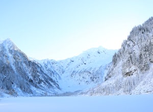
Winter Hike to Goat Lake
4.010.4 mi / 1400 ft gainThis trail is a perfect winter hike for the average outdoorsmen. Be warned that the most difficult part of this hike is getting to the trailhead in winter. The Mountain-loop highway can be a dangerous drive with black ice, snow, and serious potholes along the way. Take proper precautions like cha...Read more -
Darrington, Washington
Hike to Goat Lake
4.510.4 mi / 1400 ft gainThe trail starts by lazily winding through beautiful forest. Fairly quickly, you'll reach a fork for the Upper and Lower Elliot Creek Trails. Both will take you to Goat Lake in about the same distance (~3 miles), but each offers a different take on the area. The lower trail winds along as it foll...Read more -
Darrington, Washington
Scramble Mount Pugh
5.011 mi / 5300 ft gainNot for the faint of heart - or those with a fear of heights - Mount Pugh offers some of the most rewarding summit views in the Cascades.Located off the northern end of the Mountain Loop Highway, this is an easy day trip from anywhere in the Puget Sound area. Though finding the trailhead can be t...Read more -
Snohomish County, Washington
Hike to Glacier Basin
13 mi / 2600 ft gainStart off by traveling down the Mountain Loop Highway, arriving at the Barlow Pass Trailhead. You will walk about 200ft to reach an old gated road. This road will lead you towards Monte Cristo. About 1.5 miles down the road, the road will start to turn into a trail that runs along the river. You ...Read more -
Gold Bar, Washington
Scramble up Mt. Persis
4 mi / 2658 ft gainThere isn’t a clearly designated trail to start this scramble/hike. Look for the trail that more resembles a boot path. The trail won’t be well marked, but there might be some orange tape or markers to help you find your way.During the first mile of the hike, you’ll see the most elevation gain, s...Read more -
Sultan, Washington
Heybrook Ridge
3.71 mi / 856 ft gainAlthough short, this new trail is a great warm-up to the many other trails this area has to offer. Starting immediately across the North Fork Skyhomish River at the new trailhead, you will make your way up this moderately steep hike to the Heybrook Ridge. once you reach the top of the trail, you ...Read more -
Gold Bar, Washington
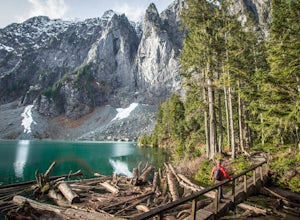
Lake Serene and Bridal Veil Falls
4.87.74 mi / 2569 ft gainConsider this a must-do if you are in Seattle and feel like knocking out two amazing hikes AND getting to see a hidden lake all along US 2. The trail starts out on an old road with the typical amazing forest surrounding you. After roughly 2 miles the road will end and you can go right (signage i...Read more -
Darrington, Washington
Climb Sloan Peak via the Corkscrew Route
5.014 mi / 6035 ft gainYou'll start the approach to this climb at the Sloan Peak trailhead at 1800ft elevation. Moving south along the trail, you'll begin with a traverse through some marshlands and several water crossings along the Sauk River and its tributaries for the first mile and before gaining any elevation. It ...Read more -
Gold Bar, Washington
Heybrook Lookout
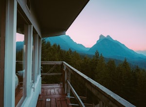
4.72.47 mi / 984 ft gainTo the trailhead, drive east on highway 2 from Everett. Just past milepost 37 you will see a gravel parking area on the left side of the highway. Wander through a mossy forest that reminds me of Olympic National Park and traverse up 1.3 miles of switch backs to ascend heybrook lookout! Dogs ar...Read more -
Darrington, Washington
Backpack to Glacier Peak Meadows and White Chuck Glacier
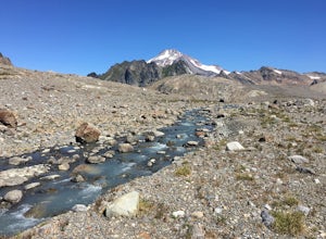
34 mi / 9000 ft gainStarting at the North Fork Sauk Trailhead (NFD 49) off the Mountain Loop Highway, you will travel 5.3 miles and gain a leisurely 1,100 feet of elevation until you reach Mackinaw Shelter. This is where the real work begins. The trail gains a calf-burning 3,000 feet in the next 2.9 miles until you ...Read more -
Gold Bar, Washington
Blanca Lake
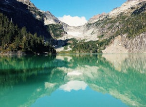
5.07.42 mi / 3540 ft gainAlthough the drive to the trailhead is mostly over gravel roads, Blanca Lake is a very popular hike. The drive is better for cars with clearance and AWD capabilities. The trail gets right down to it gaining almost 3,000 feet in the first 3 miles. But don't worry, the hard work is well worth the...Read more -
Gold Bar, Washington
Winter Backpack to Blanca Lake
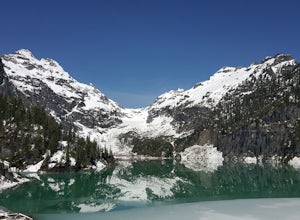
7.5 mi / 3300 ft gainSince Blanca Lake is a very popular place for folks to explore and with the nice and sunny weekend. I drove out Friday night and slept in my Jeep. Got up at 7:30am when folks first started arriving to the trail head.A couple of things to keep in mind before you start this hike. The 7.5 miles ro...Read more

