Snoqualmie Pass, Washington
Top Spots in and near Snoqualmie Pass
-
North Bend, Washington
5.0
10.61 mi
/ 3629 ft gain
Starting at the McClellan's Butte Trailhead, right off of I-90 exit 47, head out on the main (only) trail at the trailhad. The first half mile of the trail is quite easy as it meanders through the forest, but don't be fooled or worried, it will get harder. This first half mile has a crossing of a...
Read more
-
Snoqualmie Pass, Washington
This trail features beautiful wildflower meadows during the summer season and is relativity low trafficked. Bring your hammock for breathtaking views from the lookout and catch an incredible sunset. The summit has no established camping spots, so if staying overnight prepare to sleep on uneven gr...
Read more
-
Snoqualmie Pass, Washington
5.0
18.91 mi
/ 3058 ft gain
Depending on when you arrive at the Pete Lake Trailhead, expect to be traveling with company as it is one of the more popular locations on the eastside of Snoqualmie Pass. At an elevation of 2600 feet, the beginning route is a moderate 400 feet of elevation gain.
Start on your way through the va...
Read more
-
Snoqualmie Pass, Washington
The Owhi Campground on Cooper Lake is tucked away in the Okanogan-Wenatchee National Forest near Salmon La Sac. It sits at 2,788 feet and has views of Chikamin Peak (6960') and Lemah Mountain (7480'). The lake is quiet, very photogenic, and easily accessible.
The campground is on the north si...
Read more
-
North Bend, Washington
You can reach this area off I-90. Take exit 38. If you are coming from the west (Seattle) take a right after exiting the highway and continue for about 2 miles. You will drive under I-90 and then come to a parking area. This is it! If you are coming from the east it's even easier, turn right...
Read more
-
North Bend, Washington
This beautiful tucked-away trail offers runners, hikers, and backpackers a new view of their favorite neighboring peaks - like Mailbox Peak and Mt. Si - from one of the most scenic river trails in the Seattle area.
Often overlooked in favor of more rigorous hikes, the Middle Fork is a gently gra...
Read more
-
North Bend, Washington
Sport Climbing at Exit 38, the Deception Crags Area, is an amazing area to climb within 1/2 hour drive of downtown Seattle. It is an amazing resource for climbers living in Seattle, as during the spring, summer, and fall, it can be reached quickly afterwork, with minimal traffic.There are 5 disti...
Read more
-
North Bend, Washington
4.0
8.37 mi
/ 853 ft gain
The hike begins at Snoqualmie Lake Trailhead, but you'll actually have to start your hike about a half mile down the road from the trailhead as some cement barricades are up. There is plenty of room to park below the barricades, and the walk up to the trial head is easy and quick.
Once at the tr...
Read more
-
North Bend, Washington
This one can be a bit tricky to find. The trailhead is unmarked and is a bit hidden around a curve of Middle Fork Road so it is easy to miss. At about 9.80 miles from the junction of 468th St. and Middle Fork Road, look for two signs on the right warning of upcoming gravel patches (probably will ...
Read more
-
Ronald, Washington
This area is a very secluded camp area, so unless it's a holiday weekend, be prepared to be alone :) It is a very quiet lake and along the roadside there are plenty of spots to hike, camp, and fish by the lake or the Cle Elum river.So bring your day hiking gear and pole as well and head out in th...
Read more
-
Ronald, Washington
5.0
26.47 mi
/ 2300 ft gain
Nestled in a high rocky cirque near the upper reaches of Mt Daniel, Spade and Venus Lakes are two of the most remote lakes in the Alpine Lake Wilderness. But to experience this level of pure isolation, you'll need to earn it; the shortest hike in to the lakes is 14 miles, the majority of which i...
Read more
-
North Bend, Washington
This is an abandoned trail that heads south along Rainy Creek, off of the downstream section of the Middle Fork Snoqualmie Trail, and up to Rainy Lake. The lake is popular among fisherman, since it is home to lots of trout, but be warned -- route-finding skills are a must on this trip. I do my be...
Read more
-
North Bend, Washington
4.3
2.89 mi
/ 3058 ft gain
You start out at an elevation of about 1200 feet and you gradually make your way up to the top at 4450 feet. You are hiking through forest land the whole time with peaks of a beautiful view to the north every so often. Along the way there are many rock walls which you can climb at, however on our...
Read more
-
North Bend, Washington
4.4
4.96 mi
/ 3898 ft gain
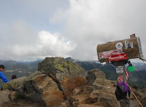
Note this adventure covers the old route. For the updated route, check out Hike Mailbox Peak New Trail.
Take exit 34 from I-90. Head north on 468th Ave SE until the intersection with the SE Middle Fork Road. Turn right onto the Middle Fork Road. Follow SE Middle Fork Road 2.2 miles to the stop ...
Read more
-
North Bend, Washington
4.2
10.53 mi
/ 4127 ft gain
*Disclaimer this article is in regards to the newly built trail.* For the old trail, head to Hike Mailbox Peak.
Just off of exit 34, Mailbox Peak offers a birds-eye view of the surrounding area. This hike begins at a mere 800 ft. above sea level and by the time you are done you are nearly touch...
Read more
-
Skykomish, Washington
The trail was not crowded although when we got to Snoqualmie Lake there were only a couple camping spots left. The trail up from Dorothy is not too hard at all. The weather was perfect. After passing Dorothy you have to ford a creek where the bridge has been washed out. We went through it on foot...
Read more

