Washington
Looking for the best photography in Washington? We've got you covered with the top trails, trips, hiking, backpacking, camping and more around Washington. The detailed guides, photos, and reviews are all submitted by the Outbound community.
Top Photography Spots in and near Washington
-
Concrete, Washington
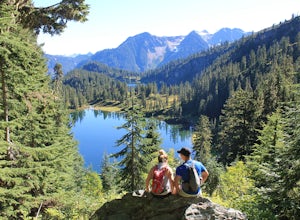
Anderson and Watson Lake
5.68 mi / 1165 ft gainThe drive up to the starting point of the trail to Anderson and Watson Lake was easy, but at the end it gets a little tricky - the service road is sharp gravel and runs for about 10 miles to the trailhead. Some spots are steep and there are large potholes, but slow and steady wins the race. There...Read more -
North Bend, Washington
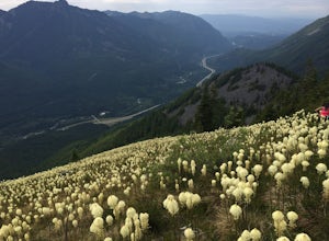
Bandera Mountain
4.47.8 mi / 3176 ft gainThis hike has unreal views of Mount Rainier. On a great clear spring day, the mountain is out. It's right in your face. It's incredible. If you tackle this hike in the spring the bear grass and wildflowers are alive and blooming towards the top and it makes for some fantastic picture-taking. Once...Read more -
North Bend, Washington
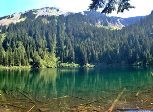
Annette Lake
4.57.2 mi / 1923 ft gainFrom Seattle drive east on I-90 to exit 47 (Asahel Curtis/Denny Creek). Turn right from the off-ramp and continue 0.25 mile, then turn left on Forest Road 5590. You'll find the parking area in 0.3 mile. Between the thick second-growth forest stands and the high alpine lake, the trail rolls along...Read more -
Forks, Washington
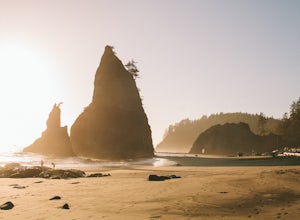
Rialto Beach to the Sea Stacks
4.71.06 mi / 26 ft gainBefore you start this hike, you'll need to pick up a permit at the Wilderness Information Center in Port Angeles, WA - (360) 565-3100. The trail itself starts at Rialto Beach, which is at the end of Mora Road in La Push. There's a large parking lot for overnight campers so there shouldn't be any ...Read more -
Leavenworth, Washington
Aasgard Pass via Stuart Lake Trail
3.511.15 mi / 4560 ft gain“These fleetingly rare sights offer a recipe for what I call ‘the Quest.’ The Quest is the force that motivates us to travel. It’s putting oneself in the perfect place at the perfect time. It’s the insatiable urge to find that quintessential moment.” - Washington AAA Journal The arrival of “gold...Read more -
Anacortes, Washington
Hike to the Summit of Mt. Erie
4.05 mi / 900 ft gainTo start this hike, jump on trail 215 for a short distance of about a 1/4 mile. From here, continue until you cross trail 320 and head left onto it. Stay on 320 until you come across trail 230.Take 230 uphill (resembles an old fire road) toward the ravine just above a creek. From here, head onto ...Read more -
Deming, Washington
Hike to Racehorse Falls
3.7Racehorse Creek is broken up into four distinct waterfalls that drop a total of 140ft through a relatively shallow gorge. The first two waterfalls are punchbowl-type falls that have deep holes at their bases. Immediately below the second waterfall, the creek descends rapidly before it arrives at...Read more -
Washtucna, Washington
Explore #thatnwbus
4.2A broken down, graffiti covered, abandoned school bus! Located 7 miles southwest of Washtucna, WA resides the social media named & famed, #thatnwbus. It's easy to find, easy to walk to and very close to Palouse Falls; a very popular and stunning Washington attraction. The bus is right off of ...Read more -
Spokane, Washington
Hike along Iller Creek
5.05 mi / 1200 ft gainIller Creek hike leads you on a 5 mile loop through lush shaded forest to a ridge with excellent views of the Eastern Washington Palouse. I love the variety of trees through the forest on this hike! Half way through the hike you reach the Big Rocks (Rocks of Sharon) which is a popular rock clim...Read more -
Liberty Lake, Washington
Hike Liberty Lake Loop
5.08 mi / 1200 ft gainThis 8 mile loop hike begins from Liberty Lake Regional Park, just 30 minutes away from Spokane! The first mile follows a dry grassy meadow and swamp. Make sure and look for beaver dams and houses! The trail winds up into the hills above Liberty Lake. At 2.0 miles, you reach one of Spokane's ...Read more -
Ellensburg, Washington
Hike Umtanum Creek Canyon
4.53 mi / 500 ft gainPark your vehicle at the Umtanum Creek Canyon Recreation Area. Be aware that from mid-May to mid-September there is a $5.00 per vehicle, per day parking fee since the land is owned by Bureau of Land Management.Grab your gear and head for the swinging suspension bridge that will lead you over the ...Read more -
Arlington, Washington
Three Fingers Lookout
4.514.31 mi / 4357 ft gainApproximately 11 miles east of Granite Falls, WA, on the Mt. Loop Highway, turn onto Forest Service road 41 and follow this road for 18.0 miles to the trailhead. The road is quite rough and it is recommended you have a four-wheel drive vehicle. There is a washout about halfway along the road, an...Read more -
Darrington, Washington
Hike to Goat Lake
4.510.4 mi / 1400 ft gainThe trail starts by lazily winding through beautiful forest. Fairly quickly, you'll reach a fork for the Upper and Lower Elliot Creek Trails. Both will take you to Goat Lake in about the same distance (~3 miles), but each offers a different take on the area. The lower trail winds along as it foll...Read more -
Yacolt, Washington
Hike Silver Star Mountain via Grouse Vista
4.56 mi / 2000 ft gainThe Grouse Vista Trailhead is located through the town of Washougal off of highway 14 just past Camas. Once you leave the city, the road will turn to gravel and dirt though it is fairly well maintained until snow arrive and accessible by most cars so long as you're willing to get drive over loose...Read more -
Randle, Washington
Hike to Goat Lake, Goat Rocks Wilderness
3.710.5 mi / 1400 ft gainThe trip to Goat Lake starts at the Walupt Lake campground parking lot. You will start on the Walupt Lake Trail (#101) and a short distance from the campground, take Trail #98 (Nannie Ridge) as it branches off and climbs steeply northeast onto an open, scenic ridge top.Continue on to Sheep Lake, ...Read more -
Brinnon, Washington
Rocky Brook Falls
4.80.25 mi / 141 ft gainTo find the falls, head north up Hwy. 101 past Brinnon, Washington and hang a left at Dosewallips Rd. Keep an eye on the mile markers. Right after mile three and crossing a small bridge, there's a parking area on the left side enough for about 6 cars. The hike to Rocky Brook Falls is a short on...Read more

