Washington
Looking for the best photography in Washington? We've got you covered with the top trails, trips, hiking, backpacking, camping and more around Washington. The detailed guides, photos, and reviews are all submitted by the Outbound community.
Top Photography Spots in and near Washington
-
Ashford, Washington
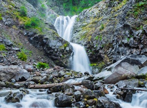
Hike to Comet Falls
5.0Located on Paradise Road along the south side of Mount Rainier, the Comet Falls Trail follows Van Trump Creek up to the magnificent Comet Falls. The hike is 3.8 miles round trip with 1250' of elevation gain.The trail starts off at 3650' and soon crosses over a bridge above Christine Falls. It qui...Read more -
Ashford, Washington
Backpack the Wonderland Trail
4.890 mi / 22000 ft gainPossibly one of the greatest loop hikes in the Lower 48, this trail sees a lot of use. You won't be alone out there, but opportunities for solitude are abundant with a little effort. The crowds show up for good reason - it's incredibly beautiful, relatively wild, and about as close to feeling l...Read more -
Ashford, Washington
Hike to Upper Palisades Lake
6.6 mi / 1200 ft gainPark at the Sunrise Point parking lot and find the Palisades Trail at the northeast corner of the parking lot. If you bring along a pair of binoculars, you can stop at the first overlook on the left and scan the adjacent mountain slopes for the white dots of mountain goats. Continue down the trai...Read more -
North Bend, Washington
Snoqualmie Mountain
4.32.87 mi / 3054 ft gainFor this hike, you park at the same parking lot as the Snow Lake hike. The trailhead to Snoqualmie Mountain is an unmarked trail just 30 feet or so before the Snow Lake trail. This is a tough hike even though its only a ~4 mile out and back trip because you gain 3100 feet to reach the summit. Th...Read more -
Cougar, Washington
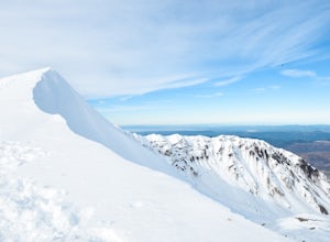
Mount St. Helens Summit via Monitor Ridge
4.48.64 mi / 4652 ft gainMonitor Ridge is the "easiest" of the routes one can take in order to claim that they have stood on top of the sleeping giant better known as Mount St. Helens. This route is heavily favored over Worm Flows as the starting elevation is not only an additional 1,000 feet higher but the overall asce...Read more -
Mason County, Washington
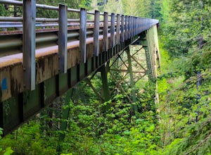
High Steel Bridge
4.5Located about 20 minutes outside of Shelton, Washington on US Forest Service Road NF-2340. To get there, head North on Highway 101 and exit onto W Skokomish Valley Rd. about 12 miles (or 20 minutes) after passing Shelton. W Skokomish Valley Road will take you through a beautiful area of farml...Read more -
Granite Falls, Washington
Foggy Lake via Gothic Basin
4.59.78 mi / 3179 ft gainDrive the Mountain Loop Highway to Barlow Pass and park at the pass using your Northwest Forest Pass. (In early or late season, be aware of snow conditions at the pass and, more importantly, along the trail up to Gothic Basin.) From Barlow Pass, start hiking south past the trail gate and in the ...Read more -
Leavenworth, Washington
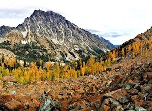
Day Hike to Lake Ingalls
4.39 mi / 2500 ft gainFrom the parking lot you start out on an old miners road that leads to the trail. Keep right at the first fork (left lead to Esmeralda Basin), then in about 2 miles, go left at the next fork (right leads to Ingalls Pass). The trail will climb steadily as you continue. In about another mile you wi...Read more -
Deming, Washington
Hike to Table Mountain via Artist Point
5.03 mi / 560 ft gainThe hike takes off from the Artist Point parking lot at an elevation of 5,220 feett.The trail slowly meanders up for a while until reaching the final steep switchbacks where you'll have a sheer cliff to your side—don't let it distract you, and keep focused on the trail in front of you!Once you've...Read more -
Skykomish, Washington
Hike to Big Heart Lake
5.014.6 mi / 3300 ft gainThis hike takes you past 5 lakes and a few different waterfalls, so if you don't wish to push on to Big Heart, you won't be disappointed! Start at the West Fork Foss River Trailhead, about 2.6 miles past the Necklace Valley Trailhead. The first mile is relatively flat. Once you reach the bridge t...Read more -
Olga, Washington
Hike to the Mount Constitution Summit
5.07 mi / 1500 ft gainThis 7 mile round-trip hike takes you to the mountain's summit. From here you'll be able to take in an amazing view. During the hike, you'll head around the left side of Mountain Lake, and then continue on to Twin Lakes, before starting your jaunt to the top of Mt. Constitution. The hike around ...Read more -
Port Angeles, Washington
Hike to Elk Mountain from Obstruction Point
5.04 mi / 644 ft gainOlympic National Park is built for someone with a week or more to spare for backpacking deep into the heart of the park's endless miles of wilderness. Between the mountains, the coast, and the rainforest, there is a lot of park to see for someone who is trying to fit their visit into an extended ...Read more -
Skamania County, Washington
Hike to the Summit of Mount Adams via South Climb
5.012 mi / 6700 ft gainStart by checking in at the Trout Lake Ranger station to pick up a Cascade Volcanoes pass for $10-$15. Continue the South Climb trailhead at the Cloud Cap Campground. Some hikers overnight here for an early start the next day.Sign out a wilderness permit at the trailhead and follow the South Clim...Read more -
Marblemount, Washington
Thornton Lakes & Trappers Peak
3.710.57 mi / 3885 ft gainTo get to your campground or to Trappers Peak, hike roughly five miles along the trail to ridge, where the trail divides. If you head left you'll go down into lake basis where you can drop your gear. Come back to the divide and head right, which will lead you up to trappers peak. Something to ke...Read more -
Ashford, Washington
Hike to Spray Park
5.07 miThe trailhead to Spray Park begins at the Mowich Lake Campground (4,929 ft). You'll begin descending quickly for the first 0.1 miles until you reach the Wonderland Trail junction. Head left and make your way up a steady climb for the next 1.7 miles. The first stop you'll come across is Eagle Clif...Read more -
Neah Bay, Washington
Hobuck Beach
4.0Cape Flattery, the most northwesterly point of the lower contiguous 48 states is accessed via an easy trail which includes many board walks and sets of stairs. Maintained by the Makah Tribe of Indains, the trail provides spectacular views of the Pacific Ocean, Tatoosh Island, nearby rocky cliffs...Read more

