Easton, Washington
Top Spots in and near Easton
-
Leavenworth, Washington
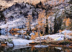
Hike to the Enchantments' Horseshoe Lake
1.016 mi / 6000 ft gainGetting There From Leavenworth, WA, drive Icicle Creek Road for 8.5 miles until you reach Bridge Creek Campground. Turn left here onto Forest Service Road #7601 signed for the Stuart Lake Trailhead. The pavements ends and the road gains elevation quickly as your car transports you high above the ...Read more -
Leavenworth, Washington
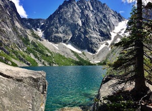
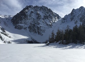
Colchuck Lake via Stuart Lake Trail
4.48.13 mi / 2156 ft gainTo reach the trailhead, turn onto Icicle Creek Road from US2. Drive 8.4 miles and turn left onto Forest Service Road 7601. Follow the potholed dirt road 3.7 miles to the Stuart Lake trailhead. Parking for about 20-30 cars and a toilet are available in the lot. Northwest Forest Pass required. The...Read more -
Leavenworth, Washington
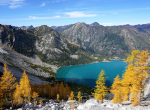
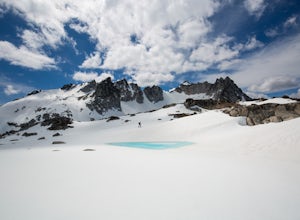
Aasgard Pass via Stuart Lake Trail
3.511.15 mi / 4560 ft gain“These fleetingly rare sights offer a recipe for what I call ‘the Quest.’ The Quest is the force that motivates us to travel. It’s putting oneself in the perfect place at the perfect time. It’s the insatiable urge to find that quintessential moment.” - Washington AAA Journal The arrival of “gold...Read more -
Leavenworth, Washington
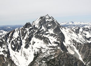
Climb to the Summit of Colchuck Peak
12.5 mi / 5300 ft gainGetting There: From US2 in Leavenworth, Washington, turn onto Icicle Creek Rd. Drive 8.2 miles and turn left on Forest Service Road 7601—you might be able to spot it more easily as the turnoff for the Bridge Creek Campground. In 3.7 miles, you'll arrive at the Stuart Lake Trailhead parking lot; w...Read more -
Leavenworth, Washington
Snowshoe to Colchuck Lake
3.316 mi / 3000 ft gainFrom Leavenworth, head south on Icicle Creek rd for 8.2 miles until you reach USFS rd 7601. This road isn't plowed and is blocked by a locked gate about one quarter mile from where it intersects with Icicle Creek Road (usually from November to May), so parking at the intersection is probably your...Read more -
Leavenworth, Washington
Ski Tour the Enchantments
5.0The Enchantments is one of the most beautiful spots in Washington, but rarely visited outside the summer months, when access is merely difficult. But for those brave souls with the knowledge and determination to ski these hallowed slopes, the experience is surreal.The approach up Aasgard Pass is ...Read more -
North Bend, Washington
Sport Climbing at Exit 38, Deception Crags Area
4.0Sport Climbing at Exit 38, the Deception Crags Area, is an amazing area to climb within 1/2 hour drive of downtown Seattle. It is an amazing resource for climbers living in Seattle, as during the spring, summer, and fall, it can be reached quickly afterwork, with minimal traffic.There are 5 disti...Read more -
Leavenworth, Washington
Backpack to Lake Caroline in the Enchantments
5.75 mi / 3100 ft gainFrom Leavenworth, WA head down Icicle Creek road and head to the Eightmile Lake Trailhead.The backpack starts at roughly 3270 feet of elevation and the highest point of the hike is 6300 feet. To start you will hike through a very beautiful and forested area for a while before getting into a burn ...Read more -
Leavenworth, Washington
Eightmile Lake
4.06.76 mi / 1496 ft gainBeginning at the trailhead, fill out a self-issued permit allowing you to stay overnight. Start your trek heading upwards at an elevation of 3300 feet. As you become adapted to the trail, you will start to realize it is maintained and well groomed. In addition, The 1300 feet of elevation gained t...Read more -
Leavenworth, Washington
Climb Cashmere Mountain
4.017 mi / 5700 ft gainTo get to Cashmere Mountain, drive east towards Leavenworth on Highway 2 and turn right on Icicle Creek Road. After 8.5 miles, turn left onto Eightmile Road for 3 miles, and park at the Eightmile Lake trailhead. The hike begins at Eightmile Lake Trail. After 2.8 miles, just past Little Eightmile ...Read more -
North Bend, Washington
Hike Mount Washington
4.32.89 mi / 3058 ft gainYou start out at an elevation of about 1200 feet and you gradually make your way up to the top at 4450 feet. You are hiking through forest land the whole time with peaks of a beautiful view to the north every so often. Along the way there are many rock walls which you can climb at, however on our...Read more -
Enumclaw, Washington
Hike Grand Park and Lake Eleanor
9 mi / 1100 ft gainPrepare in advance to hold your jaw from dropping. Stunning views of Mt. Rainier await visitors of Grand Park. A quick jaunt through the forest via the trailhead leads first to Lake Eleanor. Well groomed campsites are available for overnight stays.Head past Lake Eleanor and you're on the way to G...Read more -
North Bend, Washington
Middle Fork Snoqualmie River Trail
27.57 mi / 3609 ft gainThis beautiful tucked-away trail offers runners, hikers, and backpackers a new view of their favorite neighboring peaks - like Mailbox Peak and Mt. Si - from one of the most scenic river trails in the Seattle area. Often overlooked in favor of more rigorous hikes, the Middle Fork is a gently gra...Read more -
Enumclaw, Washington
Crystal Peak Trail
7.49 mi / 2966 ft gainMake sure you are going out on a clear day to catch the best views of the mountains, and bring your camera! From the summit, it’s possible to see six volcanoes spanning two states. Baker, Glacier, Adams, Rainier, St. Helens and Hood wait patiently for you to climb the more-than-moderately steep p...Read more -
Skykomish, Washington
Backpack from Dorothy Lake Trailhead to Snoqualmie Lake
18 mi / 1900 ft gainThe trail was not crowded although when we got to Snoqualmie Lake there were only a couple camping spots left. The trail up from Dorothy is not too hard at all. The weather was perfect. After passing Dorothy you have to ford a creek where the bridge has been washed out. We went through it on foot...Read more -
Skykomish, Washington
Hike to Lake Deer via Lake Dorothy Trailhead
12.6 mi / 1600 ft gainStart off by traveling along Highway 2 and turning towards the Money Creek Campground. Turn off onto Forest Road 6410 and follow that to the Lake Dorothy Trailhead (about 9 miles).This first section of the hike can be pretty crowded on a nice summer day as the trail is very family friendly and it...Read more

