Easton, Washington
Top Spots in and near Easton
-
Ronald, Washington
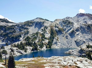
Trail Run to Robin Lakes
17 mi / 4100 ft gainStarting Elevation: 3400 Feet Ending Elevation: 6178 Feet Round Trip Run: 17 Miles Total Elevation Gained for the Day: 4100 FeetIt's best to drive to the trailhead the night before and camp out (I slept in my Jeep to get an early start on the next morning). The parking lots are jammed full on the...Read more -
Ronald, Washington
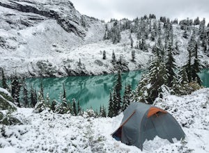
Winter Backpack to Jade Lake
4.022 mi / 4000 ft gainStarting at the Hyas Lake trailhead north of Cle Elum, it's a meandering easy hike through the woods for about 5.0 miles up to Deception Pass. You gain 1100 feet through this first five miles to the junction with the PCT. From here take a left to continue on the Lake Clarice Trail towards Marmot...Read more -
Enumclaw, Washington
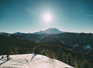
Snowshoe to Sun Top Peak
12 mi / 2000 ft gainFrom Tacoma, Wa. take Hwy 167 to Hwy 410 and follow that until you get to the Chinook Pass Hwy. Then from there follow this road and take the second Service Road on the right and follow this road until it dead ends. The trail starts on NF-7315. You have to walk this road until you reach the first...Read more -
North Bend, Washington
McClellan Butte
5.010.61 mi / 3629 ft gainStarting at the McClellan's Butte Trailhead, right off of I-90 exit 47, head out on the main (only) trail at the trailhad. The first half mile of the trail is quite easy as it meanders through the forest, but don't be fooled or worried, it will get harder. This first half mile has a crossing of a...Read more -
North Bend, Washington
Summit Mt. Defiance
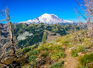
5.011 mi / 3300 ft gainThis hike offers some of the best views one can see in the area. On a clear day, you'll get amazing views of Mt. Rainier. The best part is that as you start heading uphill in the first half mile, you'll get great views of McClellan Butte. Once you reach the summit of Defiance at 5584 feet, you'll...Read more -
North Bend, Washington
Bandera Mountain
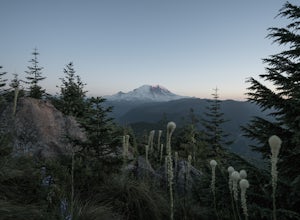
4.47.8 mi / 3176 ft gainThis hike has unreal views of Mount Rainier. On a great clear spring day, the mountain is out. It's right in your face. It's incredible. If you tackle this hike in the spring the bear grass and wildflowers are alive and blooming towards the top and it makes for some fantastic picture-taking. Once...Read more -
North Bend, Washington
Mason Lake via Ira Spring
4.26.88 mi / 2316 ft gainIra Spring trail offers up great views prior to reaching the ridge that you go over to reach Mason Lake. The lake itself is an amazing sight—beautiful water with rocks and trees along the shores, making this 6.5-mile roundtrip hike well worth it. The trail to Mason Lake, the Ira Spring trail, pr...Read more -
North Bend, Washington
Camp and Trail Run from Rainbow Lake
I backpacked to and setup basecamp at Rainbow Lake and then I ran over to Island Lake. After enjoying the peace and quite I ran up to the top of Bandera Mountain and enjoyed the views. Then, I ran back to basecamp and spent the night. The following morning I ran up to the top of Mount Defiance a...Read more -
North Bend, Washington
Goldmyer Hot Springs
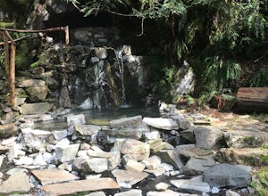
4.110.48 mi / 817 ft gainGoldmyer Hot Springs is a beautiful little gem nestled within the wilderness of the stunning Cascade Mountains. This hot springs complex is situated on the old remains of a mining town, and delivers steadily flowing water to a set of tiered pools along the mountainside. The “cave” pool at the top...Read more -
Enumclaw, Washington
Catch the Sunset at Suntop Lookout
5.0Catching a beautiful sunset has never been so easy. This lookout tower is accessible by vehicle. The road is fairly smooth too. No car would have any trouble getting up to the top. The last gate before the lookout tower/peak is about a mile down. The gate does close at 8pm but is ran by voluntee...Read more -
Enumclaw, Washington
Norse Peak via Silver Creek
7.77 mi / 2405 ft gainStart out in Crystal parking lot A. There is a small and steep trail that heads up the hill labeled as Silver Creek Trail. The trail follows a horse trail for the majority of the route and gets renamed Bullion Basin Trail shortly after you enter the woods, so when it doubt keep following the hoof...Read more -
North Bend, Washington
Swim in the South Fork of the Snoqualmie River
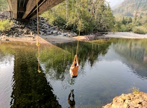
5.0You can reach this area off I-90. Take exit 38. If you are coming from the west (Seattle) take a right after exiting the highway and continue for about 2 miles. You will drive under I-90 and then come to a parking area. This is it! If you are coming from the east it's even easier, turn right...Read more -
Leavenworth, Washington
The Enchantments: Stuart Lake Trailhead to Snow Lake Trailhead
5.018.02 mi / 4626 ft gainThere are a couple different ways to tackle this hike through the stunning Central Cascade region. I recommend checking out this handy resource for more detailed info. Bottom line: this is an absolutely amazing hike for people willing to take a little bit of an ass kicking. Aasgard Pass rises 1,...Read more -
Leavenworth, Washington
Day Hike the Enchantments
5.018.05 mi / 4675 ft gainStart at the Stuart Lake trailhead, which at 3400' is a full 2000' higher than the Snow Lake trailhead you'll finish at. Put 2.5 easy miles under your feet along Mountaineer Creek before turning left on the trail up to Colchuck Lake. The trail steepens for the next 1.5 miles before popping you ou...Read more -
Leavenworth, Washington
Hike to Lake Stuart
4.89 mi / 1665 ft gainBegin this hike at the Lake Stuart trailhead at the end of Eightmile road just outside of Leavenworth, Washington. The trail follows Mountaineer Creek and leads you across a log bridge over the falls. After the bridge, the trail narrows and steepens through several switchbacks. After 2.2 miles...Read more -
Leavenworth, Washington
Scramble to the Summit of Dragontail Peak
16 mi / 7000 ft gainGetting There From Leavenworth, WA, drive Icicle Creek Road for 8.5 miles until you reach Bridge Creek Campground. Turn left here onto Forest Service Road #7601 signed for the Stuart Lake Trailhead. The pavements ends and the road gains elevation quickly as your car transports you high above the ...Read more

