Easton, Washington
Looking for the best photography in Easton? We've got you covered with the top trails, trips, hiking, backpacking, camping and more around Easton. The detailed guides, photos, and reviews are all submitted by the Outbound community.
Top Photography Spots in and near Easton
-
North Bend, Washington
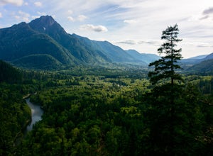
Hike Pratt Balcony
2.2 miThis one can be a bit tricky to find. The trailhead is unmarked and is a bit hidden around a curve of Middle Fork Road so it is easy to miss. At about 9.80 miles from the junction of 468th St. and Middle Fork Road, look for two signs on the right warning of upcoming gravel patches (probably will ...Read more -
North Bend, Washington
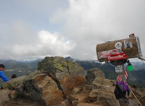
Mailbox Peak Old Trail
4.44.96 mi / 3898 ft gainNote this adventure covers the old route. For the updated route, check out Hike Mailbox Peak New Trail. Take exit 34 from I-90. Head north on 468th Ave SE until the intersection with the SE Middle Fork Road. Turn right onto the Middle Fork Road. Follow SE Middle Fork Road 2.2 miles to the stop ...Read more -
Skykomish, Washington
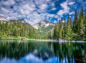
Hike to Big Heart Lake
5.014.6 mi / 3300 ft gainThis hike takes you past 5 lakes and a few different waterfalls, so if you don't wish to push on to Big Heart, you won't be disappointed! Start at the West Fork Foss River Trailhead, about 2.6 miles past the Necklace Valley Trailhead. The first mile is relatively flat. Once you reach the bridge t...Read more -
Skykomish, Washington
Hike to Foss River and Lakes
4.04.2 mi / 2400 ft gainChoose from Trout Lake (1.6 miles each way with 500 feet of elevation gain), Copper Lake (4.2 miles each way with 2400 feet of elevation gain), or Big Heart Lake at 7.3 miles each way, with 3300 feet elevation gain). There are plenty of camp sites if you decide to go overnight at any of the lakes...Read more -
North Bend, Washington
Mailbox Peak New Trail
4.210.53 mi / 4127 ft gain*Disclaimer this article is in regards to the newly built trail.* For the old trail, head to Hike Mailbox Peak. Just off of exit 34, Mailbox Peak offers a birds-eye view of the surrounding area. This hike begins at a mere 800 ft. above sea level and by the time you are done you are nearly touch...Read more -
Skykomish, Washington
Hike Mount Sawyer
8 mi / 1200 ft gainThis trail starts off going through the forest of fir and hemlock for the first mile. Once you reach the top of the first hill, you will get a glimpse of all the views you will have the opportunity to enjoy later on. As you descend, the trees will start to thin out. The trail follows the ridge l...Read more -
North Bend, Washington
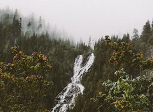
Twin Falls
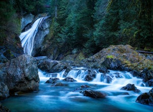
3.32.51 mi / 778 ft gainFor a portion of this 3-mile hike, you'll trek next to the South Fork Snoqualmie River, so take in the peaceful sound of the river running. Along the trail runs a river, where massive boulders create wading pools of icy water for warm summer days. At 1.5 miles, you'll reach a viewpoint bridge, wh...Read more -
Ashford, Washington
Hike to Upper Palisades Lake
6.6 mi / 1200 ft gainPark at the Sunrise Point parking lot and find the Palisades Trail at the northeast corner of the parking lot. If you bring along a pair of binoculars, you can stop at the first overlook on the left and scan the adjacent mountain slopes for the white dots of mountain goats. Continue down the trai...Read more -
Leavenworth, Washington
Hike Fourth of July Creek to Icicle Ridge
12 mi / 4800 ft gainMost adventurers travel down Icicle Creek Road to visit Colchuck Lake and the Enchantment Basin. But, if you're looking for an adventure for a cool summer morning without the crowds, continue past the Colchuck/Stuart forest road and explore this trail! Expansive views of the entire Stuart range...Read more -
Naches, Washington
Hike the Naches Peak Loop Trail
5.03.5 mi / 700 ft gainNaches Peak Loop Trail is a great introductory trail to Mount Rainier National Park situated on the Eastern side of Rainier. Half located within Mount Rainier NP and half within Okanogan-Wenatchee National Forest, Naches Peak is a 3.5 mile trail with minimal elevation gain (700ft) yet with views ...Read more -
Leavenworth, Washington
Winter Camping in Leavenworth
It's an easy day hike to the Ridge of only 2.5 miles. On the ridge you can relax and enjoy the view of the surrounding mountains and a view of Leavenworth. I went into the Rangers office to ask for a good spot to take night time photos and this is one of the areas they suggested. Make sure you ge...Read more -
Skykomish, Washington
Tank Lakes via Necklace Valley
18.94 mi / 4721 ft gainTucked high in the heart of the Alpine Lakes Wilderness, Tank Lakes has everything you could ask for out of a Washington hike. You start low at the Necklace Valley trailhead just south of Skykomish along Highway 2 and meander five miles to a giant log crossing of the East Fork Foss River. From h...Read more -
Enumclaw, Washington
Explore Tipsoo Lake
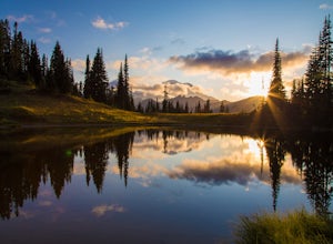
4.0Tipsoo Lake provides a great spot for capturing a sunset at Mount Rainier. There are two lakes at Tipsoo, with Upper Tipsoo Lake providing a better view of the Mountain. To access Upper Tipsoo Lake, drive past the main parking lot for Tipsoo Lake and park at the pullout around the bend on the sam...Read more -
North Bend, Washington
Drive Along the Middle Fork Snoqualmie River
5.0Some days you don't need to tackle a grueling summit or long mileage loop, just getting outside the city is enough. Driving forest roads is always an adventure and pays its dividend in seclusion, viewpoints, and peacefulness. The Middle Fork Snoqualmie (FR56) offers a photo enthusiast numerous pi...Read more -
King County, Washington
Teneriffe Falls (Kamikaze Falls)
4.55.64 mi / 1732 ft gainThe lesser known Mt Si Rd trail starts off as a relatively flat road. This continues for two miles until you reach the Teneriffe Falls sign. Upon turning right at this junction, the terrain takes a shift and the incline steepens. This is where most of the elevation is gained. The rest of the way...Read more -
Leavenworth, Washington
The Enchantments: Leprechaun Lake via Snow Lake Trailhead
4.719.57 mi / 5948 ft gainThe Alpine Lakes Wilderness named “The Enchantments” draws explorers from all over the world. On a four day backpacking trip you can take day trips from camp to explore over a dozen crystal clear lakes, summit surrounding peaks, and camp at an alpine lake of your choice! Before you set out to c...Read more

