Cle Elum, Washington
Looking for the best photography in Cle Elum? We've got you covered with the top trails, trips, hiking, backpacking, camping and more around Cle Elum. The detailed guides, photos, and reviews are all submitted by the Outbound community.
Top Photography Spots in and near Cle Elum
-
Wenatchee, Washington
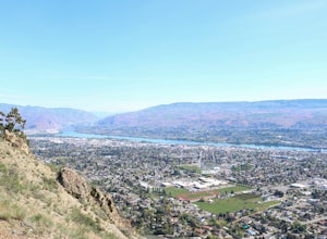
Hike to Saddle Rock
3.02 mi / 920 ft gainStarting from the south end of Wenatchee, hike straight up the obvious wide trail to the south side of Saddle Rock. You'll wind around the iconic rock feature and approach it from the back. A short and steep hike will reward you with wide open views of the Wenatchee Valley as you crest the hill...Read more -
Ellensburg, Washington
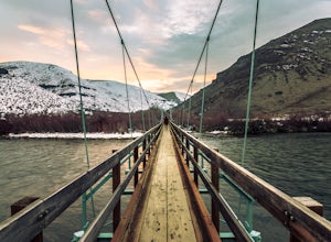
Hike Umtanum Creek Canyon
4.53 mi / 500 ft gainPark your vehicle at the Umtanum Creek Canyon Recreation Area. Be aware that from mid-May to mid-September there is a $5.00 per vehicle, per day parking fee since the land is owned by Bureau of Land Management.Grab your gear and head for the swinging suspension bridge that will lead you over the ...Read more -
Enumclaw, Washington
Catch the Sunset at Suntop Lookout
5.0Catching a beautiful sunset has never been so easy. This lookout tower is accessible by vehicle. The road is fairly smooth too. No car would have any trouble getting up to the top. The last gate before the lookout tower/peak is about a mile down. The gate does close at 8pm but is ran by voluntee...Read more -
Skykomish, Washington
Hike Mount Sawyer
8 mi / 1200 ft gainThis trail starts off going through the forest of fir and hemlock for the first mile. Once you reach the top of the first hill, you will get a glimpse of all the views you will have the opportunity to enjoy later on. As you descend, the trees will start to thin out. The trail follows the ridge l...Read more -
North Bend, Washington
McClellan Butte
5.010.61 mi / 3629 ft gainStarting at the McClellan's Butte Trailhead, right off of I-90 exit 47, head out on the main (only) trail at the trailhad. The first half mile of the trail is quite easy as it meanders through the forest, but don't be fooled or worried, it will get harder. This first half mile has a crossing of a...Read more -
North Bend, Washington
Summit Mt. Defiance
5.011 mi / 3300 ft gainThis hike offers some of the best views one can see in the area. On a clear day, you'll get amazing views of Mt. Rainier. The best part is that as you start heading uphill in the first half mile, you'll get great views of McClellan Butte. Once you reach the summit of Defiance at 5584 feet, you'll...Read more -
North Bend, Washington
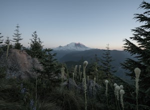
Bandera Mountain
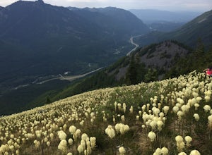
4.47.8 mi / 3176 ft gainThis hike has unreal views of Mount Rainier. On a great clear spring day, the mountain is out. It's right in your face. It's incredible. If you tackle this hike in the spring the bear grass and wildflowers are alive and blooming towards the top and it makes for some fantastic picture-taking. Once...Read more -
Wenatchee, Washington
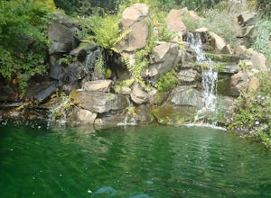
Stroll through Ohme Garden
This is a great place to take a stroll and stretch your legs. With waterfalls and other beautiful scenery, definitely make a stop here if you find yourself in the area. No pets allowed.Read more -
Skykomish, Washington
Hike to Big Heart Lake
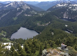
5.014.6 mi / 3300 ft gainThis hike takes you past 5 lakes and a few different waterfalls, so if you don't wish to push on to Big Heart, you won't be disappointed! Start at the West Fork Foss River Trailhead, about 2.6 miles past the Necklace Valley Trailhead. The first mile is relatively flat. Once you reach the bridge t...Read more -
Skykomish, Washington
Hike to Foss River and Lakes
4.04.2 mi / 2400 ft gainChoose from Trout Lake (1.6 miles each way with 500 feet of elevation gain), Copper Lake (4.2 miles each way with 2400 feet of elevation gain), or Big Heart Lake at 7.3 miles each way, with 3300 feet elevation gain). There are plenty of camp sites if you decide to go overnight at any of the lakes...Read more -
Wenatchee, Washington
Drive Up Burch Mountain
At the north end of the Wenatchee Valley, drive up Burch Mountain Road until it turns into dirt. It is closed in the winter and early spring due to snow, so make sure it's open before you go. Once you start driving, the mountain is your playground. Go all the way up to the trees or stop just h...Read more -
Naches, Washington
Hike the Naches Peak Loop Trail
5.03.5 mi / 700 ft gainNaches Peak Loop Trail is a great introductory trail to Mount Rainier National Park situated on the Eastern side of Rainier. Half located within Mount Rainier NP and half within Okanogan-Wenatchee National Forest, Naches Peak is a 3.5 mile trail with minimal elevation gain (700ft) yet with views ...Read more -
Skykomish, Washington
Backpack from Dorothy Lake Trailhead to Snoqualmie Lake
18 mi / 1900 ft gainThe trail was not crowded although when we got to Snoqualmie Lake there were only a couple camping spots left. The trail up from Dorothy is not too hard at all. The weather was perfect. After passing Dorothy you have to ford a creek where the bridge has been washed out. We went through it on foot...Read more -
Enumclaw, Washington
Explore Tipsoo Lake
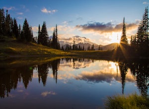
4.0Tipsoo Lake provides a great spot for capturing a sunset at Mount Rainier. There are two lakes at Tipsoo, with Upper Tipsoo Lake providing a better view of the Mountain. To access Upper Tipsoo Lake, drive past the main parking lot for Tipsoo Lake and park at the pullout around the bend on the sam...Read more -
Ashford, Washington
Hike to Upper Palisades Lake
6.6 mi / 1200 ft gainPark at the Sunrise Point parking lot and find the Palisades Trail at the northeast corner of the parking lot. If you bring along a pair of binoculars, you can stop at the first overlook on the left and scan the adjacent mountain slopes for the white dots of mountain goats. Continue down the trai...Read more -
Skykomish, Washington
Tank Lakes via Necklace Valley
18.94 mi / 4721 ft gainTucked high in the heart of the Alpine Lakes Wilderness, Tank Lakes has everything you could ask for out of a Washington hike. You start low at the Necklace Valley trailhead just south of Skykomish along Highway 2 and meander five miles to a giant log crossing of the East Fork Foss River. From h...Read more

