Stanardsville, Virginia
Top Spots in and near Stanardsville
-
Stanley, Virginia
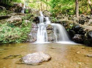
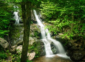
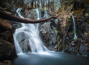
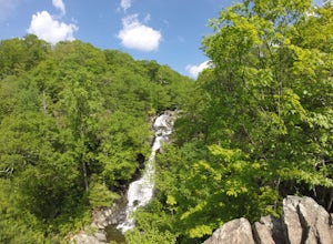
Dark Hollow Falls
4.61.32 mi / 440 ft gainCatch the trailhead to these falls at mile 50.7 on Skyline Drive, just north of Big Meadows Lodge and Campground and the trailhead is just to the left of the parking lot. This is an easy 1.4 mile roundtrip hike, straight down to get to the falls, and straight up to arrive back at your car. Many...Read more -
Stanley, Virginia
Camp at Big Meadows, Shenandoah National Park
4.4Visiting Shenandoah National Park for the first time can be quite overwhelming. The 109 mile long Skyline Drive, combined with over 500 miles of hiking trails, makes camping is a necessity if you truly want to experience Shenandoah.From the Appalachian thru-hiker to the RV'er, Big Meadows is perf...Read more -
Stanley, Virginia
Three Falls Hike
8.3 mi / 2200 ft gainThe Three Falls Hike in Shenandoah National Park will take you past three beautiful waterfalls all found within the central district of the park: Lewis Spring Falls, Dark Hollow Falls, and Rose River Falls. You are able to start the loop from any of the waterfalls’ trailheads, but I prefer to sta...Read more -
Crozet, Virginia
Hike to Jones Run Waterfall
4.02 mi / 800 ft gainThis little known waterfall is located close to the more popular waterfall, Doyles River Falls. Staring at the Jones Run parking area turn left downhill following the blue blazed Jones Run trail. After 1.7 miles you will reach the main waterfall. You can either stay here and enjoy the waterfall o...Read more -
Stanley, Virginia
Hike to Rose River Falls
4.54 mi / 853 ft gainRose River Falls is often overshadowed by it's more popular cousin, Dark Hollow Falls, as both hikes begin at the same trail head. But because Dark Hollow Falls is such a short and well known hike, it can get extremely crowded. It is also one of the few trails in Shenandoah where dogs are not al...Read more -
Stanley, Virginia
Hike the Rose River Falls to Dark Hollow Falls Loop
5.04 mi / 950 ft gainParking at the trailhead is a few miles north of Big Meadows at the Fisher's Gap Overlook parking area. You will find much more solitude along this loop trail than if you were to park at the Dark Hollow Falls trailhead as the Dark Hollow Falls is much more popular. That makes being able to fin...Read more -
Stanley, Virginia
Backpack Rose River Loop
5.04 mi / 900 ft gainThe trail can be found on Skyline Drive. Though it is a little challenging to locate, you should park at Fisher’s Gap Overlook (mile marker 49.4), and then walk over across the road and find the trail. You'll spot it by looking over the side of the road and then hiking down. The Rose River Loo...Read more -
Appalachian Trail, Virginia
Blackrock Summit, Shenandoah NP
4.71.11 mi / 253 ft gainThere are two route options, both are under 2 miles and are suitable for hikers of all experience levels. The shortest option, a 1-mile circuit, follows the Appalachian Trail from the Blackrock Summit parking area, which is just north of mile marker 85 on Skyline Drive. With only 175-feet of ele...Read more -
Luray, Virginia
Upper Hawksbill Trail
2.09 mi / 482 ft gainThe trailhead has a small parking area at mile marker 46.7 on Skyline Drive, just past the Old Rag overlook (on the opposite side of the road) if you're driving south. The hike is a 2-mile out-and-back that takes you right to the summit. The first ~2/3 of it is relatively flat and very easy walk...Read more -
Stanley, Virginia
Photograph Spilter Knoll Overlook
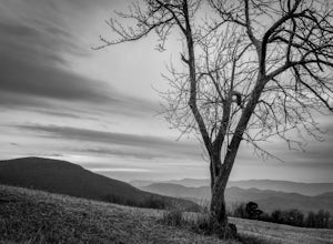
5.0The Spitler Knoll is one of 72 overlooks for people to enjoy as they travel through Shenandoah National Park along Skyline Drive. Skyline Drive is the road that winds through the heart of Shenandoah National Park, starting at Front Royal in the north and ending at Rockfish Gap in the south. This...Read more -
Syria, Virginia
Fly Fish on the Robinson River
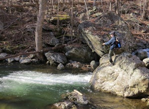
5.06 mi / 2000 ft gainThere are two sections that you can fish on the Robinson River. The first section is about 15 minutes away from the trailhead of White Oak Canyon. The river is on the right side of the road and you can see where it has bee stocked from the white diamonds on the trees on the side of the road. This...Read more -
Syria, Virginia
Hike Cedar Run Falls Trail
4.72.6 mi / 1000 ft gainCedar Run Falls is located in the central district of Shenandoah National Park. This is a pretty waterfall that flows into a deep swimming hole. There are two ways to get to the Cedar Run Waterfall: from the top of the mountain off of Skyline Drive and from the bottom of the mountain off of Wea...Read more -
Syria, Virginia
White Oak Canyon Cedar Run Loop
4.07.67 mi / 2257 ft gainThis route combines Cedar Run Falls and White Oak Canyon Trail (one of the more popular hikes in SNP, with separate adventures detailing those hikes). Parking is easy, but gets very crowded due to the popularity of White Oak Canyon (WOC). When starting from the parking area/Shenandoah ranger stat...Read more -
Stanley, Virginia
Hawksbill Mountain Summit
4.81.54 mi / 669 ft gainA hike to the summit of Hawksbill Mountain will not only put you at the highest point in Shenandoah National Park (4050'), but you'll have a 270 degree view perfect for a sunset. This moderate hike is located at MP 45.6 on the Skyline Drive in Shenandoah National Park, so you'll have to pay a $2...Read more -
Stanley, Virginia
Lower Hawksbill to Salamander to Appalachian Trail Loop
2.68 mi / 666 ft gainThis is one of 2 trails that will take you to the summit of Hawksbill Mountain. The other is the Upper Hawksbill Trail (which I also wrote an adventure about!). This trail is a combination of the Lower Hawksbill Trail, the AT, and the Salamander Trail. The parking are area for this hike is at mi...Read more -
Massanutten, Virginia
Kaylor's Knob Trail
4.03.56 mi / 381 ft gainKaylor's Knob Trail in Massanutten, Virginia is a moderately challenging hiking trail that spans approximately 3.56 miles. The trail is marked by a steady incline, making it a suitable choice for intermediate hikers. The trailhead is easily accessible, located near the Massanutten Resort. The tr...Read more

