Rockbridge Baths, Virginia
Looking for the best hiking in Rockbridge Baths? We've got you covered with the top trails, trips, hiking, backpacking, camping and more around Rockbridge Baths. The detailed guides, photos, and reviews are all submitted by the Outbound community.
Top Hiking Spots in and near Rockbridge Baths
-
Lyndhurst, Virginia
Camp at Sherando Lake
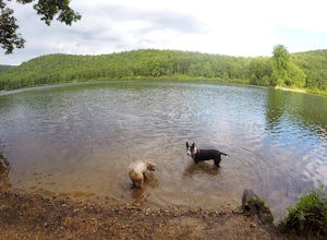
4.0Sherando Lake is a beautifully maintained dog/family friendly campground situated between two lakes. Upper Sherando Lake is available for fishing only but the larger, 25 acre, Lower Sherando Lake offers swimming, fishing, kayaking, and relaxing on the beach. The campground is divided into three ...Read more -
Big Island, Virginia
Hike to Little and Big Rocky Row
5.010.8 mi / 2700 ft gainStarting at the James River Footbridge, which is the longest foot traffic only bridge on the entire Appalachian Trail. Head north on the Appalachian Trail. You will quickly cross over Rt. 501. After a mile of hiking through the woods skirting the Rocky Row Run stream, you will cross over Forest ...Read more -
Roseland, Virginia
Backpack Reeds Gap to Rockfish Gap
5.020 miNote: We usually get a chance to take this trip in the summer, so please pay attention to the weather and pack accordingly. This description is for a July/August hike and the temperatures were in the 80s during the day and 60s at night. During this time of year rain showers are always a possibili...Read more -
Lyndhurst, Virginia
Backpack Three Ridges Loop
4.614.2 mi / 3960 ft gainFrom the parking area at Reids Gap, start off on the white-blazed A.T heading south as the trail begins on the left side of a clearing. You will begin climbing Meadow Mountain shortly and in .8 miles arrive at the top of the ridge, where you will continue on downhill for another .8 miles until y...Read more -
Natural Bridge Station, Virginia
Hike Devil's Marbleyard
5.03.24 mi / 1421 ft gainWant to scale the side of a rock face? If you do, I highly suggest adding this adventure to your list. Hiking to the marbleyard and back to the parking lot will have you at a 3 mile journey. How many hours will it take to hike the trail and tackle Antietam Quartzite boulders larger than cars you ...Read more -
Lyndhurst, Virginia
Hike to Shamokin Falls
4.42.2 mi / 950 ft gainStarting from the Dripping Rock Parking area at MP 10 on the Blue Ridge Parkway, head north on the white blazed Appalachian Trail (trail leading into woods from parking lot- don't cross the road). In about 20 steps the trail splits- go right. In another 20 steps or so the trail splits again but t...Read more -
Buchanan, Virginia
Hike to Apple Orchard Falls
4.05.6 mi / 1000 ft gainThere are a few different ways that you can do this hike. One way is to start at the North Creek campground (37.54244, -79.58531) and do a loop hike that's about 6 miles, which will take you to the falls up along a stream with some swimming holes and nice campsites. I did it the other way, which ...Read more -
Afton, Virginia
Humpback Rocks
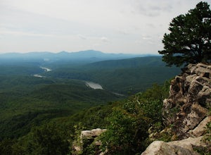
4.61.73 mi / 833 ft gainThis little hike is one of the most popular in the area, and for good reason! It's a short and steep one mile to the top, but the views of the Blue Ridge Mountains and Shenandoah National Park to the east, are some of the best around. It's somewhat of a tradition for students from the Universit...Read more -
Buchanan, Virginia
Hike Apple Orchard Mountain
4.04 mi / 400 ft gainThe top of Apple Orchard Mountain is easily accessible via the Appalachian Trail. Access the trail at the Sunset Field Overlook at MP 78.4 on the Blue Ridge Parkway. The concrete path will end shortly and turn into a blue blazed trail. Follow this for 0.25 miles until it intersects the Appalachia...Read more -
Lovingston, Virginia
Fortune's Cove Via Yellow Trail
3.05.02 mi / 1486 ft gainFortune's Cove via Yellow Trail is a loop trail where you may see beautiful wildflowers located near Lovingston, Virginia.Read more -
Eagle Rock, Virginia
Hike Roaring Run Falls
4.72.4 miFrom 615 (Craig Creek rd) you turn on to 621 (Roaring Run rd) and about mile down is a little gravel road on the left that you turn down. Go down this gravel road a little ways to reach the parking area, you'll know you're there when you see a big gate held up by two stone pillars. Once you are r...Read more -
Hot Springs, Virginia
Backpack around Lake Moomaw
5.06.6 mi / 1200 ft gainOn your way to the trailhead don't forget to pull off the road at the scenic outlook to take in the vast expanse of Lake Moomaw (you won't miss it!).Start off your adventure by parking at the end of Twin Ridge Drive (37.976545, -79.985582). From this point, hike down the little paved driveway int...Read more -
Buchanan, Virginia
Hike to Fallingwater Cascades
4.5The trailhead for this hike is at the same parking area for the Flat Top Trail. From the Peaks of Otter Visitor Center, travel north up the Blue Ridge Parkway for about 3 miles, where you will come to small parking area. It is quite tiny, and probably holds around 10 vehicles, but there was only ...Read more -
Buchanan, Virginia
Hike Flat Top Mountain
4.5From the Peaks of Otter Visitor Center, travel north up the Blue Ridge Parkway for about 3 miles, where you will come to small parking area for the Flat Top Trailhead. The parking area is quite tiny, and probably holds around 10 vehicles, but there was only one other car there when I went. It's p...Read more -
Bedford, Virginia
Hike the Harkening Hill Loop
3.33.3 mi / 850 ft gainTo get to the trailhead, pull into the Peaks of Otter Visitor Center off of the Blue Ridge Parkway and park there. Proceed to the outdoor amphitheater behind the center. At the rear of the amphitheater there is a large sign showing Harkening Hill and other nearby trails, here the trail begins. Th...Read more -
Bedford, Virginia
Sharp Top Trail
4.72.91 mi / 1296 ft gainOnce thought to be the highest peak in Virginia, this 2.5 hour hike is one that will leave you speechless at the top. Park at the Peaks of Otter Nature Center (which is now closed). The trailhead is located to the right of the building. You will cross over a paved bus road soon after beginning th...Read more

