Mount Solon, Virginia
Looking for the best hiking in Mount Solon? We've got you covered with the top trails, trips, hiking, backpacking, camping and more around Mount Solon. The detailed guides, photos, and reviews are all submitted by the Outbound community.
Top Hiking Spots in and near Mount Solon
-
Luray, Virginia
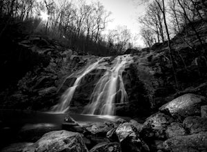
White Oak Canyon to Upper Falls
4.84.28 mi / 866 ft gainBetween mile 42 and 43 of Skyline Drive in Shenandoah National Park is the trailhead for WhiteOak Canyon. Begin at the trailhead from the parking lot and cross the Limberlost Trail in .3 miles. Continue on and you will cross your first footbridge shortly. After another mile you will cross the s...Read more -
Luray, Virginia
White Oak Trail to Lower Falls
5.06.68 mi / 1982 ft gainThe round trip is a total of 6.7 miles (10.8 km) from the Skyline Drive parking lot to the Whiteoak Canyon Trailhead parking lot (mile 42.6) to the final waterfall of the lower three. The elevation is moderate with a 900-foot drop to the upper falls, but an additional 1,100 feet to the lower fall...Read more -
Syria, Virginia
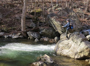
Fly Fish on the Robinson River
5.06 mi / 2000 ft gainThere are two sections that you can fish on the Robinson River. The first section is about 15 minutes away from the trailhead of White Oak Canyon. The river is on the right side of the road and you can see where it has bee stocked from the white diamonds on the trees on the side of the road. This...Read more -
Syria, Virginia
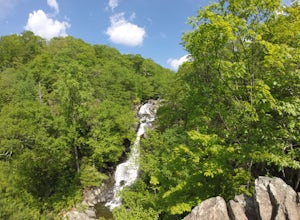
Hike Cedar Run Falls Trail
4.72.6 mi / 1000 ft gainCedar Run Falls is located in the central district of Shenandoah National Park. This is a pretty waterfall that flows into a deep swimming hole. There are two ways to get to the Cedar Run Waterfall: from the top of the mountain off of Skyline Drive and from the bottom of the mountain off of Wea...Read more -
Syria, Virginia
White Oak Canyon Cedar Run Loop
4.07.67 mi / 2257 ft gainThis route combines Cedar Run Falls and White Oak Canyon Trail (one of the more popular hikes in SNP, with separate adventures detailing those hikes). Parking is easy, but gets very crowded due to the popularity of White Oak Canyon (WOC). When starting from the parking area/Shenandoah ranger stat...Read more -
Luray, Virginia
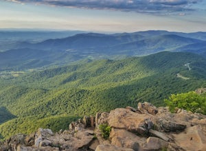
Stony Man Trail, Shenandoah National Park
4.51.47 mi / 279 ft gainThis short, easy hike will take you to some of the best views in Shenandoah National Park. As an added bonus, it’s perfect for catching the sunset without a long walk back to your car in the dark. If you’re looking to increase the level of difficulty, there is an alternate, moderate trail option ...Read more -
Orkney Springs, Virginia
Hike Laurel Run
6.6 mi / 2100 ft gainThere are two parking spots for this trail. Park at the lower lot if the gate is closed, if the gate is open, continue up the road for another mile until you reach another closed gate. Park here. If the gate is closed you will need to hike a mile up the road to get to the trail head.From the seco...Read more -
Luray, Virginia
Hike Around Lake Arrowhead Recreation Park
5.01 mi / 10 ft gainA few miles east of the town of Luray and just a couple miles outside of the Thorton Gap entrance to Shenandoah National Park sits Lake Arrowhead Recreation Park. This small lake and park features fishing, swimming, picnic areas, and other recreational park type of activities. Use of the faciliti...Read more -
Luray, Virginia
Little Stony Man, Shenandoah National Park
4.71.23 mi / 433 ft gainThe parking lot for the trail is right before mile 40 on Skyline drive in Shenandoah National Park. The entire out and back is only .9 miles, so it's the perfect hike to take in a sunset after a long day, take a break from driving, or just pick a hike that is family and dog friendly as Stoney Ma...Read more -
Cabins, West Virginia
Hike to Chimney Rock in the Monongahela National Forest
4.74.85 mi / 1319 ft gainChimney Rock (also referred to as Chimney Top) is a hidden gem in the Monongahela National Forest that offers some of the best views in the state of West Virginia. There are several trail options that pass this overlook, including a 24 mile point-to-point backpack of the North Fork Mountain Trai...Read more -
Lexington, Virginia
House Mountain Trail
4.08.93 mi / 2733 ft gainHouse Mountain provides two amazing views via two out-and-back hikes, for a combined hike of 8.75 miles. If you’re short on energy and/or time, the 6 miles round trip to Big House Mountain is (in my opinion) the better of the two overlooks. Either way, keep in mind that this hike covers a great...Read more -
Luray, Virginia
Hike to The Pinnacle in Shenandoah NP
4.52.2 mi / 400 ft gainThe Pinnacle is a little-known outcrop on the Appalachian Trail in Shenandoah National Park. You will not find it marked on the park map, but that doesn’t make it any less-worthy of your time. The Pinnacle can be reached by a quick, easy hike with the family (and dog!), or you can combine it wit...Read more -
Cabins, West Virginia
Backpack the North Fork Mountain Trail & Chimney Top
5.024.7 miOne of my favorite hikes in West Virginia, since the whole ridge is full of views. Backpacking the North Fork Mountain Trail is about 24.7 miles in total and a challenging hike but with relentless views. In my opinion, the best West Virginia has to offer. Summertime backpacking the whole the NFM...Read more -
Amherst, Virginia
Swim at Panther Falls
5.00.7 mi / -100 ft gainFrom Lexington or Buena Vista, Virginia, take Rt. 60 east for several miles. As soon as you pass under the Blue Ridge Parkway, look for a gravel road on your right marked Panther Falls Road. This is a fairly bumpy gravel road, so take it easy. Follow Panther Falls Road down the mountain for just ...Read more -
Davis, West Virginia
Hike to Rohrbaugh Cliffs in Dolly Sods
5 miRohrbaugh Cliffs is the social name given to the expansive views found along the Rohrbaugh Plains Trail. This easy hike in the Dolly Sods Wilderness will take you to one of the best overlooks in the area. For a longer or more challenging hike, connect this trail with one of the many others in t...Read more -
Wardensville, West Virginia
Big Schloss via Wolf Gap Trail
5.04.27 mi / 997 ft gainBig Schloss via Wolf Gap Trail is an out-and-back trail that takes you by a river located near Lost City, West Virginia.Read more

