Mount Solon, Virginia
Looking for the best hiking in Mount Solon? We've got you covered with the top trails, trips, hiking, backpacking, camping and more around Mount Solon. The detailed guides, photos, and reviews are all submitted by the Outbound community.
Top Hiking Spots in and near Mount Solon
-
Wardensville, West Virginia
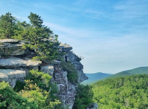
Hike Big Schloss
5.04.2 mi / 1000 ft gainBig Schloss (the German word for “palace”) is a popular hike in the George Washington National Forest. The trailhead is conveniently located at the Wolf Gap Campground. To begin, follow the path behind the restrooms at the parking lot. Cross the paved road where you will find a trail map with ...Read more -
Wardensville, West Virginia
Tibbet Knob via Wolf Gap
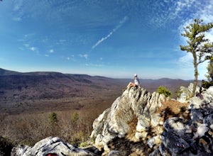
5.03.17 mi / 702 ft gainPark for free at Wolf Gap Campground and cross the road where you will pass some picnic tables and campsites. Follow the signs to the yellow-blazed Tibbet Knob trail. In half a mile, there is a little path to a summit on your left where you can catch a glimpse of Mill Mountain and Big Schloss. ...Read more -
Wardensville, West Virginia
Camp at Wolf Gap
5.0Wolf Gap is a FREE year round campground located just outside of Woodstock, VA. It is a great base camp for several scenic hikes like the Tibbet Knob trail (trailhead is just across the road) and the popular Big Schloss trail (trailhead begins at campsite number 9) -- super convenient if you hav...Read more -
Elkins, West Virginia
Hike to High Falls in Monongahela National Forest
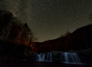
5.08.2 mi / 1440 ft gainThough this beautiful hike is a serious workout, it's actually quite easy to follow. It's also listed on Google Maps - I'd highly recommend downloading the map offline just in case something happens. Starting at the trailhead (park at a pull-off along the gravel road just a few hundred feet befor...Read more -
Etlan, Virginia
Old Rag Mountain Loop
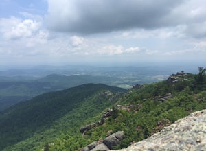
4.78.95 mi / 2510 ft gainBe prepared to deal with crowds, especially on the rock scrambles, which tend to cause a bottle neck on this trail in Shenandoah National Park. I would recommend starting out early on this loop hike, around 6 or 7 am to avoid the crowds. Definitely arrive no later than 9:30am, as the parking lot ...Read more -
Etlan, Virginia
Hike to the Summit of Mt. Robertson in Shenandoah NP
9 mi / 2500 ft gainThis hike is one of the lesser known hikes in Shenandoah. While everyone else is headed to Old Rag, hikers will find themselves on a peaceful hike to the summit of Mt. Robertson. Hikers should park in the Old Rag Parking lot and make sure to pay the daily fee ($25). If you have a yearly pass, be ...Read more -
Luray, Virginia
Mary's Rock via Meadow Spring Parking Area
4.62.75 mi / 640 ft gainMary’s Rock is just south of the Thornton Gap Entrance in Shenandoah National Park’s Central District. This write-up details the hike from the Meadow Spring Parking area, but there are alternate routes starting from the Panorama parking area (3.7 miles round trip), Jewell Hollow Overlook (6 mile...Read more -
Luray, Virginia
Hike to Hazel Falls in Shenandoah National Park
5.05.2 mi / 100 ft gainThe trail to Hazel Falls may not be the most "wow" trail in Shenandoah but it is well worth it to reach the beautiful gorge where Hazel River falls over big boulders. You should park at the Meadow Spring parking lot at mile 33 on Skyline Drive. You will see the trail post to the right of the par...Read more -
Luray, Virginia
Mary's Rock via Appalachian Trail
3.36 mi / 1214 ft gainIf you're driving south on Skyline Drive, park in the lot on the right side of Skyline Drive immediately after you cross Route 211/Thornton Gap entrance. If you're driving north on Skyline Drive, the lot will be on the left side immediately before the Thornton Gap entrance. The trailhead is at t...Read more -
Davis, West Virginia
Camp at Red Creek Campground
5.0Beginning your hikes from the Red Creek Campground gives you plenty of good options. For day hikers there is parking at the signed trailheads and for those who want to call the Campground home for a few days the campsites are nice and spaced out so you don't feel like you're sharing your tent spa...Read more -
Millboro, Virginia
Hike Blue Suck Falls and the Tuscarora Overlook
3.47.2 mi / 2200 ft gainIn Douthat State Park, park at the Discovery Center/Amphitheater parking lot near the children's fishing area. The Blue Suck Falls trail head will be towards the dam on the left side and is well-marked.Note: A trail map is highly recommended for this trail! It is fairly well-marked with blue blaz...Read more -
Rileyville, Virginia
Backpack Jeremy's Run Trail, Shenandoah NP
3.310 miThis hike is best done as a two-day, one-night backpacking trip, however it can be done as a day hike if you don't wish to backpack.Jeremy’s Run is a beautifully forested 10 mile roundtrip hike with numerous stream-crossing. The trailhead starts at the Elkwallow Picnic area, at about mile 24 of S...Read more -
Davis, West Virginia
Dolly Sods Wilderness North Loop via Rocky Ridge Trail
5.012.78 mi / 1378 ft gainThe hike begins at the "Dolly Sods Trailhead Parking" location easily found on Google Maps. The lot is big enough for about 6-8 vehicles. Begin walking at the end of the gravel parking lot/road for about 0.5 miles until you enter the Dolly Sods Wilderness Area in a small grassy field where sever...Read more

