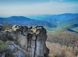
Mount Solon, Virginia
Looking for the best hiking in Mount Solon? We've got you covered with the top trails, trips, hiking, backpacking, camping and more around Mount Solon. The detailed guides, photos, and reviews are all submitted by the Outbound community.
Top Hiking Spots in and near Mount Solon
-
Stanley, Virginia
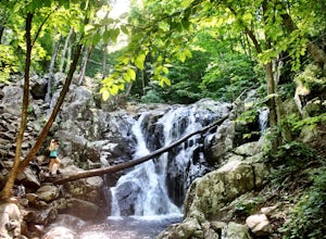
Hike to Rose River Falls
4.54 mi / 853 ft gainRose River Falls is often overshadowed by it's more popular cousin, Dark Hollow Falls, as both hikes begin at the same trail head. But because Dark Hollow Falls is such a short and well known hike, it can get extremely crowded. It is also one of the few trails in Shenandoah where dogs are not al...Read more -
Mathias, West Virginia
Hike Cranny Crow to Millers Rock Loop
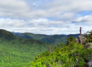
10.6 mi / 2100 ft gainThis is a really good day hike to explore another one of the many fantastic state parks that West Virginia has to offer while avoiding some of the crowds that many of the popular ones have. The main feature of the park is the Cranny Crow Overlook which features views into two Virginia and three W...Read more -
Madison, Virginia
Hike Bear Church Rock via the Graves Mill Trail
3.58.5 mi / 2250 ft gainStarting at the Graves Mill Parking area, head up the yellow blazed trail that is marked by a big cement marker. The trail will follow closely beside the gorgeous Rapidan River. Hike for half a mile until you come to the intersection of the Staunton River Trail. Turn left (do not cross the river)...Read more -
Madison, Virginia
Fly Fish on the Rapidan River
5.05 miPark at the Graves Mill Parking Area. From here you can easily follow the Rapidan River up the mountain. Fishing reports inform that the lowest concentration of brookies are at the lower boundaries of the park so take some time to enjoy the trail and hike up stream. At the lower boundaries you mi...Read more -
North Garden, Virginia
Wilkins Way Loop
4.33 mi / 640 ft gainWilkins Way Loop is a loop trail that takes you by a lake located near North Garden, Virginia.Read more -
North Garden, Virginia
Explore Walnut Creek Park
4.2Just 25 minutes outside of Charlottesville, this is a great spot to take the family for the day and get some sunshine. If you are into mountain biking, you're in the right place. There are 13 miles of mountain bike trails that circle the lake. At the end of your ride, there are 2 beaches to stre...Read more -
Luray, Virginia
Upper Hawksbill Trail
2.09 mi / 482 ft gainThe trailhead has a small parking area at mile marker 46.7 on Skyline Drive, just past the Old Rag overlook (on the opposite side of the road) if you're driving south. The hike is a 2-mile out-and-back that takes you right to the summit. The first ~2/3 of it is relatively flat and very easy walk...Read more -
Lovingston, Virginia
Fortune's Cove Via Yellow Trail
3.05.02 mi / 1486 ft gainFortune's Cove via Yellow Trail is a loop trail where you may see beautiful wildflowers located near Lovingston, Virginia.Read more -
Stanley, Virginia
Hawksbill Mountain Summit
4.81.54 mi / 669 ft gainA hike to the summit of Hawksbill Mountain will not only put you at the highest point in Shenandoah National Park (4050'), but you'll have a 270 degree view perfect for a sunset. This moderate hike is located at MP 45.6 on the Skyline Drive in Shenandoah National Park, so you'll have to pay a $2...Read more -
Stanley, Virginia
Lower Hawksbill to Salamander to Appalachian Trail Loop
2.68 mi / 666 ft gainThis is one of 2 trails that will take you to the summit of Hawksbill Mountain. The other is the Upper Hawksbill Trail (which I also wrote an adventure about!). This trail is a combination of the Lower Hawksbill Trail, the AT, and the Salamander Trail. The parking are area for this hike is at mi...Read more -
Charlottesville, Virginia
Preddy Creek & Creekside Trail Loop
4.33.75 mi / 266 ft gainMy husband is a runner and I am not. I hate to run and the entire time I am running I am exhausting myself thinking how much I hate running. However, I love hiking. I can hike all day and I can kick my runner husband's butt with a pack on going up a mountain trail. The problem with this though is...Read more -
Charlottesville, Virginia
Hang Out At Riverview Park
4.5Riverview park has tons of options for getting outside around Charlottesville, VA. Part of the Rivanna Trail runs through here, so if you are really ambitious, this trail goes around the entire city. There are paved trails right along the river, so you can choose your activity. Running, biking, a...Read more -
Vesuvius, Virginia
Cole Mountain Loop
4.85.89 mi / 1280 ft gainThe large open meadow at the summit of Cole Mountain is a unique and breathtaking experience that is worth the 5.8 mile hike. Cole Mountain is frequently referred to as Cold Mountain, but the official name listed by the United States Geological Survey is the former. This hike is in the George W...Read more -
Amherst, Virginia
Mount Pleasant Loop
4.65.98 mi / 1427 ft gainFrom the Mount Pleasant Parking Area, take the blue blazed Pompey Mountain Trail that is just beyond the horse gate. As it's a loop, you can start at either entrance, but I prefer heading left to get the longer leg of the hike before the summit (always better to have an easy journey down in the a...Read more -
Luray, Virginia
Hike Limberlost Trail in Shenandoah National Park
5.01.3 mi / 114 ft gainThe Limberlost Trail is a loop trail within Shenandoah National Park. It is classified as 'accessible' as the trail is flat and has features that would help those in a wheelchair or with other needs access the trail (boardwalk, bridge, benches). There is little-to-no elevation change and the pat...Read more -
Luray, Virginia
Hike Robertson Mountain in Shenandoah NP
6 mi / 1200 ft gainRobertson Mountain is often overshadowed by the nearby Old Rag Mountain, but standing 5 feet taller than Old Rag, this hike offers seclusion and gorgeous views to the south. Starting from the Limberlost Trailhead parking lot at MP 43 on the Skyline Drive, take the chained off Old Rag Fire Road. ...Read more

