Harrisonburg, Virginia
Looking for the best camping in Harrisonburg? We've got you covered with the top trails, trips, hiking, backpacking, camping and more around Harrisonburg. The detailed guides, photos, and reviews are all submitted by the Outbound community.
Top Camping Spots in and near Harrisonburg
-
Raphine, Virginia
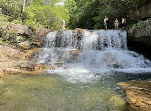
Saint Mary's Wilderness
4.56.03 mi / 538 ft gainSaint Mary's Wilderness is an out-and-back trail that takes you by a waterfall located near Vesuvius, Virginia.Read more -
Roseland, Virginia
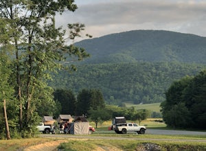
Camp at Devil’s Backbone Basecamp
5.0This place has it all : a bomb fire pit, live music, distillery, restaurant, 48 taps, mountain views, and more! Not to mention, it’s in a great location for exploring. It’s close to tons of breweries, wineries, and cideries, it’s just a few miles from the Appalachian trail, and close to Shenando...Read more -
Wardensville, West Virginia
White Rocks Loop, George Washington NF
4.59.26 mi / 1690 ft gainThe trail begins near the upper parking area next to a closed gate. If you park in the lower parking area, you'll have to walk about .3 miles up the road to get to this gate. Start out on the forest service (FS) orange-blazed trail, following it for about a quarter mile. From there head onto Old...Read more -
Bentonville, Virginia
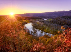
Hike the Shenandoah River State Park Loop
5.08 mi / 650 ft gainShenandoah River State Park is located in the heart of the Shenandoah Valley. The park is full of well-maintained trails great for hiking and mountain biking. The trails both parallel the banks of the river as it snakes through the Shenandoah Valley and through the rolling hills, which provides...Read more -
Cabins, West Virginia
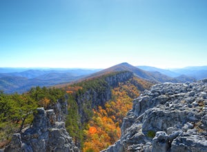
Backpack the North Fork Mountain Trail & Chimney Top
5.024.7 miOne of my favorite hikes in West Virginia, since the whole ridge is full of views. Backpacking the North Fork Mountain Trail is about 24.7 miles in total and a challenging hike but with relentless views. In my opinion, the best West Virginia has to offer. Summertime backpacking the whole the NFM...Read more -
Meadows Lane, Virginia
Camp near Crabtree Meadows in GWNF
5.0As stated, the campsites are free. They do not require reservations or permits and are on a first come, first served basis. Regardless of which direction you're coming from, you will be traveling on Crabtree Falls Highway until reaching Meadows Lane. This is a gravel access road that requires 4WD...Read more -
Tyro, Virginia
Spy Rock via Cash Hollow
4.95.71 mi / 1191 ft gainThe hike is part of the George Washington National Forest, and can easily be combined with nearby Crabtree Falls (300ft cascading waterfall with a hike to the top). The entire trip is 5.7 miles, and there are nice campsites at the base of the summit (no water source) if you want to add on this pr...Read more -
Davis, West Virginia
Camp at Red Creek Campground
5.0Beginning your hikes from the Red Creek Campground gives you plenty of good options. For day hikers there is parking at the signed trailheads and for those who want to call the Campground home for a few days the campsites are nice and spaced out so you don't feel like you're sharing your tent spa...Read more -
Goshen, Virginia
Hike Goshen Pass
4.35.6 mi / 1200 ft gainThe parking for the trailhead is down an unmarked gravel/dirt road about 1.5 miles upriver from the Virginia Wayside rest area on Route 39 West. You'll see the swing bridge out across the river and the road will be immediately after this on your right. The road goes back about 200 yards to the pa...Read more -
Davis, West Virginia
Bear Rocks Loop
4.710.54 mi / 1293 ft gainThis particular hike is great as there are multiple camping sites, both established and backcountry, and views for miles around almost every bend. Still not convinced? This high-altitude plateau has characteristics typically found in Canadian landscapes. so you can travel north without leaving y...Read more -
Davis, West Virginia
Bear Rocks and Beaver Dam Loop
6.36 mi / 699 ft gainStarting on Bear Rocks Trail, hike down to the Red Creek. Sometimes water levels can be high, but most of the time you can cross the creek without getting any deeper than your knees. Link up with the Raven Ridge Trail and head south. Enjoy the views through this section, as it's a great place to ...Read more -
Maysville, West Virginia
Dolly Sods North Loop via Bear Rocks
5.011.69 mi / 1171 ft gainArguably one of the most beautiful hiking areas on the United States' east coast, the Dolly Sods Wilderness inarguably has the most unique trailhead warning sign: Watch out for unexploded ordinance in the area. (The U.S. Army used the area for artillery and mortar training during WWII.) Don't fre...Read more -
Maysville, West Virginia
Lions Head Loop
5.020.35 mi / 2195 ft gainWhat used to be an artillery testing site during WWII, Dolly Sods is a great place for backpackers of almost any expertise. Water is easily found throughout the wilderness area and while 21 miles might feel like a lot, it is very manageable over the course of 3 days. Attached (at the bottom) is...Read more -
Davis, West Virginia
Dolly Sods Wilderness North Loop via Rocky Ridge Trail
5.012.78 mi / 1378 ft gainThe hike begins at the "Dolly Sods Trailhead Parking" location easily found on Google Maps. The lot is big enough for about 6-8 vehicles. Begin walking at the end of the gravel parking lot/road for about 0.5 miles until you enter the Dolly Sods Wilderness Area in a small grassy field where sever...Read more

