Castleton, Vermont
Looking for the best hiking in Castleton? We've got you covered with the top trails, trips, hiking, backpacking, camping and more around Castleton. The detailed guides, photos, and reviews are all submitted by the Outbound community.
Top Hiking Spots in and near Castleton
-
368 Weathersfield Trail, Vermont
Hike Mount Ascutney
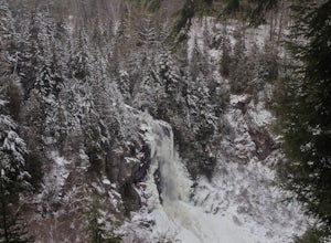
3.05.2 mi / 2326 ft gainThis route to the top of Mount Ascutney is completed via the Weathersfield Trail. This trail goes past gorgeous Cascade Falls - often frozen in the winter months. There is a great spot to eat lunch at the top of Mount Ascutney to the side of the hang glider landing. While the summit itself does n...Read more -
Hartford, Vermont
Camp at Quechee State Park
4.0Located on the Ottauquechee River, Quechee State Park offers camping options right beside one of Vermont's most famous gorges—Quechee Gorge. The steel bridge that passes over the 165 ft. gorge is just one of many spectacular views in this area. Quechee State Park is on Route 4 and easily accessi...Read more -
Johnsburg, New York
Hike Crane Mountain
4.54.6 mi / 1100 ft gainAt the trail register stay to your right at the fork in the trail. The left trail will be where you return. At approximately 0.5 miles you will reach an open ledge area, as you look up a rock cairn will mark where you pick up the trail. At 0.8 miles you will reach the first of two ladders to a...Read more -
285 Salmon Hole Lane, Vermont
Hike Hamilton Falls
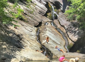
3.56.8 mi / 889 ft gainThe hike to Hamilton Falls is an enjoyable 6.8 miles roundtrip voyage through gorgeous forest scenery alongside a babbling brook. Be sure to visit the upper and lower falls! This trail is kid and dog friendly, so why not bring both?! If you are visiting the falls in the summer, bring a towel and ...Read more -
Shaftsbury, Vermont
Hike Around Lake Shaftsbury
1.3 mi / 42 ft gainLake Shaftsbury State Park is a small park in Southern Vermont between Bennington and Manchester. It is well-loved by locals as swimming spot in the summer, especially for families with kids. Less well known is the nature trail that meanders around the perimeter of the lake. While only a mile in...Read more -
North Creek, New York
Hike Gore Mountain
5.010 mi / 3040 ft gainYou will start this hike following the blue blazed Schaefer trail. Though the sign shows 5.8 miles to the summit it is actually only 5.0 miles. Much of the way you follow Roaring Brook which has many waterfalls along the way. Just after the North Creek Reservoir you will get your first glance at...Read more -
Hadley, New York
Hike the Adirondack's Hadley Mountain
5.03.6 mi / 1545 ft gainHadley Mountain historically has faced its share of forest fires. The fires left thin soil, leading to more exposed rock on this fairly quick, scenic hike. Due to the rockiness, when you're thinking about heading out for this hike, be sure to grab a sturdy pair of hiking boots or at least your st...Read more -
Keene Valley, New York
Backpack the Dix Range
4.517 miDay 1The trail begins about a mile past the intersection of Rt. 73 and Rt. 9 just east of a bridge over the North Fork Boquet River. Note: this trail is unmarked, so be sure to have an accurate map of the area. I recommend going to The Mountaineer store in Keene Valley and asking one of the cler...Read more -
324 State Park Road, Vermont
Hike to Mount Philo
5.01.9 mi / 538 ft gainMount Philo is a great hike year-round with incredible views from the summit. Starting from the bottom, the right hand portion of the loop is ‘paved,’ while the left hand portion is more of a traditional trail hiking experience. Dogs are allowed on this trail, but must be kept on leash. Take caut...Read more -
Keene Valley, New York
Hike to Noonmark Mountain
5.04.6 mi / 2300 ft gainThis trail actually begins off an easement of private roads at the Ausable Club. From the main road, you will see the Register and signage showing 2.1 miles to Noonmark. Continue on a gravel road until an arrow directs you to take a right into the woods. Follow the Stimson Trail to the summit. Th...Read more -
Keene Valley, New York
Hike Indian Head and Fish Hawk Cliffs
4.310.4 mi / 2000 ft gainAt 10.4 mile long, this lengthy, but easy loop takes you to two ADK lower peaks. The views from Indian Head and Fish Hawk Cliffs will blow your mind away. I love stopping here every time I make my way to ADK. The colors are absolutely gorgeous in the fall. From the parking lot, take the lake road...Read more -
Keene Valley, New York
Hike to Gothics Mountain, Pyramid Peak, and Sawteeth Mountain via Beaver Meadow Falls
4.014.3 mi / 4900 ft gainGothics Mountain is number 10 in height on the 46ers list, standing at 4,736 feet. Pyramid Peak stands at 4,550 feet, but because of it's location and closeness to Gothics, it is not considered one of the 46ers. Sawteeth is number 35 in height on the 46ers list, standing at 4,100 feet.This is a 1...Read more -
Keene Valley, New York
Hike to Mount Colvin and Blake Peak
4.014.6 mi / 4000 ft gainMount Colvin and Blake Peak are located along the Colvin Range in the High Peaks Wilderness. Mount Colvin is number 39 on the 46er list, at 4,057 feet. Blake Peak is is number 43 on the list, at 3,960 feet, although new surveying methods discovered this summit just short of 4,000 feet, tradition ...Read more -
Indian Lake, New York
Hike to OK Slip Falls
5.06.4 miStarting at the parking area you will walk 0.2 miles west on Route 28 to the north side of the road to locate the marked trailhead. After signing the trail register you will follow the the red marked trail approximately 0.5 miles to the first junction. At the junction you will branch right and f...Read more -
Huntington, Vermont
Camel's Hump Summit via the Burrows Trail
4.04.4 mi / 2228 ft gainThis adventure takes you up the Burrows Trail from the Huntington side of Camel's Hump. There are multiple trails to the summit, but this trail is the shortest. It is 2.4 miles to the summit with 2300' elevation gain. The trailhead is accessed from the aptly named Camel's Hump Road out of Huntin...Read more -
Keene Valley, New York
Hike Rooster Comb Mountain
5.2 mi / 1795 ft gainTake in two unique views of the Adirondacks on one hike. Rooster Comb offers a great 5.2 mile round trip hike that gives you some unique vantage points. Starting from the parking lot you cross over a nice wooden bridge to the trail registry. Remember to sign in. Next you'll come up on a pond in w...Read more

