Wallsburg, Utah
Top Spots in and near Wallsburg
-
Salt Lake County, Utah
Hike Thayne Canyon
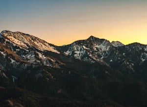
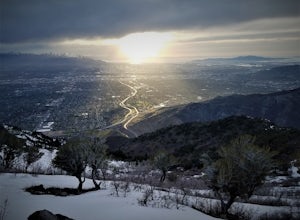
6 mi / 2800 ft gainIf you want to avoid the crowds heading to the Salt Lake Overlook and are looking for a bigger challenge with better views, Thayne Canyon is the ticket. The trail is 6 miles roundtrip with 2,800 feet of elevation gain. It’s a great evening hike and the peak is a nice place to watch the sunset. Th...Read more -
Salt Lake City, Utah
Salt Lake Overlook via Desolation Trail
4.14.76 mi / 1729 ft gainThis popular trail follows a portion of the Desolation Trail leaving from Mill Creek Canyon. The trail to the overlook is 4.75 miles round trip with a 1700 ft elevation gain. You begin at the Desolation Trailhead and then turn around once you have a view of the Salt Lake Valley. It is a perfect h...Read more -
Salt Lake City, Utah
Grandeur Peak East Trail
4.45.97 mi / 2513 ft gainThis is the peak that can be seen from the valley located between Millcreek Canyon and Parleys Canyon. There are 2 trails that head up to this peak, but the one up Millcreek Canyon at the top of Church Fork is by far the more popular/enjoyable one (and the one described here). The other one heads...Read more -
Holladay, Utah
Mt. Olympus Trail
4.76.46 mi / 4124 ft gainThe trail begins right on Wasatch Blvd. and after the first 0.5 miles you're into the Superior Wilderness. This is a very strenuous hike and you will be gaining elevation the whole way from the parking lot (4830 ft) to the summit (9026 ft). About .2 mile from the summit you will reach a saddle....Read more -
Salt Lake City, Utah
Hike Neff's Canyon
4.3From the parking lot, you will follow a 4-wheel drive track that runs straight up to the beginning of the different trailheads. You can also take an actual trail up to that same spot, situated below the 4-wheel gravel track on the righthand side.There are a few different trails that merge togethe...Read more -
Kamas, Utah
Hike Bald Mountain in the Uintas
4.54 mi / 1250 ft gainBald Mountain is one of the most popular hikes in the Uintas, so get an early start if you want to beat the crowds. Those willing to hike in before dawn will be rewarded with an unforgettable sunrise at the summit. I HIGHLY recommend this as a sunrise hike. The trail starts out with steep switchb...Read more -
Kamas, Utah
Photograph Bald Mountain in Utah
Bald Mountain is a 12,000' peak in the Uintas, and of the most popular hikes in the Uinta Mountains of Utah. If you're looking for more details on the hike, check out the adventure Hike Bald Mountain in the Uintas. Not only is it incredible to photograph from the top, with panoramic views of doze...Read more -
Kamas, Utah
Backpack to Notch Lake
5.04.6 mi / -600 ft gainThe hike to Notch Lake begins at the Bald Mountain trailhead. You'll need to display a recreation pass in your vehicle to park at the trailhead. You can purchase a pass for $6 at the fee station entering the forest boundary (east of Kamas) or at the Forest Service office right in Kamas. Take the ...Read more -
Salt Lake City, Utah
Climb West Slabs of Mount Olympus
5.0Park at the top of Thousand Oaks Drive, and make your way to the dirt path heading east. It will be a well maintained, well-covered single dirt track which takes you to the base of a really impressive couloir. Follow the trail until you reach the couloir / rocky gully. You will then see the West ...Read more -
Salt Lake City, Utah
Hike Mt. Aire
4.54 mi / 2000 ft gainMount Aire, standing around 8600 ft, certainly isn't the most inspiring peak in or around Salt Lake City, but to me it serves as a quick summit to catch the sunset when I'm short on time.Getting There:Start by heading up Mill Creek Canyon Rd. After passing the ranger booth, drive about 5.5 miles ...Read more -
South Jordan, Utah
Fish at the East Riverfront Fishing Ponds
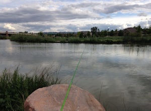
5.00 mi / 0 ft gainThese are great little ponds located at 11267 S. River Front Pkwy in South Jordan. It is just off of a section of the Jordan River. Kidney Pond is the one located just by the parking. Midas is just above and you can see it from the parking. You can fish here for rainbow trout, channel catfish, bl...Read more -
Hanna, Utah
Hike to Cuberant Lake
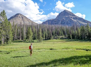
6 mi / 1066 ft gainThe hike to Cuberant Lake is 3-miles with a couple of steeper sections, but for the most part, it is a flat hike. From the Pass Lake Trailhead, you will head west on the Lofty Lake Loop Trail. On this part of the trail, you pass through meadows with Bald and Reid Peaks in the background, which is...Read more -
Hanna, Utah
Hike the Lofty Lake Loop Trail
4.54.2 mi / 935 ft gainLofty Lake Loop Trail is located in the High Uintas near Kamas, Utah. The trail can be found right off the Mirror Lake Scenic Byway about 32 miles east of Kamas and starts at the Pass Lake Trailhead. This is a fairly mellow trail with some areas of good elevation gain, enough to get your heart w...Read more -
Salt Lake City, Utah
Grandeur Peak West Face
2.23 mi / 3307 ft gainAre you planning a big adventure and need a boost getting ready for it? You came to the right place. This is my go-to when I’m preparing to climb a big mountain. It’s hard to find a steeper trail in the area (that’s not a game trail), and the West Face is usually free of snow early in the season....Read more -
Salt Lake City, Utah
Kayak at Little Dell Reservoir
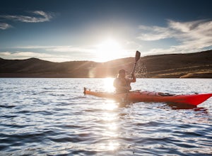
3.8Located just 20 minutes from the heart of Salt Lake City, Little Dell Reservoir is the perfect quick getaway for a recreational paddler or angler.The reservoir is surrounded by mountains in Parleys Canyon, just off of Interstate 80 and along Utah State Route 65. The parking and ranger station are...Read more -
Kamas, Utah
Hike to Round, Sand, and Fish Lake in the Uinta Mountains
9 mi / 2000 ft gainThe Dry Fork Trailhead at the end of Weber Canyon Rd is the starting point for the hike to Round, Sand, and Fish Lakes in the Uinta Mountains of Utah. In the early spring and summer, this trail can be wet due to snowmelt runoff, but by mid-summer, it dries out and is a fantastic hike. The trail i...Read more

