Utah County, Utah
Top Spots in and near Utah County
-
Draper, Utah
Lone Peak via Jacobs Ladder
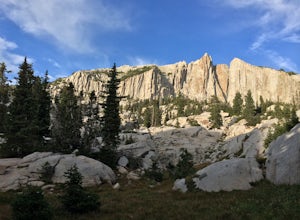
4.714.2 mi / 6713 ft gainThe main trail to Lone Peak is via Jacobs Ladder. To get to the start of the trailhead you need to drive on a dirt road for a little bit until you get to a little parking area (start of the road indicated on the map). The trail starts just south of where you park on the dirt road. The Jacobs Lad...Read more -
Park City, Utah
Hike Past Mining Relics in Daly Canyon
4.02.5 mi / 500 ft gainTo get to Daly Canyon, just continue up Main Street in Park City. The road turns to dirt soon after the last house and a gate is closed across the road not far beyond that. Hiking, biking, or jogging up the old road you'll have the stream to your left and about a 1/4 mile up you'll see the old J...Read more -
Pleasant Grove, Utah
Battlecreek Falls
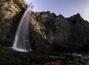
4.71.09 mi / 486 ft gainBattlecreek Falls is a great place to get away after a long day of work—or if you're looking for a great hike but are short on time. It's a great way to get the dog or your family out to enjoy some nature. The falls are about a 15-25 minute walk from the parking lot, the waterfall is enormous an...Read more -
Provo, Utah
Floating the Provo River
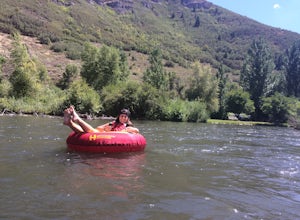
4.3There's no better way than spending a hot summer day floating down a river with your friends. The Provo River offers incredible views of Mount Timpanogos and other surrounding mountains in the Provo Canyon. The easiest way to do this adventure is to visit High Country Adventure in the Provo Cany...Read more -
Cottonwood Heights, Utah
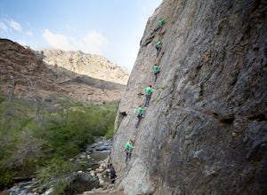
Rock Climbing at Dogwood
4.4If you can avoid the crowds, Dogwood is an easy crag to get to with a lot of 5.fun climbs and a legendary 5.13a sport climb. From the mouth of Big Cottonwood Canyon, the Dogwood picnic area is 1.1 miles up the canyon. Park on the street to avoid having to pay $8 and walk into the picnic area. Fol...Read more -
Cottonwood Heights, Utah
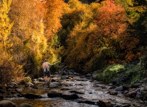
Fishing Big Cottonwood Creek
4.0Big Cottonwood Creek is a fun little creek that is often overlooked by the more popular fly-fishing waters of the Provo, Weber, and the Green Rivers of Utah. The fish aren't as big, but make up for it by being less selective with flies and a willingness to go after dry flies any time of the year....Read more -
Cottonwood Heights, Utah
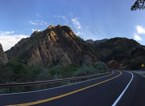
Cycle Big Cottonwood Canyon
5.0Big Cottonwood Canyon (BCC) is one of the longest rideable canyons in the Salt Lake City area, taking you from the base of the canyon to Brighton Ski Resort. Riders have the option to ride any length of the canyon, all of which will be visually rewarding.There are 3 relatively steep sections in B...Read more -
Provo, Utah
Upper Falls
2.70.54 mi / 423 ft gainComing from Provo, at about 2.5 miles make a right hand turn for Nunn's Park/ Bridal Veil. Go straight through the intersections and pass Bridal Veil Falls (on your right) and continue until you see a park on your right (Upper Falls Park). Park here and cross the bridge over the creek and then fo...Read more -
Park City, Utah
Park City Mountain Ski Resort Trail
18.24 mi / 3468 ft gainPark City Mountain Ski Resort Trail is a loop trail where you may see beautiful wildflowers located near Park City, Utah.Read more -
Provo, Utah
Bridal Veil Falls
4.80.47 mi / 285 ft gainHeading on Provo Canyon Rd the waterfall is just on the right hand side. You will see a sign that says "Bridal Veil" to turn in and park at the falls. At the falls you can hike up a bit to get closer to the waterfall but you will get sprayed quite a bit. Usually a few people there take photos at ...Read more -
Provo, Utah
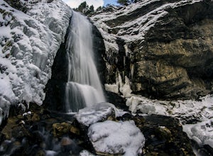
Ice Climbing Provo Canyon
There are a number of good ice climbing areas in the canyon. Everything from short easy water ice on up to the most difficult mixed route in the state are available. The area surrounding Bridal Veil Falls usually sees the most traffic. There are too many great routes to names here. For more in de...Read more -
Park City, Utah
Mountain Bike Deer Valley, Park City
5.07 mi / 1200 ft gainIf you’re a downhill bomber, you came to the right place. The resort has lift-served singletrack of every difficulty with machine-built table tops, berms, tree runs and technical obstacles. If cross country is more your scene, there are miles of forested climbs, beautiful views and enjoyable down...Read more -
Salt Lake City, Utah
Trail Run Upper Big Water Trail to Dog Lake
4.06.2 mi / 1267 ft gainDrive all the way to the top of Millcreek Canyon until you can't drive any further. (They close the road further down the canyon in the winter so this trail is not accessible to cars in the winter.) There is a small parking lot at the end of the road, park here. The trail head is going to be on t...Read more -
Salt Lake City, Utah
Hike Old Red Pine Road Trail
5.04.2 mi / 1000 ft gainThe trail begins at the parking lot at the very top of Millcreek, called Upper Big Water. The trail begins on the east side of the lot, where bathrooms are available. Walk to trail sign and head left to Old Pine Road Trail.From there, the trail remains relatively flat with some steep gains. The t...Read more -
Salt Lake City, Utah
Mountain Bike Dog Lake, Millcreek Canyon
4.4 mi / 1260 ft gainIf it’s an even day and you’re in Salt Lake and you’re in possession of a mountain bike, put down your phone and spend the next 2 hours in pure bliss. Mountain bikers are only allowed to use the trails of upper Millcreek Canyon on even days, which makes for a busy route, but well worth it. This i...Read more -
Sandy, Utah
Dimple Dell Trail West
3.88 mi / 236 ft gainDimple Dell Trail West is an out-and-back trail where you may see beautiful wildflowers located near Sandy, Utah.Read more

