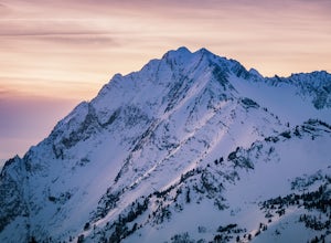
Tooele, Utah
Top Spots in and near Tooele
-
Alta, Utah
Snowshoeing Twin Lakes Pass
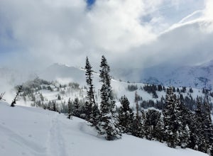
5.05.21 mi / 1781 ft gainStarting at the parking lot near the Albion Basin gate, travel up the summer road until the second switchback. Just past the second switchback and cabins, leave the summer road heading east. The Trail heads northeast into Grizzly Gulch. It should be easy to follow—it gets a lot of traffic. From h...Read more -
Salt Lake City, Utah
Ski Baldy's Main Chute at Alta Ski Area
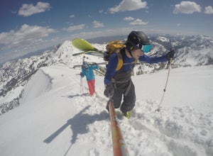
5.0Do you like hiking? In ski boots? Good.You start the hike from the gate to Snowbird at the EBT near the top of the Sugarloaf lift. The start of the bootpack is at 10,500 ft of elevation. From there, follow the likely well established boot pack to the top of Baldy. There is one rather steep sectio...Read more -
Alta, Utah
Milky Way Astrophotography At Alta
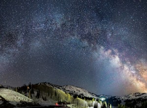
4.0Early spring is a unique time to photograph the Milky Way due to its low angle and the distinctive perspective of its galactic core. The low angle position of the Milky Way arc during the early morning hours, prior to dawn, allows for some striking panoramas, with the still snow-covered Wasatch M...Read more -
Centerville, Utah
Hike to the Parrish Creek Pictographs
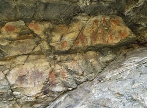
4.71 mi / 200 ft gainThe petroglyphs are pretty easy to find and it is such a short hike you can do it in about 45 minutes. To get to the trailhead, drive to Centerville, Utah and take 400 N all the way towards the mountain. The road with curve to the right with a small dirt road heading to the left. Take the dirt ro...Read more -
Provo, Utah
Camp at Timpooneke Campground
5.0The Timpooneke Campground sits at 7,400 ft. elevation with views of Mount Timpanogos and campsites surrounded by beautiful aspen, fir and spruce trees. The leaves in the fall put on a show you will not want to miss. Within the campground there are 9 equestrian sites, 1 large group site and 20 sta...Read more -
Provo, Utah
Mount Timpanogos via Timpanogos Trail #053
4.815.72 mi / 4970 ft gainThe Timpooneke trailhead is located in American Fork Canyon, next to the Timpooneke Campground. There is a $6 fee to enter the canyon, unless you have a National Park Pass with which you get in free. On the weekends, it may be difficult to find parking at the Timpooneke Campground, so arrive earl...Read more -
Provo, Utah
Timpanogos Basin via Timpooneke Trail
5.09.78 mi / 3015 ft gainThe wildflowers are normally at their peak from mid to end of July or the beginning of August. Depending on the amount of snow that year and how wet of a spring we had it could vary a little bit. But anytime during the mid summer you will encounter amazing Indian Paintbrush, Lupine, and other co...Read more -
Provo, Utah
Hike to Scout Falls
2.8 mi / 675 ft gainStarting at a little over 7,300 feet, the Timpooneke Trailhead offers a beautiful alpine setting for starting your hike. Several trails originate from the same parking lot so you will want to make sure you get on the correct trail. The parking lot can also get quite full on summer days as people ...Read more -
Alta, Utah
Albion Meadows Trail
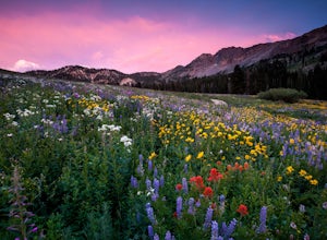
4.92.86 mi / 696 ft gainAt Albion Basin, wildflowers you will see include lupine, Indian paintbrush, American bistort, sunflowers, fireweed, and many more! Drive to the very top of Little Cottonwood Canyon and park at the Albion Grill. There is a trail just behind the Grill that takes you through a variety of wildflowe...Read more -
Alta, Utah
Cecret Lake from Albion Basin
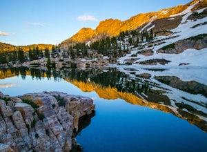
4.94.48 mi / 1214 ft gainThe out-and-back trail from Albion Basin to Cecret Lake climbs a gentle slope and along the way there are interpretive signs with information about the basin, its plants, animals and geology. From the lake you can return the same way you came, or explore the area more. If you head there during t...Read more -
Alta, Utah
Mountain Bike Catherine's Pass
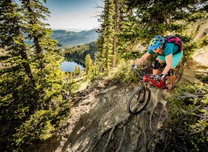
4.5 mi / 1200 ft gainThis ride isn't for the faint of heart. It's seriously tough. It's one of the most scenic and rewarding rides you'll ever do, though. The climbing is steep and the descents are rocky.Try to ride it early in the morning. Hikers frequent these trails. An early morning rip is the best way to keep fr...Read more -
Alta, Utah
Backcountry Ski Grizzly Gulch
1.5 mi / 1400 ft gainTo get to the Grizzly Gulch trailhead, drive up Little Cottonwood until you reach Alta Ski Resort. Keep left along the road and park in the upper Alta parking lot. Head up the cat track with all the cats and snowmobiles parked to the side. About 100 yards up, you'll take a left and head up the st...Read more -
Salt Lake City, Utah
Hike Days Fork
5.07.5 mi / 2494 ft gainTo get to the trailhead drive up Big Cottonwood Canyon to Spruces Campground. Once in the parking lot, walk to the southwest corner of the parking lot and go up the road past the bathrooms. The trailhead will be next to the overgrown baseball field. The trail is awesome single track the whole wa...Read more -
Alta, Utah
Spring Backcountry Ski Alta Ski Area
5 mi / 1800 ft gainStill have the skiing itch but it's late in the spring and the resorts have closed and the other backcountry skiing areas have melted? No problem, just head up to Alta Ski Area and get some amazing backcountry corn skiing laps in. Drive up Little Cottonwood Canyon all the way to the top and park...Read more -
Salt Lake City, Utah
Backcountry Ski Days Fork
3.2 miDays Fork is on the south side of Big Cottonwood Canyon behind the Spruces parking lot. The trail head begins on the south west corner of the parking lot. The approach to Days Fork is long, but gradual. Continue south along the skin track until you reach the end of the Days Fork Basin. Here you c...Read more -
Salt Lake City, Utah
Backcountry Ski Short Swing, Mill D North
4 mi / 1900 ft gainDrive up Big Cottonwood Canyon until you reach the Spruces Campground on the right. You will park here and prep your gear for the day. Walk back out to the canyon road and cross the street to the trail head. As you hike up the trial, you'll pass some cabins, once you've passed all the cabins, you...Read more

