Pleasant Grove, Utah
Top Spots in and near Pleasant Grove
-
Lehi, Utah
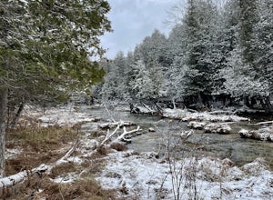
Jordan River Parkway Trail
4.045.33 mi / 2113 ft gainJordan River Parkway Trail is a point-to-point trail that takes you by a lake located near Saratoga Springs, Utah.Read more -
Alpine, Utah
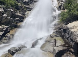
Horsetail Falls - Dry Canyon
5.04.01 mi / 1808 ft gainHorsetail Falls is a somewhat short hike located near Alpine, UT. The hike has good elevation gain and will make you work a bit to get there. The reward is worth the effort as you arrive at the falls and take a great view while being refreshed in the mist of the falls. The trail is straightforwar...Read more -
Alpine, Utah
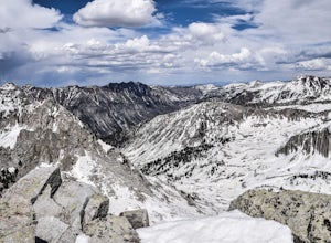
Day Hike to South Thunder Mountain
12.2 mi / 5604 ft gainThe summit of South Thunder Mountain, sitting at 11,154 ft, is a superb peak. Located on the Alpine Ridge of the Wasatch Mountains, this peak is criminally overlooked.The Schoolhouse Springs trailhead leads you onto an old dirt road, that switchbacks for about 2 miles through the foothills, befor...Read more -
Saratoga Springs, Utah
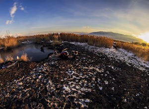
Saratoga Hot Springs
3.30.7 mi / 46 ft gainAwesome all year round, but one of the best places to chill out during winter. The water is just hot enough to feel amazing and escape from the cold. This place is public and not supervised. It does close from 10pm-6am and police have been known to pass by and enforce it. Pulling in to the parki...Read more -
Provo, Utah
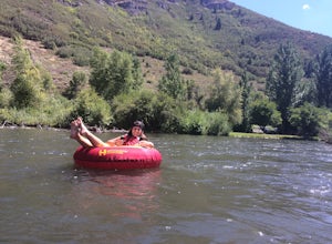
Floating the Provo River
4.3There's no better way than spending a hot summer day floating down a river with your friends. The Provo River offers incredible views of Mount Timpanogos and other surrounding mountains in the Provo Canyon. The easiest way to do this adventure is to visit High Country Adventure in the Provo Cany...Read more -
Provo, Utah
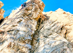
Rock Climb in Rock Canyon
4.5Rock Canyon, unsurprisingly, has a ton of great, local rock climbing routes for those in the Provo area. The marked location is for the parking lot. Once you're parked, head into the canyon. You will start to see bolts and anchors—and, depending on when you go, climbers—a few minutes in. There a...Read more -
Provo, Utah
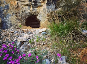
Hike to Buckley's Abandoned Mine
4.63 mi / 200 ft gainOnce you reach the mine it's gated but you can slide in. Follow the main tunnel a hundred or so feet back and climb the 75 foot ladder up to the second level. You can then make your way back out to the cliff face where there is another gate to the outside. That gate is a little trickier to squeez...Read more -
Provo, Utah
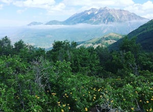
Hike Squaw Peak
4.57.1 mi / 2700 ft gainSquaw Peak Trail is a great hike if you live in Provo, since it is a quick getaway. But still definitely worth the trip if you don't. This 7.1 mile hike has beautiful views and does not long to do Usually it takes about three hours from start (Rock Canyon) to finish (the Peak) at a decent clip. T...Read more -
Provo, Utah
Snowshoe the Rock Canyon Trail
3 mi / 1630 ft gainThe Rock Canyon trail is a heavily trafficked path that brings people of all ages. In the winter the mountains are covered in snow and the path is well packed down due to the volume of people that are hiking. After about a mile of hiking, you will enter the more dense part of the canyon with lo...Read more -
Provo, Utah
Hike to Summit of Buffalo Peak
1 mi / 500 ft gainDrive up Provo Canyon and turn right on Squaw Peak Road. Follow the road til you reach the T in the road and head left on Road 027. Follow it 2.9 miles to the unmarked trail head. It is located next to a wooden fence on the right of the road and next to a sign about fire and wildlife safety. ...Read more -
Provo, Utah
Buffalo Peak Trail
0.97 mi / 213 ft gainBuffalo Peak Trail is an out-and-back trail where you may see wildflowers located near Provo, Utah.Read more -
Sandy, Utah
Climbing in the Lone Peak Cirque
4.0Lone Peak reaches 11,253 feet at its summit. It's alpine feel is unique as it stands above the busy city below. While this gem is one of the highlights in the Wasatch range, it must be earned. A long steep approach, best done at night in the summer months, deposits you in the high meadow surround...Read more -
Provo, Utah
The Y Trail
3.52.29 mi / 1063 ft gainHiking the Y is a classic hike in Provo, Utah—but don't expect it to be easy! There's no shade and not much greenery, so it's a hot, dusty trek to the top. Once you reach the Y, though, the view of the Provo and Utah Lake is amazing. There are also benches at the top. When you reach the Y, you w...Read more -
Provo, Utah
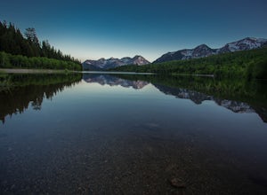
Backpack to Silver Lake
4.44.1 mi / 1500 ft gainThe trail is 4.1 miles roundtrip gaining almost 1,500 feet for the duration of the adventure. Some parts are exposed, so you can get a fair amount of sun.When you're on the trail, you'll get amazing views as you’re hiking to the lake of Mount Timpanogos and American Fork Canyon. This is followed ...Read more -
Provo, Utah
Camp at Silver Lake
4.54.4 mi / 1500 ft gainSilver Lake is a wonderful place to go if you're in need of a quick adventure in the woods. Located in the the Uinta National Forest, Silver Lake is relatively easy to get to via American Fork Canyon in Utah, however I do recommend driving a car with 4WD and can handle steep dirt roads with shar...Read more -
Wallsburg, Utah
Walk the Deer Creek Dam Trail
4.08.03 mi / 400 ft gainWhile driving East, the turnoff to the trailhead is just left of the dam. There is a size-able parking lot and rest rooms available. The hike itself is a dirt path and easy to follow. Access to the water's edge is restricted until you are 1500 feet past the dam. Though the trail is designed for b...Read more

