Utah
Looking for the best photography in Utah? We've got you covered with the top trails, trips, hiking, backpacking, camping and more around Utah. The detailed guides, photos, and reviews are all submitted by the Outbound community.
Top Photography Spots in and near Utah
-
Orderville, Utah
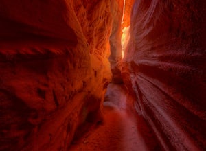
Kanab's Peek-a-Boo Canyon
4.87.71 mi / 587 ft gainThe trailhead is Red Canyon (aka Peek-a-boo) trailhead located just off of Highway 89 between Kanab and Mt. Carmel Junction. The GPX track shows the entirety of the trail, but if you have 4WD and a high-clearance vehicle, you're able to reach the closer parking area for a less than 1-mile roundtr...Read more -
Grand County, Utah
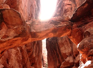
Fiery Furnace Loop
4.51.53 mi / 328 ft gainArches National Park is an incredible place with a variety of places to explore. One of the great places to explore is the Fiery Furnace. The Fiery Furnace requires a permit, which can be obtained at the Visitor Center after watching a short video. For the most part, they are making sure you are ...Read more -
Salt Lake City, Utah
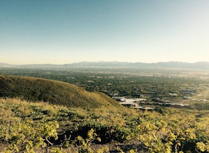
Hike Neff's Canyon
4.3From the parking lot, you will follow a 4-wheel drive track that runs straight up to the beginning of the different trailheads. You can also take an actual trail up to that same spot, situated below the 4-wheel gravel track on the righthand side.There are a few different trails that merge togethe...Read more -
Hurricane, Utah
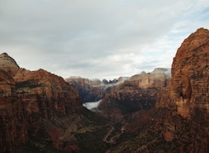
Canyon Overlook Trail
4.80.88 mi / 57 ft gainThe trailhead is located east out of the 1.1 mile long tunnel off highway 9. Parking is available immediately to the right after exiting the tunnel and the trail then begins with these charming steps, carved into sandstone, that climb above the Zion-Mt. Carmel Tunnel. The trail is broad and easy ...Read more -
Salt Lake City, Utah
Hike the Living Room
4.42.5 mi / 1000 ft gainBecause if its proximity to downtown Salt Lake, this is a great quick hike to do after work. Although it's short, it is fairly steep, climbing nearly 1000 feet in 1.25 miles. However, most people can do it without too much difficulty. This is a good family hike and allows dogs on leashes. Due to ...Read more -
Kanab, Utah
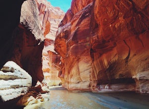
Hike through Paria Canyon
5.014.94 mi / 846 ft gainNo matter how far you plan on hiking, it is ideal to get an early start so you aren’t hiking too long under the desert sun. There is no shade on this hike except for the shadows offered from the steep walls of the canyon, so make sure you bring sunscreen! From the very start, you’ll get your fee...Read more -
Bryce, Utah
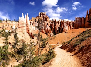
Navajo Loop and Queens Garden Trail
4.92.93 mi / 679 ft gainThere are many many trails that explore the hoodoos of Bryce Canyon and this is just one option of a combination of trails that is about 3.5 miles. The Navajo trail begins at Sunset Point and you head straight down dozens of switchbacks to what is called "Wall Street". It doesn't take long to get...Read more -
Springdale, Utah
Camp at Lava Point
Didn't make a reservation? Are all the Zion campgrounds full as usual? Don't worry, the less popular and more secluded Lava Point Campground is just about a 45 minute drive away and it's free! We camped here because we rolled in late at night to Zion National Park and everything was full. It turn...Read more -
Moab, Utah
Photograph Arches National Park
4.9Located in Southeast Utah, 5 miles North of Moab, Utah. From Hwy 70, take Exit 182 towards Crescent Jct/Moab, taking Hwy 191 S for about 25 miles until you reach Arches National Park on your left.From the Visitor Center, the La Sal Mountains Viewpoint area is about a 4 mile ride on your right. Th...Read more -
Kane County, Utah
Coyote Gulch Loop
4.710.59 mi / 4354 ft gainEasy hiking, water availability, and spectacular scenery make this a "must do" hike. Three days are best to see all this canyon has to offer. You can either make this a 3-5 mile hike or a longer 10-15 mile hike. The perfect trip down Coyote Gulch is three days and two nights. Hike in to Jacob Ham...Read more -
New Harmony, Utah
Hike to the Timber Creek Overlook in Kolob Canyon
5.01.15 mi / 102 ft gainThe Timber Creek Overlook trail is located at the end of the Kolob Canyon drive in Zion National Park. This hike is very family friendly and offers restrooms, picnic tables, and a well maintained trail. Bring your camera and hike the trail around sunset to get beautiful sunset shots of the valle...Read more -
Bryce, Utah
Hike the Fairyland Loop Trail at Bryce Canyon NP
4.77.8 mi / 1545 ft gainLet's face it: Bryce Canyon National Park is stunning. Its remarkable and unique hoodoos bring people from all over the world, and lots of them. If you're looking to enjoy this incredible park with a little more solitude than the main lookouts or the more popular Under the Rim trail, make sure to...Read more -
Salt Lake City, Utah
Hike Stairs Gulch
4.2Drive up Big Cottonwood Canyon for around 2.8 miles, parking will be along the road and there will be a large rock waterfall on the right hand side of the road. The trailhead is just a short distance from that rock fall (40.623824, -111.743208)Stairs Gulch is an easy, short hike, unless you're lo...Read more -
Bryce, Utah
Wall Street Loop in Bryce Canyon
4.73.25 mi / 610 ft gainHoodoos? What's that you say? Hoodoos are these amazing rock formations that Bryce Canyon is famous for. This hike is hands down the best way to see the hoodoos of Bryce Canyon. This hike allows for stunning lookout points from the rim and the experience of hiking through the hoodoos of the cany...Read more -
Salt Lake City, Utah
Hike to Big Cottonwood Canyon's Desolation Lake
4.67.4 mi / 1900 ft gainDrive 9 miles into Big Cottonwood Canyon and park at the Mill D North Trailhead (on the left). On the right side of the road, there is a restroom. The trial head begins on the left, there is a visible sign you cannot miss before beginning.The trail is about 7.4 miles round trip, about half way t...Read more -
Draper, Utah
Lone Peak via Jacobs Ladder
4.714.2 mi / 6713 ft gainThe main trail to Lone Peak is via Jacobs Ladder. To get to the start of the trailhead you need to drive on a dirt road for a little bit until you get to a little parking area (start of the road indicated on the map). The trail starts just south of where you park on the dirt road. The Jacobs Lad...Read more

