Park City, Utah
Looking for the best hiking in Park City? We've got you covered with the top trails, trips, hiking, backpacking, camping and more around Park City. The detailed guides, photos, and reviews are all submitted by the Outbound community.
Top Hiking Spots in and near Park City
-
Kamas, Utah
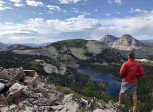
Ibantik Lake via Crystal Lake Trailhead
5.03.96 mi / 646 ft gainFrom the Crystal Lake trailhead, follow the trail 1.1 miles north to Wall Lake. Here, you'll come to a junction with the trail from Trail Lake; take the left trail heading north to Notch Mountain, and Ibantik Lake is a mere .6 miles northeast, nestled next to Notch Peak. At Ibantik Lake, you'll ...Read more -
Kamas, Utah
Hike to Weir Lake
5 mi / 800 ft gainWeir Lake is one of many mountain lakes located in the High Uintas near Kamas, Utah. The trail can be accessed off the Mirror Lake Scenic Byway about 33 miles east of Kamas and starts at the Crystal Lake Trailhead. There is a parking lot near the start of the trailhead, but expect it to be fairly...Read more -
Kamas, Utah
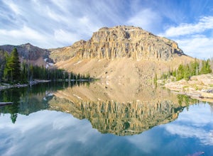
Camp and Climb at Cliff Lake
4.3 miCliff Lake can be located from the Crystal Lake Trailhead. The exact location is pinned, but you get there driving from Kamas. From Kamas take the Mirror Lake Highway and take the exit for Trial Lake Campground, the turn north to the Crystal Lakes Trailhead. There is a parking lot with bathrooms ...Read more -
Kamas, Utah
Camp at Fire Lake
The hike to Fire Lake starts at the Crystal Lake Trailhead just off the Mirror Lake Highway in the Uinta mountains. The main trailhead parking lot fills up quickly on weekends since it serves multiple trail options. If it’s full, no need to worry, there is an overflow lot down the road. The trai...Read more -
Provo, Utah
The Y Trail
3.52.29 mi / 1063 ft gainHiking the Y is a classic hike in Provo, Utah—but don't expect it to be easy! There's no shade and not much greenery, so it's a hot, dusty trek to the top. Once you reach the Y, though, the view of the Provo and Utah Lake is amazing. There are also benches at the top. When you reach the Y, you w...Read more -
Saratoga Springs, Utah
Saratoga Hot Springs
3.30.7 mi / 46 ft gainAwesome all year round, but one of the best places to chill out during winter. The water is just hot enough to feel amazing and escape from the cold. This place is public and not supervised. It does close from 10pm-6am and police have been known to pass by and enforce it. Pulling in to the parki...Read more -
Provo, Utah
Hike to the Summit of Buckley Mountain
4.018 mi / 5000 ft gainThere are a few ways to get to the top of Buckley, but the funnest (and most strenuous) way to get up to Buckley is taking the trail up Slate Canyon. Slate Canyon has a parking lot and bathroom located at the base of the trail, and the trailhead is about ten minutes from the Provo Center Street e...Read more -
Wasatch County, Utah
Hike Little Deer Creek to Cataract Gorge
4.04 miLittle Deer Creek Canyon can be accessed from the Emerald Lake Highway (150) in the Uinta National Forest east of Kamas, Utah. Turn right onto Murdoch Basin Road (Forest Service Road 137) until it splits off to the road to Cataract Gorge (Forest Service Road 027). It is recommended you park her...Read more -
Kamas, Utah
Photograph Bald Mountain in Utah
Bald Mountain is a 12,000' peak in the Uintas, and of the most popular hikes in the Uinta Mountains of Utah. If you're looking for more details on the hike, check out the adventure Hike Bald Mountain in the Uintas. Not only is it incredible to photograph from the top, with panoramic views of doze...Read more -
Kamas, Utah
Backpack to Notch Lake
5.04.6 mi / -600 ft gainThe hike to Notch Lake begins at the Bald Mountain trailhead. You'll need to display a recreation pass in your vehicle to park at the trailhead. You can purchase a pass for $6 at the fee station entering the forest boundary (east of Kamas) or at the Forest Service office right in Kamas. Take the ...Read more -
Kamas, Utah
Hike Bald Mountain in the Uintas
4.54 mi / 1250 ft gainBald Mountain is one of the most popular hikes in the Uintas, so get an early start if you want to beat the crowds. Those willing to hike in before dawn will be rewarded with an unforgettable sunrise at the summit. I HIGHLY recommend this as a sunrise hike. The trail starts out with steep switchb...Read more -
Hanna, Utah
Camp at Pyramid Lake in Murdock Basin of Utah's Uinta Mountains
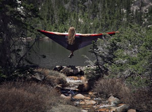
Grab a fishing pole, hammock, or book. Pyramid Lake is the perfect setting to kick back and relax in Murdock Basin of Utah's Uinta Mountains! Pyramid Lake is at an elevation of 9,700 feet with a 1,000-foot tall mountain directly to the west of the lake. Due to this steep face butting up to the e...Read more -
Hanna, Utah
Hike to Cuberant Lake
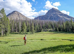
6 mi / 1066 ft gainThe hike to Cuberant Lake is 3-miles with a couple of steeper sections, but for the most part, it is a flat hike. From the Pass Lake Trailhead, you will head west on the Lofty Lake Loop Trail. On this part of the trail, you pass through meadows with Bald and Reid Peaks in the background, which is...Read more -
Hanna, Utah
Hike the Lofty Lake Loop Trail
4.54.2 mi / 935 ft gainLofty Lake Loop Trail is located in the High Uintas near Kamas, Utah. The trail can be found right off the Mirror Lake Scenic Byway about 32 miles east of Kamas and starts at the Pass Lake Trailhead. This is a fairly mellow trail with some areas of good elevation gain, enough to get your heart w...Read more -
Herriman, Utah
Hike to Kennecott Copper Mine
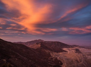
5.04 miFrom Salt Lake City go on UT-201W, then take Bacchus Highway all the way until the intersection with Butterfield Canyon Road. This is where you can park your car and follow the dirt road for roughly 2 miles until you come to a fork. One road from the fork leads to Middle Canyon and the other to t...Read more -
Oakley, Utah
Backpack to Cutthroat Lake
4 mi / 280 ft gainThere isn't a trail to Cutthroat Lake so for a portion of the hike will be cross-country. I highly recommend bringing a GPS but with intermediate route-finding skills you should be able to find your way. We used the Gaia GPS app and this made the hike much easier. The distance depends on the r...Read more

