Ogden, Utah
Our rich mountain to metro personality derives from a unique balance of vibrant shopping, delicious dining and exciting nightlife with backyard access to year-round, heart-pounding outdoor recreation and the majestic beauty of the Wasatch Mountain Range. Ogden, Utah offers one-of-a-kind outdoor recreation and metropolitan delights throughout the year.
Top Spots in and near Ogden
-
Salt Lake City, Utah
Hike Mount Wolverine
4 mi / 1425 ft gainThis mountain can be conquered two ways and is a great after-work adventure to watch the sunset, an early morning trail run, or a fun family challenge. The trail is 4 miles and 1,425 feet elevation gain (from the Alta side) or 6 miles and 2,050 feet (from the Brighton side). Both routes converge ...Read more -
Salt Lake City, Utah
Backpack Lake Catherine and Bag Sunset Peak
3.53 mi / 1200 ft gainAny chance to get into the backcountry of the Wasatch Mountains is worth it. Many people day hike in the area, but not very many backpack in. The trail meets up with the Great Western Trail and overlooks Lake Catherine. The best place to camp is in the woods next to the lake. Hike down to the lak...Read more -
Salt Lake City, Utah
Hike Catherine Pass
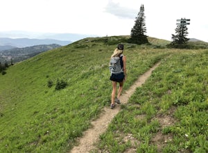
4 mi / 1115 ft gainCatherine Pass is a must do if you are in the Salt Lake vicinity in July. The wildflowers are mind-blowing. But it’s a great hike to do in the Spring, after Alta Ski Resort has closed, and the Fall as well. It costs $6 per vehicle to drive to the trailhead, or $10 per person to ride the lift (if...Read more -
Richmond, Utah
Backpack to White Pine Lake, Logan
4.57.6 mi / 1344 ft gainYou will start from the Tony Grove Lake parking lot and start hiking northeast on the White Pine Lake trailhead. The trail is roughly 3.8 miles to the lake through beautiful Quaking Aspens and Pines. The first 2.5 miles are fairly easy with a slight incline. You will then reach the top of a ridge...Read more -
Richmond, Utah
Hike Mt. Magog
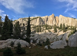
5.05 mi / 1702 ft gainMt. Magog is one of the most visually striking mountains in the Bear River range. With its very rocky peak being visible from Tony Grove, it is often photographed, but rarely ever hiked. It is rarely hiked because there is not actually an official trail that goes to the summit. This makes the hik...Read more -
Alta, Utah
Cecret Lake
4.41.78 mi / 509 ft gainCecret Lake is reached by driving up Little Cottonwood Canyon to Albion Basin above Alta Ski Resort. The hike is just under 1 mile to the lake and should take about 30 minutes. The hike goes through fields full of wildflowers and wildlife is abundant. Moose, deer, and various wildlife can be s...Read more -
Park City, Utah
Bike or Hike Park City's Mid Mountain Trail
5.022.8 mi / 4457 ft gainThe Mid-Mountain Trail is unique to Park City. It's an epic trail that connects Deer Valley, to Park City Mountain Resort, and Canyons Village. Traversing at approximately 8,300 feet elevation, the trail is comprised of 13 sections and is a 22.8 mile point-to-point ride from Deer Valley to Canyon...Read more -
Park City, Utah
Deer Valley Resort
5.07.51 mi / 1161 ft gainDeer Valley Resort is a loop trail where you may see local wildlife located near Park City, Utah.Read more -
Salt Lake City, Utah
Ski Baldy's Main Chute at Alta Ski Area
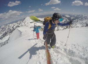
5.0Do you like hiking? In ski boots? Good.You start the hike from the gate to Snowbird at the EBT near the top of the Sugarloaf lift. The start of the bootpack is at 10,500 ft of elevation. From there, follow the likely well established boot pack to the top of Baldy. There is one rather steep sectio...Read more -
Park City, Utah
Hike Empire Pass Ridge
3.25 mi / 800 ft gainStarting at an elevation of 8,960 feet at Empire Pass, the trail follows the ridge to the west. It starts off on a gravel road, but quickly turns into a single-track trail once you pass the buried water tank. For the most part, you will stay on the ridge and have great views of Clayton Peak, Deer...Read more -
Draper, Utah
Lone Peak via the Cherry Creek Logging Trail
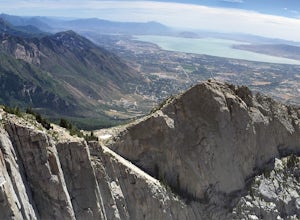
14.8 mi / 6378 ft gainYou start this trail at the Orson Smith Park in Draper. It joins with the Bonneville Shoreline Trail briefly before turning off onto the cherry creek logging trail. It switchbacks for a long ways exposed on towards the valley. It is fairly steep in places, but doable. I had tennis shoes with ...Read more -
Draper, Utah
Lone Peak via Jacobs Ladder
4.714.2 mi / 6713 ft gainThe main trail to Lone Peak is via Jacobs Ladder. To get to the start of the trailhead you need to drive on a dirt road for a little bit until you get to a little parking area (start of the road indicated on the map). The trail starts just south of where you park on the dirt road. The Jacobs Lad...Read more

