Moab, Utah
Looking for the best photography in Moab? We've got you covered with the top trails, trips, hiking, backpacking, camping and more around Moab. The detailed guides, photos, and reviews are all submitted by the Outbound community.
Top Photography Spots in and near Moab
-
Grand County, Utah
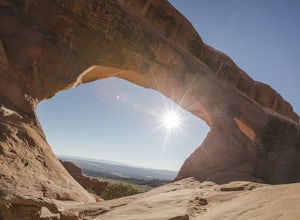
Partition Arch
4.52.88 mi / 364 ft gainHiking to Partition Arch begins at Devils Garden Trailhead which is at the end of the 16 mile Arches Scenic Drive road. Make sure to get to the trailhead early for 2 reasons: beating crowds and beating the heat. Arriving at sunrise will almost guarantee you a parking spot. Budget 2-3 hours round...Read more -
Moab, Utah
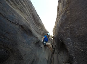
Descend MMI Canyon
3 mi / 700 ft gainFor this descent you will need to be comfortable with 4th class slick rock, have two 60m ropes, and an Arches National Park canyoneering permit along with your usual canyon kit. MMI Canyon can be accessed with 4WD/AWD as long as it has not rained. The pin on the map will take you to this locati...Read more -
Moab, Utah
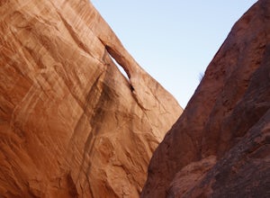
Rock Climb Dragonfly Canyon
5 mi / 400 ft gainThis canyon is a bit more advanced as it requires a mandatory swim and most likely a section of wet pot holes to surmount which, if dry, can also pose their own challenge. You will need standard canyoneering gear as well as two 60m ropes for the last rappel. Start by parking on a small pullout on...Read more -
Moab, Utah
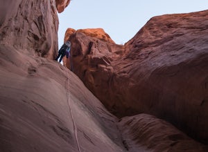
Descend Lost and Found Canyon
4 mi / 600 ft gainFor this descent you will need two 60 meter ropes, an Arches National Park canyoneering permit, be comfortable with 4th class slick rock, and have your usual canyoneering kit. This canyon does require some basic chimneying and canyoneering climbing techniques as well. The trailhead can be reache...Read more -
Moab, Utah
Hike to the Klondike Bluff Dinosaur Track
3.03 miI think these tracks are the best in Moab. Take route 191 north out of Moab for about 13 miles (mile post 142). Klondike Bluff road is on the right. If you pass the airport, you went too far. This road is easily accessed with two wheel drive cars. The parking area is at the end where you will see...Read more -
Moab, Utah
Tower Arch
5.02.46 mi / 440 ft gainTower Arch is located in the remote Klondike Bluffs area in Arches National Park. If you're looking at the park map, you can see the unimproved Salt Valley Road that leads south then west from the main road towards Klondike Bluffs. The road is rough in a few places, but can easily be traversed in...Read more -
Moab, Utah
Hike the Neck Spring Trail
5.8 mi / 260 ft gainWith minor changes in elevation, a couple easy scrambles and the opportunity to find your route by cairns, the Neck Spring Trail is the perfect way to get acquainted with Island in the Sky area of Canyonlands National Park.Starting at the Shafer Canyon Overlook parking lot, the Neck Spring trail ...Read more -
Moab, Utah
Backpack the Lathrop Canyon Trail in Canyonlands
18 mi / 2130 ft gainAccess to this trailhead is a few miles south of the Islands in the Sky Visitor Center in Canyonlands National Park. An easy drive from Moab or Interstate 70. Remember to get permits and check in with the rangers if camping. If just doing a day hike then no permits are needed. REMINDER: There is ...Read more -
Moab, Utah
Climb Mount Tukuhnikivatz
6 mi / 2200 ft gainFrom the parking area at La Sal Pass, follow a well defined but unmapped trail though meadow, brief forest, and then switchbacks up the prominent ridge just east of the summit ridge of Mt Tuk. Once on the ridge bear west (climbers left) along the ridge as it narrows. Depending on conditions the r...Read more -
Cisco, Utah
Off Road to the Top of The World
13.2 mi / 2000 ft gainThe off road trail called Top of the World is a dirt road meant for *OFF ROAD VEHICLES ONLY*. All wheel drives jeeps and trucks are most common on this route but it is frequented by ATV and Dirt Bike users as well. If you elect to hike this route be mindful of their presence and give off-road veh...Read more -
Moab, Utah
Night Photography at Mesa Arch
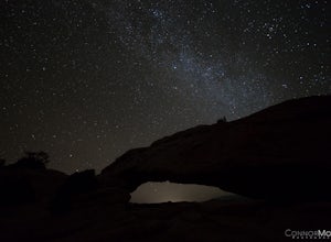
5.0From the parking lot, the hike is a .6 mile loop (20-30 min hike round trip). It took 10 minutes to get to the Arch. I arrived at 2am and hiked to the Arch to get some Milky Way shots, definitely arrive earlier to shoot the stars. I explored around when I got to the Arch and came up with a bunch ...Read more -
Moab, Utah
Mesa Arch
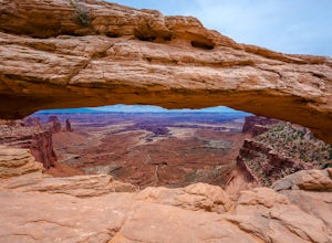
4.50.74 mi / 164 ft gainThis is an easy 0.6 mile loop. The hike takes you out to Mesa Arch, which is one of the most famous structures of Canyonlands National Park. If you're out with your camera, you can get amazing shots of the arch with the rugged canyon as your backdrop. Some of the best photos of the arch are at s...Read more -
Moab, Utah
Hike the Aztec Butte Trail
4.52 mi / 500 ft gainThe Aztec Butte Trail is a two pronged out and back trail for a total of two miles. The trail is single track and easy to follow. After a third of a mile the trail splits. To the left, a trail takes you to the top of a small mesa. There is an informative sign marking the way. On the other side of...Read more -
Monticello, Utah
Explore Looking Glass Arch
4.0Getting there:From Moab, follow Highway 191 south for about 23 miles until you get to Looking Glass Road/Co. Rd. 131. Take a right and follow the road for about 2 miles and then turn left into the parking lot.It is only about 0.10 miles from the parking lot to the arch itself, but there is a ~150...Read more -
Moab, Utah
Hike to Murphy Point
4.33.4 mi / 320 ft gainMurphy Point, found in the Island In The Sky district of Canyonlands NP, takes hikers on a mesa that ends at an overlook with sweeping vistas over Murphy Basin, the White Rim, and Green River. If you're looking to get away from the tourists, then head to this quiet and often overlooked trail.The ...Read more -
Moab, Utah
Catch a Sunset at Green River Overlook
4.5Turn right on Highway 313 after Mesa Arch Trailhead and follow the road past Willow Flat Campground to Green River Overlook. Park at the parking lot. Climb over the railing onto the rock edge. Sit and breathe in that desert wind and distant sun. Simple as that.I recommend camping at Willow Flat t...Read more

