Glen Canyon National Recreation Area, Utah
Looking for the best camping in Glen Canyon National Recreation Area? We've got you covered with the top trails, trips, hiking, backpacking, camping and more around Glen Canyon National Recreation Area. The detailed guides, photos, and reviews are all submitted by the Outbound community.
Top Camping Spots in and near Glen Canyon National Recreation Area
-
Kane County, Utah
Coyote Gulch Loop
4.710.59 mi / 4354 ft gainEasy hiking, water availability, and spectacular scenery make this a "must do" hike. Three days are best to see all this canyon has to offer. You can either make this a 3-5 mile hike or a longer 10-15 mile hike. The perfect trip down Coyote Gulch is three days and two nights. Hike in to Jacob Ham...Read more -
Kane County, Utah
Hike Hole in the Rock
5.0Hole in the Rock is a historic site in Utah where the Mormon Pioneers had to dynamite a path down the mountain to get through to the Colorado River. The pathway at Hole in the Rock is still cleared out, and you get to hike through the path that these enduring people traveled, bringing wagons down...Read more -
Lake Powell, Utah
Boat-In Camp at The Rincon in Lake Powell
To get to The Rincon, you will first want to park your car and rent a boat (or bring your own power boat) at Bullfrog Marina. The marina does rentals for everything from houseboats to power boats to jet skis and kayaks/SUP boards. For this adventure, I recommend either a houseboat or a power boat...Read more -
Kane County, Utah
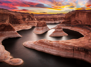
Reflection Canyon
5.015.24 mi / 1368 ft gainBackpacking Reflection Canyon is not for the faint of heart. It's an intense, challenging hike that takes you through slot canyons, climbing up and down shifty sandstones and traversing rugged terrains and ravines. Although the elevation gain is almost nothing, the up and down climbs from one rav...Read more -
Kane County, Utah
Hike to Broken Bow Arch
4.76.28 mi / 732 ft gainThe trailhead starts at the Willow Gulch Trailhead, located just off of Hole in the Rock Road in the Grand Staircase -Escalante National Monument. The coordinates for the trailhead are 37.324812,-111.023019. To get there head east on highway 12 out of Escalante, Utah until you get to Hole in the ...Read more -
Garfield County, Utah
Golden Cathedral Trail
4.59.27 mi / 1398 ft gainFrom highway 12, drive south down the hole in the rock road for about 17 miles to a dirt road on the left that is well marked for Egypt. Follow that dirt road 9.9 miles to the Egypt Trailhead. There is a BLM trail register at the trail head. After that, take one of the numerous ways down to the E...Read more -
Escalante, Utah
Explore Devils Garden
4.4This is a great area that the whole family can enjoy. It is located about 15 miles down the hole-in-the-rock road south of Escalante, Utah. There is a sign marking the turn-off. In the parking lot there is a restroom and a picnic area.You're free to walk among the hoodoos and even on them in some...Read more -
Garfield County, Utah
Hike in the Upper Muley Twist Canyon
4.510 mi / 750 ft gainThis hike is by far my favorite trail I've been on. To begin, you access Upper Muley Twist Canyon Road from the top of the Burr Trail Road switchbacks. Regular vehicles can be driven a little less than half a mile to the trailhead (adding about 3 miles to get to the trailhead, about 6 miles round...Read more -
Boulder, Utah
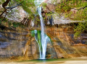
Lower Calf Creek Falls
4.65.74 mi / 515 ft gainThe trailhead for lower calf creek falls begins at the Calf Creek Campground. There is a small fee to park in the campground and a larger fee if you plan on camping in the campground. There is potable water and outhouses at the trailhead but parking can be difficult to find during the spring and ...Read more -
Boulder, Utah
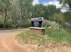
Camp at Deer Creek Campground
5.0Deer Creek campground is off of the Burr Scenic drive and right outside of the lower part of Capitol Reef National Park. This campground is perfect if you are driving from Bryce Canyon to Capitol Reef. There are a total of 7 tent sites in the campground. There are no spots for RVs and no turn aro...Read more -
Page, Arizona
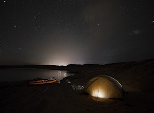
Kayak Camp on Lake Powell
3.7Kayak camping right on the beaches of Lake Powell and then paddling out into the stillness of the morning to hike antelope canyon is one of my all time favorite memories. Just across from the Antelope Point Launch Ramp is a fantastic beach with several flat areas that are perfect for tent campin...Read more -
Kane County, Utah
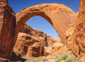
Backpack to Rainbow Bridge
5.017 mi / 2800 ft gainThis incredible trip isn't only about Rainbow Bridge. Honestly, the Bridge is just icing on the cake.The scenery is breathtaking along the way, changing and evolving as you pass through epic canyons and climb over rocky ledges to be rewarded with spanning vistas. It really is amazing. There's eve...Read more -
Kane County, Utah
Camp At Wahweap Campground
4.0This modern campground is just steps from the beach and centrally located on the Arizona / Utah border -- perfect for exploring both sides of the Glen Canyon National Recreational Area. You do need a national parks pass or will incure a $25 fee to enter the park (good for one week). The campgrou...Read more -
Kane County, Utah
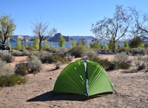
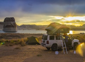
Beach Camp On Lake Powell's Lone Rock Beach
4.6Just twelve miles north of Page, Arizona on Highway 89 across the Utah border, Lone Rock Beach is a great open beach where you can drive right up and make camp anywhere you like. There is a $10 fee to get on the beach and it can get a little busy during the summer, but it seems like you can alway...Read more -
Torrey, Utah
Camp at McMillan Springs In The Henry Mountains
McMillan Springs Campground is south of Hanksville, Utah and within the Henry Mountains, which run north and south between Canyonlands, and Capitol Reef National Parks. Situated at 8,400 feet, McMillan Springs Campground has moderate temperatures and is managed by the BLM, so fees are donation b...Read more -
Page, Arizona
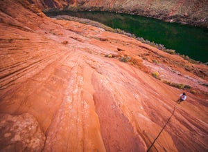
Hiking the Ropes Trail in Page Arizona
5.0The Ropes Trail is an old hiking trail below Glen Canyon Dam that has long since been abandoned by the park service. It is also one of the few trails that leads down the steep walls into the canyon. Let me say that again, it's steep. Getting there Take Highway 89 from Page going north and take th...Read more

