Escalante, Utah
Top Spots in and near Escalante
-
Escalante, Utah
Backpack the Escalante River
14 mi / 400 ft gainThe Escalante River trail is an easily accessible, moderately strenuous hike within Grand Staircase-Escalante National Monument. The national monument encompasses over 2 million acres of wilderness, choc-full of large canyons, narrow slot canyons, rivers, hoodoos, arches, natural bridges and more...Read more -
Escalante, Utah
Escalante River Trail: Escalante to UT-12
12.97 mi / 3373 ft gainEscalante River Trail: Escalante to UT-12 is a point-to-point trail that takes you by a river located near Eggnog, Utah.Read more -
Escalante, Utah
Covered Wagon Natural Bridge Trail
4.00.59 mi / 66 ft gainCovered Wagon Natural Bridge Trail is an out-and-back trail where you may see beautiful wildflowers located near Escalante, Utah.Read more -
Boulder, Utah
Escalante Natural Bridge
5.03.25 mi / 266 ft gainThis is a 3.2 mile hike in the Escalante River Canyon near Escalante, Utah. This hike features a number of brief river crossings, so be prepared to get wet! The hike traverses a number of small boulder fields and dense riverside vegetation before concluding at the Escalante Natural Bridge. This h...Read more -
Boulder, Utah
Lower Calf Creek Falls
4.65.74 mi / 515 ft gainThe trailhead for lower calf creek falls begins at the Calf Creek Campground. There is a small fee to park in the campground and a larger fee if you plan on camping in the campground. There is potable water and outhouses at the trailhead but parking can be difficult to find during the spring and ...Read more -
Boulder, Utah
Backpack Death Hollow in Grand Staircase-Escalante
22 mi / 1600 ft gainThe most popular route into Death Hollow is from the Boulder airstrip near the town of Boulder, Utah. The trailhead for the Boulder Mail Trail begins, or ends here depending on which way you are hiking. Leave a car at the Highway 12 bridge over the Escalante River for the thru hike, or get luck...Read more -
Boulder, Utah
Upper Calf Creek Falls
5.01.76 mi / 571 ft gainFinding the trailhead for the Upper Calf Creek Falls can be a little difficult. Head east out of Escalante and follow highway 12 for about 20.6 miles. There will be a dirt turnout on the left hand side that leads to a dirt parking lot and a trail sign with registration for the Upper Calf Creek Fa...Read more -
Escalante, Utah
Zebra Slot Canyon
5.05.18 mi / 315 ft gainZebra slot canyon is located in the heart of Grand Staircase Escalante National Monument in southern Utah. The trail takes you through sandy washes to one of the areas most popular slot canyons to photograph and explore. The hike starts from the parking lot along Hole-In-The-Rock road. Hole-In-T...Read more -
Escalante, Utah
Zebra and Tunnel Slot Canyons Loop
4.86.63 mi / 535 ft gainThis place is just outside of Escalante, Utah, about 6 miles drive down the Hole in the Rock Road / BLM 200. You will see a small parking lot on the right side, the trailhead is not marked, but it's right cross the road from parking lot, once you see the trail you can just easily follow it for 1....Read more -
Boulder, Utah
Drive the Burr Trail Scenic Backway
5.066.2 mi / 4124 ft gainThe Burr Trail is a 66 miles mostly-paved road connecting Boulder, Utah / Highway 12 with the Notom-Bullfrog road that passes through some of the most scenic (and largely untouched) painted-rock backcountry in three of our national parks/monuments including Grand Staircase-Escalante, Capitol Reef...Read more -
Boulder, Utah
Camp at Deer Creek Campground
5.0Deer Creek campground is off of the Burr Scenic drive and right outside of the lower part of Capitol Reef National Park. This campground is perfect if you are driving from Bryce Canyon to Capitol Reef. There are a total of 7 tent sites in the campground. There are no spots for RVs and no turn aro...Read more -
Escalante, Utah
Hike to the Cosmic Ashtray
4.08 mi / 800 ft gain...As a frequent traveler, what's always motivated my travels were locations that have either been on my bucket list, or are places that are photogenic and a little off the beaten path. During my recent 3 week road trip through Northern Arizona and Southern Utah, I had the opportunity to visit a ...Read more -
Escalante, Utah
Explore Devils Garden
4.4This is a great area that the whole family can enjoy. It is located about 15 miles down the hole-in-the-rock road south of Escalante, Utah. There is a sign marking the turn-off. In the parking lot there is a restroom and a picnic area.You're free to walk among the hoodoos and even on them in some...Read more -
Escalante, Utah
Devils Garden
4.01.01 mi / 131 ft gainDevils Garden is a loop trail that takes you past scenic surroundings located near Escalante, Utah.Read more -
Boulder, Utah
Camp and Fish Deer Creek Lake
2.7 mi / 702 ft gainThere is something magical about Deer Creek Lake. The views are amazing, the hike is revitalizing, and the mountain air speaks to your soul. Stars seem to shine brighter here than any other trip you will go on. Out here, it is you and the wild. You will be able to see fish colored with bright cut...Read more -
Garfield County, Utah
Canyoneering in Neon Canyon
13 mi / 1000 ft gainThis is an 8-12 hour technical adventure that is usually done as an overnight backpack. Consider hiring a local guide service such as Excursions of Escalante or Escalante Outfitters! We did this as a self-guided excursion. A group is recommended because you may experience keeper potholes dependin...Read more
Top Activities
Camping and Lodging in Escalante
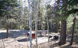
Escalante, Utah
Posey Lake Campground
Overview
Posey Lake Campground is located next to its beautiful namesake lake high on the Colorado Plateau at an elevation of 8,800 feet....

Escalante, Utah
Cowpuncher Guard Station
Overview
Cowpuncher Guard Station is located in the Dixie National Forest, 20 miles northeast of the town of Escalante in southern Utah. ...
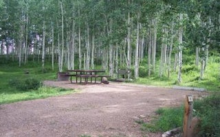
Garfield County, Utah
Barker Recreation Area
Overview
Barker Recreation Area is located high on the Colorado Plateau at an elevation of 9,300 feet. Visitors enjoy canoeing, fishing a...
Garfield County, Utah
Lower Bowns
Overview
Lower Bowns Campground is located on the east side of Boulder Mountain on the shore of Lower Bowns Reservoir at an elevation of ...
Antimony, Utah
Pine Lake Campground
Overview
Pine Lake Campground is located next to its scenic namesake lake high on the Colorado Plateau at an elevation of 8,100 feet. Vis...
, Utah
Rosebud Atv
Overview
Rosebud ATV Campground is located high on the Colorado Plateau at an elevation of 8300 feet. Torrey, Utah is just 17 miles north...


