Escalante, Utah
Looking for the best hiking in Escalante? We've got you covered with the top trails, trips, hiking, backpacking, camping and more around Escalante. The detailed guides, photos, and reviews are all submitted by the Outbound community.
Top Hiking Spots in and near Escalante
-
Bryce, Utah
Navajo Loop Trail
5.01.53 mi / 525 ft gainNavajo Loop Trail is a loop trail that takes you past scenic surroundings located near Bryce, Utah.Read more -
Bryce, Utah
Navajo Loop and Queens Garden Trail
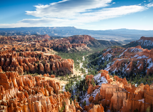
4.92.93 mi / 679 ft gainThere are many many trails that explore the hoodoos of Bryce Canyon and this is just one option of a combination of trails that is about 3.5 miles. The Navajo trail begins at Sunset Point and you head straight down dozens of switchbacks to what is called "Wall Street". It doesn't take long to get...Read more -
Bryce, Utah
Peek-a-Boo Loop in Bryce Canyon
4.54.98 mi / 1388 ft gainThis 5 mile hike begins at an elevation of 8000' at the Navajo Loop trailhead at Sunset Point. The view from the lookout of Sunset Point is only just a small taste of the sweeping vistas you will see on the hike. From Sunset Point follow the sign for the Navajo Trail and begin descending into a s...Read more -
Bryce, Utah
Sunset Point to Sunrise Point
5.01.13 mi / 105 ft gainSunset Point to Sunrise Point Trail is an out-and-back trail where you may see local wildlife located near Bryce, Utah.Read more -
Bryce, Utah
Winter Camping in Bryce Canyon National Park
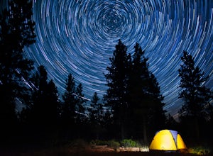
5.0The incredible views at Bryce Canyon National Park can be described with little else than a “Wow.” During a snowy winter, especially, these sights are not to be missed.There is only one campground open during the winter, Sunset Campground, and it is first come, first serve. Most visitors shy away...Read more -
Kanab, Utah
Hike WIllis Creek Slot Canyon
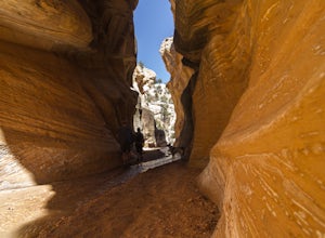
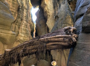
4.7Willis Creek Slot Canyon begins at the Willis Creek Trailhead, located in Grand Staircase Escalante National Monument. The trail is very easy to find and follow. It begins winding through junipers for several hundred feet before dropping gradually into a wash, at which point it meets up with Will...Read more -
Garfield County, Utah
Camp at Dave's Hollow Campground
4.2 mi / 800 ft gainWe all know the crowds well at our favorite National Parks, and Bryce Canyon is no exception. When you're looking to get a little further away from the noise, lights, and experience of a National Park campground, you often don't have to go very far off the main road. This adventure is for those w...Read more -
Kanab, Utah
Bull Valley Gorge Trail
0.89 mi / 49 ft gainBull Valley Gorge Trail is an out-and-back trail that takes you by a river located near Cannonville, Utah.Read more -
Hatch, Utah
Bike Thunder Mountain Trail
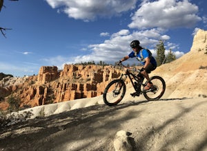
4.08 mi / 1123 ft gainThunder Mountain Trail is one that should be on every mountain bikers bucket list. It's located just outside of Bryce Canyon National Park and passes through hoodoos, classic Bryce Canyon topography and epic views to the west. For the first 2.5 miles, the trail meanders back and forth with littl...Read more -
Torrey, Utah
Capitol Gorge Trail
4.02 mi / 787 ft gainDrive along Scenic Drive in Capitol Reef National Park and you'll find this trailhead at the end of the road. After 7 miles of driving, you'll arrive at the Pleasant Creek Road turnout and parking area. From here, the road continues to Capitol Gorge, but is unpaved. We had to park at a small p...Read more -
Torrey, Utah
Golden Throne
3.59 mi / 1529 ft gainCapitol Reef National Park is filled with excellent hikes, and the hike to the Golden Throne should not be left out of the conversation. This hike is 2WD accessible, has moderate distance, and decent elevation gain, making it a great hike and exercise for everyone. The trail begins from the Cap...Read more -
Torrey, Utah
Grand Wash Trail, Capitol Reef National Park
4.37.09 mi / 1644 ft gainThe Grand Wash is a canyon in Capitol Reef National Park featuring several-hundred-foot-tall sandstone walls. The canyon walls are, for the most part, widely spaced, except for a half mile long section of scenic "narrows". Hike to nearby Cassidy Arch if you have extra time. Beware of potentiall...Read more -
Torrey, Utah
Drive the Scenic Drive in Capitol Reef National Park
5.0Inside Capitol Reed National Park there is a scenic drive. The drive you do have to pay for ($15 bucks a car) but considering the park is free, you may as well! The drive is about 8 miles long, with pull offs for ideal picture taking, the landscape is vast and ever changing with every turn, incl...Read more -
Torrey, Utah
Cassidy Arch Trail
4.43.08 mi / 1283 ft gainFollow the scenic road just past the Fruita Campground to the first dirt road on the left. The dirt road meanders through cool rock formations (great for night photography) and eventually dramatic cliffs that you will be climbing up. The parking area is obvious and there are primitive restrooms. ...Read more -
37.475264,-112.239586
Hike the Bristlecone Loop Trail
3.00.98 mi / 180 ft gainThe trail begins from the South side of the parking lot and is well marked with signs and information placards. Walk for approximately 5 minutes before reaching the intersection where the two ends of the loop come together. This loop can be done in either direction so you can take your pick. T...Read more -
37.475289,-112.240302
Hike Bryce Canyon's Riggs Spring Loop
5.08.71 mi / 2044 ft gainBryce Canyon National Park in Utah is a spectacular place. It really has to be seen to be believed. Some of the most scenic parts of Bryce are easily accessible by the average visitor via car-accessible overlooks. However, if you're not into crowds or want to hike/backpack in Bryce...there are so...Read more

