Alpine, Utah
Looking for the best chillin in Alpine? We've got you covered with the top trails, trips, hiking, backpacking, camping and more around Alpine. The detailed guides, photos, and reviews are all submitted by the Outbound community.
Top Chillin Spots in and near Alpine
-
Alta, Utah
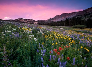
Albion Meadows Trail
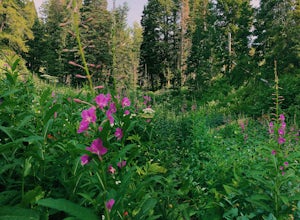
4.92.86 mi / 696 ft gainAt Albion Basin, wildflowers you will see include lupine, Indian paintbrush, American bistort, sunflowers, fireweed, and many more! Drive to the very top of Little Cottonwood Canyon and park at the Albion Grill. There is a trail just behind the Grill that takes you through a variety of wildflowe...Read more -
Provo, Utah
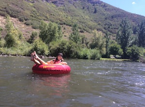
Floating the Provo River
4.3There's no better way than spending a hot summer day floating down a river with your friends. The Provo River offers incredible views of Mount Timpanogos and other surrounding mountains in the Provo Canyon. The easiest way to do this adventure is to visit High Country Adventure in the Provo Cany...Read more -
Holladay, Utah
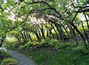
Hike Heughs Canyon (Olympus Waterfall)
4.52 mi / 1000 ft gainHeughs Canyon starts right on the edge of Salt Lake City, but within minutes, you’re in a shady forest next to a gurgling stream. This is the prefect after-work hike that can be enjoyed year-round. Two miles round-trip and just over 1,000 feet, the path takes you to a beautiful waterfall that flo...Read more -
Salt Lake County, Utah
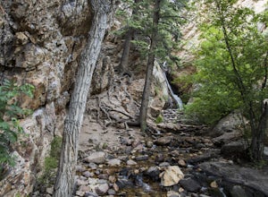
Hidden Falls
4.20.16 mi / 138 ft gainHidden Falls is a beautiful little waterfall with minimal crowds. When I say minimal, I mean I've only seen another person there 1 of the 5 or 6 times that I have been. Take it in. Stay a while. Scramble around the small canyon for different perspectives of the falls or the creek. If you don't ha...Read more -
Brighton, Utah
Photograph Star Trails at Silver Lake
1 miSilver Lake is one of the easiest, most accessible hikes in the Wasatch, located at the top of Big Cottonwood Canyon, Utah, close to the ski resorts of Brighton and Solitude.The lake is accessible all year; with a boardwalk or a well-signed path circling the lake through spring to fall. In the wi...Read more -
Salt Lake City, Utah
Hike Cardiff Fork
8 mi / 2880 ft gainCardiff Fork and Donut Falls share the same parking lot, so depending on what time of week you go exploring here, it may be the most packed parking in all of the Wasatch. Head up on a weekday for less crowds. The Cardiff Fork trailhead is follows the rocky jeep road around the parking lot to the...Read more -
Brighton, Utah
Hike and Camp at the Twin Lakes Reservoir
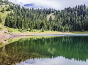
5 mi / 650 ft gainThe trailhead begins at the Solitude Nordic Center. Walking around Silver Lake, you get a chance to observe the ducks and lovely wetlands area. This trail then leads you into the lower aspens, and if you are hiking just as fall colors have begun to emerge, they create a glowing effect in the wood...Read more -
Brighton, Utah
Hike or Trail Run Butler Fork
5.07.2 mi / 1964 ft gainTo get to the trailhead, drive up Big Cottonwood Canyon 8 miles. The parking lot is on the left side of the road. The first half mile is the steepest of the whole trail so don't get too intimidated by it, it mellows out a lot after. You will come to fork in the trail about a mile in, you can eith...Read more -
Provo, Utah
Rock Climb in Rock Canyon
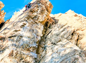
4.5Rock Canyon, unsurprisingly, has a ton of great, local rock climbing routes for those in the Provo area. The marked location is for the parking lot. Once you're parked, head into the canyon. You will start to see bolts and anchors—and, depending on when you go, climbers—a few minutes in. There a...Read more -
Salt Lake City, Utah
Photograph Guardsman Pass & The Alpine Loop
5.0Since this is a loop you can start at either end, but this is the way we did it. Start driving up Big Cottonwood Canyon. Enjoy the views and take in the impressive peaks on either side of the road. See the changes in vegetation as you gain elevation in the canyon. As you near the top and pass Sol...Read more -
Provo, Utah
Hike to Buckley's Abandoned Mine
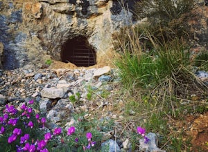
4.63 mi / 200 ft gainOnce you reach the mine it's gated but you can slide in. Follow the main tunnel a hundred or so feet back and climb the 75 foot ladder up to the second level. You can then make your way back out to the cliff face where there is another gate to the outside. That gate is a little trickier to squeez...Read more -
Salt Lake City, Utah
Hike to Big Cottonwood Canyon's Desolation Lake
4.67.4 mi / 1900 ft gainDrive 9 miles into Big Cottonwood Canyon and park at the Mill D North Trailhead (on the left). On the right side of the road, there is a restroom. The trial head begins on the left, there is a visible sign you cannot miss before beginning.The trail is about 7.4 miles round trip, about half way t...Read more -
Salt Lake City, Utah
Hike Neff's Canyon
4.3From the parking lot, you will follow a 4-wheel drive track that runs straight up to the beginning of the different trailheads. You can also take an actual trail up to that same spot, situated below the 4-wheel gravel track on the righthand side.There are a few different trails that merge togethe...Read more -
Salt Lake City, Utah
Hike Mt. Aire
4.54 mi / 2000 ft gainMount Aire, standing around 8600 ft, certainly isn't the most inspiring peak in or around Salt Lake City, but to me it serves as a quick summit to catch the sunset when I'm short on time.Getting There:Start by heading up Mill Creek Canyon Rd. After passing the ranger booth, drive about 5.5 miles ...Read more -
Herriman, Utah
Drive Butterfield Canyon
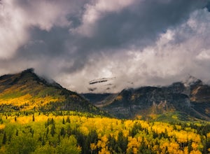
4.5Butterfield Canyon is a little-known canyon on the west side of Utah Valley. Beautiful any time of the year, it is especially beautiful in the fall—all the leaves changing colors! When you reach the marked location, turn onto Butterfield Canyon Road. Drive until you reach the end of the road (it...Read more -
Salt Lake City, Utah
Hike Bowman Fork to Baker Pass
5.08.3 mi / 3375 ft gainTo get to the trailhead, drive up Millcreek Canyon about 4.5 miles until you reach the Terraces Picnic area. Turn here and drive up the small road until you reach the parking lot by the bathrooms. You'll see the Bowman Fork trailhead marker next to the parking lot. The trail climbs steadily and i...Read more

