West Lake Hills, Texas
Top Spots in and near West Lake Hills
-
Austin, Texas
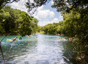
Swim at Gus Fruh
4.00.26 mi / 79 ft gainThe trailheads are located in neighborhoods and parking isn't really too much of an issue. The shortest entrance is located off Barton Hills Dr. A quick google search and you will find it and the labeled trail. You walk down into the Barton Creek Green Belt and your spirits are uplifted. That cra...Read more -
Austin, Texas
Hike along Lady Bird Hike & Bike Trail
10 miThe Hike and Bike Trail around Lady Bird Lake provides great views of the city skyline from several different perspectives. It's perfect for exercising or just taking a stroll on. It's about a 10 mile looping trail however there are several points in which you can cross the river and make the loo...Read more -
Austin, Texas
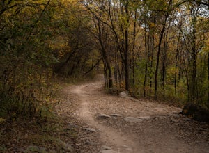
Hike Barton Greenbelt Trail Via Barton Creek Plaza
6.6 mi / 380 ft gainThe Barton Greenbelt Trail via Barton Creek Plaza is a 6.6 mile out-and-back hike located within the Barton Creek Greenbelt. This trail follows along the creek and features a couple prominent waterfalls that also serve as popular swimming holes in the summer months. Depending on the rainfall for ...Read more -
Austin, Texas
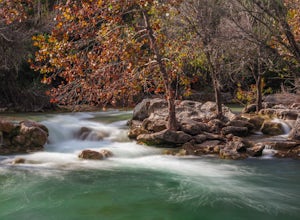
Twin Falls and Sculpture Falls via Barton Creek Greenbelt Trail
3.03.23 mi / 141 ft gainThis hike is about 3.2 miles in total and is an out-and-back trail found within the Barton Creek Greenbelt stretch. The trail follows along the Barton Creek and is popularly known for the two major waterfalls it entails: Twin Falls and Sculpture Falls, which are very popular swimming destinations...Read more -
Austin, Texas
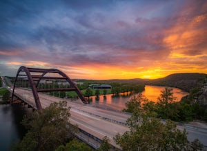
Hike the 360/Pennybacker Bridge Overlook Trail
1.8 mi / 167 ft gainThis is a pretty challenging hike but the view is most definitely worth the effort. There are two sides you can hike up on: the east and west. The west side is more popular as it gives a view of the Austin skyline as well the Pennybacker Bridge. However, the east side is good for sunset viewing. ...Read more -
Austin, Texas
Three Falls Hike
7.35 mi / 600 ft gainThe Three Falls Hike is a 7.35 mile out and back hike located in the Barton Creek Greenbelt in Austin, Texas. The hike is heavily trafficked. The trail takes you past three waterfalls, which during the summer time serve as extremely popular swimming holes. Please note that the flow of the waterf...Read more -
Austin, Texas
Photograph Pennybacker Bridge (Austin 360 Bridge)
4.30.5 mi / 75 ft gainIf you're looking for excellent views of hill country, the skyline, or just an awesome place to watch the sunset this is the place to be. If you're heading southbound from 183 on 360 just before you reach the bridge there will be a dirt parking lot on your right. There are trailheads on the easts...Read more -
Austin, Texas
Hike the Violet Crown Trail: 360 to 290 Trailhead
1.8 mi / 239 ft gainThe Violet Crown Trail: 360 Trailhead to 290 trail is a 1.8 mile point-to-point hike that stretches from Loop 360 to Highway 290. Only a portion of the trail follows alongside Barton Creek before heading south towards HWY 290 while the creek veers off to the west. Dogs are more than welcome as lo...Read more -
Austin, Texas
Walk Through Austin State Capitol
4.03.4 mi / 101 ft gainThe loop is primarily used for hiking and walking and is accessible year-round. Dogs are also able to use this trail but must be kept on leash. This walking tour provides the visitor with many views of Texas History: the beautiful state capitol building, the capitol grounds filled with historic m...Read more -
Austin, Texas
Watch the Mexican-Free-Tailed Bats Emerge from Congress Street Bridge
Every evening, just as the sun sets, you can watch the 1.5 million bats take flight into the evening sky. This is great family fun and a must if you visit/are new to Austin. Parking is easy and nearby, however it is paid. There is a separate lot located in the Austin American Stateman parking lot...Read more -
Austin, Texas
University of Texas Walk
2.99 mi / 197 ft gainThe University of Texas Walk is about a 3-mile loop trail around the University of Texas at Austin. Beginning at the LBJ Presidential Library, the trail loops around all of UT's most prominent landmarks, including the LBJ fountain, the Blanton Museum of Art and of course the renowned school tower...Read more -
Austin, Texas
Bike through Iconic Graffiti Landmarks in Austin
5.0You don't have to rent a bike but it's the "Austin" thing to do. With plenty of pick up and drop off locations all throughout the city you can start the trip and end it whenever you feel like it! It's recommended to start the trip on South Congress at the bike rental located near Doc's Motorworks...Read more -
Travis County, Texas
Hike Violet Crown Trail: Zilker to 360 Trailhead
3.03.7 mi / 282 ft gainThe Violet Crown Trail: Zilker to 360 is 3.7 mile out-and-back stretch through the Barton Creek Greenbelt. The trail begins in Zilker Park and follows Barton Creek all the way south to Loop 360. Parking can be found at Zilker Park. Though on weekends and during the summer time, the park is usuall...Read more -
Austin, Texas
Bull Creek South to North
3.67 mi / 335 ft gainThe Bull Creek Trail is an Out-and-Back trail along Bull Creek; it's a pretty beginner to intermediate hike. The trail follows along Bull Creek which runs between the hills of the Austin Hill Country. There are several waterfalls which can be found along the creek. The trail has multiple access p...Read more -
Austin, Texas
Hike the Lower Bull Creek Greenbelt Trail
5.02.86 mi / 78 ft gainPark in the lot off of Lakewood Drive (see map) to access the trail. This trail is good for all skill levels and is dog-friendly.Read more -
Austin, Texas
Valburn to Bull Creek Loop
1.6 mi / 170 ft gainThe Valburn to Bull Creek Loop is a 1.6 mile loop hike through the Bull Creek Greenbelt located in Northwest Austin, Texas. The trail follows alongside the creek and is pretty rocky and steep with many changes in elevation. The trail is very scenic and has many wildlife watching opportunities, a...Read more

