Marble Falls, Texas
Top Spots in and near Marble Falls
-
Johnson City, Texas
Hike the Wolf Mountain Trail
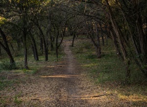
7.4 mi / 416 ft gainThe Wolf Mountain Trail is a 7.2 mile loop hike within Pedernales Falls State Park, right outside of Johnson City, Texas. The trail is pretty wide and great for all sorts of exercising and social distancing. The trail is relatively moderate and well maintained. There is little shade but it is st...Read more -
Johnson City, Texas
Hike Wolf Mountain And Juniper Ridge Trail Loop
11.2 mi / 472 ft gainWolf Mountain and Juniper Ridge Trail Loop is a 11.2 mile loop hike within Pedernales Falls State Park, right outside of Johnson City, Texas. The trail is pretty wide and great for all sorts of exercising and social distancing. The trail is relatively moderate and well maintained. There is littl...Read more -
Johnson City, Texas
Hike Juniper Spring Via Wolf Mountain And Juniper Ridge
8.4 mi / 462 ft gainJuniper Spring via Wolf Mountain and Juniper Ridge is a 8.4 mile loop hike within Pedernales Falls State Park, right outside of Johnson City, Texas. This trail is moderately trafficked. The trail is pretty wide and great for all sorts of exercising and social distancing. The trail is relatively ...Read more -
Johnson City, Texas
Hike Wolf Mountain, Juniper Ridge And South Loop Equestrian Trail
6.6 mi / 374 ft gainThe Wolf Mountain, Juniper Ridge and South Loop Equestrian Trail is a 6.6 mile loop hike within Pedernales Falls State Park, right outside of Johnson City, Texas. The trail is pretty wide and great for all sorts of exercising and social distancing. The trail is relatively moderate, with few incl...Read more -
Lakeway, Texas
Hike Hamilton Greenbelt
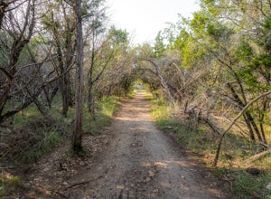
5.1 mi / 374 ft gainThe Hamilton Greenbelt is a 5.1 mile out-and-back neighborhood hike located in Lakeway, just 15 miles outside of downtown Austin. The trail is located in a neighborhood and is extremely well-maintained. At the entrance of the trail you will find a little garden area with a small waterfall and a s...Read more -
Leander, Texas
Explore Dinosaur Tracks in Leander
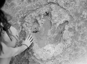
4.11 miAbout a half mile west from the Hwy 183 bridge that crosses the South Fork of the San Gabriel River lies approximately 12 dinosaur footprints embedded in the river bed. Not many people know about the dinosaur tracks just northwest of Austin in Leander, Texas. This is not a marked trail, there ar...Read more -
Llano, Texas
Catch a Sunset at Badu Park
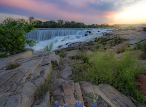
Located in the small but fun town of Llano, Texas, Badu Park is a great location for catching a sunset, fishing, picnicking, or just plain chilling. This location is located about an hour and a half west of Austin, Texas (75 miles) but is well worth the drive for a day trip! The dam is a popular...Read more -
Liberty Hill, Texas
Hike the Good Water Trail
5.012.6 mi / 1270 ft gainThe Good Water Trail which is part of the larger Good Water Loop, is a 12.6 mile point-to-point hike. This trail is heavily trafficked by both hikers and mountain bikers alike. It's a great trail for scenic views, nature, and wildlife. Please be advised that the trail is severely rocky and uneven...Read more -
Cedar Park, Texas
Hike the Brushy Creek Regional Trail
4.56.5 mi / 85 ft gainPark in the big lot off E Little Elm Trail Road (see map) to access the trailhead. Trail is accessible year round and is dog-friendly.Read more -
Austin, Texas
Swim and Relax at Common's Ford Ranch
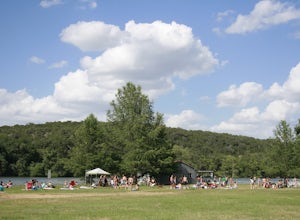
3.0Commons Ford is a lakefront park offering a boathouse that can be reserved, fishing, volleyball net and picnicking. Many people go to the park with the expectation of lounging on the large grassy area for many hours so be sure to pack food, blankets, sunscreen, and tubes if you plan to float in ...Read more -
Austin, United States
Riverplace Nature Trail
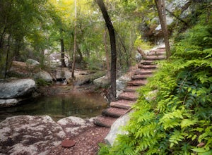
4.45.41 mi / 768 ft gainThis is a great trail to get some exercise close to downtown Austin, Texas. The trail at Natural Preserve at River Place is well maintained and has stairs and plenty of elevation gain to make your legs a little wobbly by the time you get back to your car. The trail is a 5.5-mile out-and-back hike...Read more -
Austin, Texas
Hike the Little Fern Trail
0.5 mi / 140 ft gainThe Little Fern Trail is a 1.9 mile out-and-back hike that is a part of the River Place Nature Trail. It is perfect for hiking, walking, running, and biking. The trail is open for use year-round and is easy to follow, with lots of small, side waterfalls and lush greenery scattered along. The tree...Read more -
Austin, Texas
Turkey Creek Trail
2.72 mi / 259 ft gainTurkey Creek trail is a 2.7 mile out-and-back hike located within Emma Long Metropolitan Park in Northwest Austin, Texas. This trail is perfect for cycling, running, walking, and general exercise. The trail is made of dirt with few inclines. Please note, however, at the beginning of the trail the...Read more -
Austin, Texas
St. Edwards Park Greenbelt Loop
0.75 mi / 43 ft gainParked in parking lot and walked yellow trail until it met up with the river then followed the river to the blue, purple, green trails back to parking lot. With many stops for photographs this little loop took less than an hour. North red is a little trail is longer. Where the yellow/orange/red ...Read more -
Austin, Texas
St. Edwards Park Yellow & Blue Trails
4.71.24 miSt. Edwards Park offers 2 main trails taking you along a creek, up hill trails with gorgeous views from atop a bluff, through exposed meadows filled with prairie grasses and cacti, and to a small swimming hole with a rope swing. The Creek Trail is a much easier, family friendly hike compared to ...Read more -
Austin, Texas
St. Edwards Green and Red Loop
2.8 mi / 328 ft gainSt. Edwards Green and Red Loop is a 2.7 mile loop hike located in northwest, Austin, Texas. The trail is heavily trafficked, but has a great nature scene, including a multitude of bird species and wildflowers. Bull creek flows through the trail, creating a waterfall at one point which makes for a...Read more

