Leander, Texas
Looking for the best hiking in Leander? We've got you covered with the top trails, trips, hiking, backpacking, camping and more around Leander. The detailed guides, photos, and reviews are all submitted by the Outbound community.
Top Hiking Spots in and near Leander
-
Austin, Texas
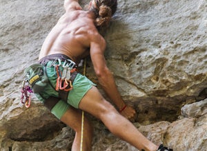
Rock Climb at Gus Fruh
0.5 mi / 50 ft gainNOTICE:For this activity it is necessary to have someone with lead climbing and belaying expertise. There is a wide range of difficulties on the routes. A guide that has climbed at this wall before is recommended. GETTING THERE:You can enter Gus Fruh from a couple of different points starting in ...Read more -
Austin, Texas
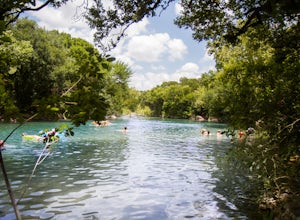
Swim at Gus Fruh
4.00.26 mi / 79 ft gainThe trailheads are located in neighborhoods and parking isn't really too much of an issue. The shortest entrance is located off Barton Hills Dr. A quick google search and you will find it and the labeled trail. You walk down into the Barton Creek Green Belt and your spirits are uplifted. That cra...Read more -
Austin, Texas
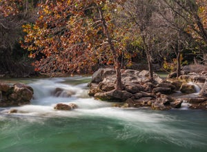
Twin Falls and Sculpture Falls via Barton Creek Greenbelt Trail
3.03.23 mi / 141 ft gainThis hike is about 3.2 miles in total and is an out-and-back trail found within the Barton Creek Greenbelt stretch. The trail follows along the Barton Creek and is popularly known for the two major waterfalls it entails: Twin Falls and Sculpture Falls, which are very popular swimming destinations...Read more -
Austin, Texas
Three Falls Hike
7.35 mi / 600 ft gainThe Three Falls Hike is a 7.35 mile out and back hike located in the Barton Creek Greenbelt in Austin, Texas. The hike is heavily trafficked. The trail takes you past three waterfalls, which during the summer time serve as extremely popular swimming holes. Please note that the flow of the waterf...Read more -
Austin, Texas
Hike Barton Greenbelt Trail Via Barton Creek Plaza
6.6 mi / 380 ft gainThe Barton Greenbelt Trail via Barton Creek Plaza is a 6.6 mile out-and-back hike located within the Barton Creek Greenbelt. This trail follows along the creek and features a couple prominent waterfalls that also serve as popular swimming holes in the summer months. Depending on the rainfall for ...Read more -
Austin, Texas
Hike the Violet Crown Trail: 360 to 290 Trailhead
1.8 mi / 239 ft gainThe Violet Crown Trail: 360 Trailhead to 290 trail is a 1.8 mile point-to-point hike that stretches from Loop 360 to Highway 290. Only a portion of the trail follows alongside Barton Creek before heading south towards HWY 290 while the creek veers off to the west. Dogs are more than welcome as lo...Read more -
Travis County, Texas
Hike Violet Crown Trail: Zilker to 360 Trailhead
3.03.7 mi / 282 ft gainThe Violet Crown Trail: Zilker to 360 is 3.7 mile out-and-back stretch through the Barton Creek Greenbelt. The trail begins in Zilker Park and follows Barton Creek all the way south to Loop 360. Parking can be found at Zilker Park. Though on weekends and during the summer time, the park is usuall...Read more -
Round Mountain, Texas
Explore Westcave Outdoor Discovery Center
0.7 mi / 80 ft gainLocated about 25 miles from downtown Austin, Westcave Preserve is a beautiful and family-friendly day adventure. The trail is out-and-back about .7 miles long. It leads down into a very lush green canyon filled with a variety of plant species and ferns. At the end of the trail is the main feature...Read more -
Austin, Texas
Hike the Western Oaks Trail
1.74 mi / 49 ft gainThe Western Oaks Trail is a 1.7 mile trail located in the Legend Oaks neighborhood in Southwest Austin, Texas. The trail is looping however there are several interconnecting trails which can shorten or lengthen the duration of the hike. The trail is mostly flat and made of crushed gravel. It is p...Read more -
Austin, Texas
Take a Stroll on the Dick Nichols Park Trail
1.09 mi / 16 ft gainThe Dick Nichols Park Trail is a 1 mile loop neighborhood park trail located in Southwest Austin. The trail is completely flat and is entirely paved. It circles the park and is equally shaded and exposed. It's very kid-friendly and perfect for walking the dog, biking, trail running, hiking, and e...Read more -
Austin, Texas
Stephenson Preserve Loop
2.17 mi / 243 ft gainThe Stevenson Preserve Trail is a 1.5 mile loop hike located in South Austin. The outer trail makes a large loop around the entire park, however there are several interconnecting trails within the loop. This trail system is part of the Stephenson Preserve, which is also connected to the Longview ...Read more -
Austin, Texas
Hike Onion Creek And Homestead Trail Loop
5.06.5 mi / 387 ft gainThe Onion Creek and Homestead Trail Loop is a 6.5 mile loop hike within McKinney Falls State Park, just outside of Austin city limits. The trail is long however pretty beginner level as there are not many inclines. The trail features two waterfalls: the Upper and Lower falls which are popular swi...Read more -
Austin, Texas
Hike the Homestead Trail
4.03.1 mi / 157 ft gainThe Homestead Loop hike is a 3.1 mile loop featuring the Lower Falls of McKinney Falls State Park. The hike is pretty intermediate and is mostly shaded. There are not many inclines. It is both dog- and kid-friendly. The trail does cross small streams, so be weary to bring water shoes/sandals. Th...Read more -
Austin, Texas
Hike Mary Moore Searight Park Trail
2.1 mi / 65 ft gainThe outer loop trail at Mary Moore Searight park is 2.1 miles and is interconnected by several smaller trails, which can be used to shorten the length of the hike. The trail is relatively easy with very few inclines and declines. The trail is mostly very thin crushed gravel and great for an easy ...Read more -
Johnson City, Texas
Explore Pedernales Falls
4.80.6 mi / 104 ft gainPedernales Falls drops 50 feet in elevation over 3,000 feet of titled, layered steps of limestone along the Pedernales River in Blanco County. In order to reach the falls you must enter Pedernales Falls State Park and follow the park road until the very end. There you'll find a parking lot and it...Read more -
Taylor, Texas
Granger Lake Trail
7.54 mi / 400 ft gainGranger Lake Trail is an out-and-back trail that starts off in Taylor Park in Granger Texas. At the end of the trail are primitive campsites, accessible by hike or by boat. This trail is used by hikers and bikers and dog-friendly on leash. Backcountry campground reservations for Fox Bottom Camp A...Read more

