Dripping Springs, Texas
Looking for the best hiking in Dripping Springs? We've got you covered with the top trails, trips, hiking, backpacking, camping and more around Dripping Springs. The detailed guides, photos, and reviews are all submitted by the Outbound community.
Top Hiking Spots in and near Dripping Springs
-
Austin, Texas
Hike Laguna Gloria Trail
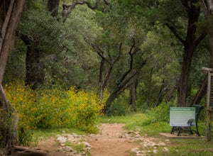
0.4 mi / 9 ft gainThe Laguna Gloria Trail is a 0.4 mile out-and-back hike beginning in Mayfield Park, a popular park located in west Austin. The trail is very short and relatively easy. The trail is made of dirt and is completely shaded. It's a very calming walk and beautiful walk, full of lush greens and dependin...Read more -
Austin, Texas
Hike Main Trail to Meadow Loop to Taylor Creek Loop
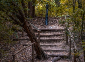
0.6 mi / 55 ft gainThe Main Trail to Meadow Loop to Taylor Creek Loop is a 0.6 loop hike found within Mayfield Park just west of downtown Austin. The trail is completely shaded and is a relatively easy hike. The trail does descend down stairs in some spots, but nothing too significant. This is a great family trail ...Read more -
Austin, Texas
Hike the Mayfield Park Lake Trail
3.01 mi / 0 ft gainMayfield Nature Preserve is a 21-acre park located just west of downtown Austin, Texas. This nature preserve is unique from all other parks in Austin in that it that features free-roaming peacocks. It's a beautiful park full of beautiful nature and the trail leads down near the lake. The trail is...Read more -
Austin, Texas
Hike the 360/Pennybacker Bridge Overlook Trail
1.8 mi / 167 ft gainThis is a pretty challenging hike but the view is most definitely worth the effort. There are two sides you can hike up on: the east and west. The west side is more popular as it gives a view of the Austin skyline as well the Pennybacker Bridge. However, the east side is good for sunset viewing. ...Read more -
Austin, Texas
Photograph Pennybacker Bridge (Austin 360 Bridge)
4.30.5 mi / 75 ft gainIf you're looking for excellent views of hill country, the skyline, or just an awesome place to watch the sunset this is the place to be. If you're heading southbound from 183 on 360 just before you reach the bridge there will be a dirt parking lot on your right. There are trailheads on the easts...Read more -
Austin, Texas
Mount Bonnell Loop
3.60.46 mi / 59 ft gainThe trail up is a combination of manmade and natural stairs that take you up to the top. At the summit, you will find beautiful views of the area, and a pavilion where you can have a picnic lunch. To head back down by a different route, continue on the northern trail, which will take you past mo...Read more -
San Marcos, Texas
Hike the Ringtail Ridge Trail
4.01.93 mi / 91 ft gainThis trail is shared by hikers, trail runners, mountain bikers, and dog walkers. The trail is open for use year round, featuring beautiful wildflowers in the spring. The trail can be slightly hard to spot - a good place to park is next to a church off Old Hwy 80, and a spur trail will take you t...Read more -
Austin, Texas
Walk Through Austin State Capitol
4.03.4 mi / 101 ft gainThe loop is primarily used for hiking and walking and is accessible year-round. Dogs are also able to use this trail but must be kept on leash. This walking tour provides the visitor with many views of Texas History: the beautiful state capitol building, the capitol grounds filled with historic m...Read more -
Austin, Texas
Hike the Shoal Creek Trail
5.05.47 mi / 173 ft gainThe Shoal Creek trail is located along the Shoal Creek Greenbelt which stretches the length of central/downtown Austin. It is a 5.4 mile out-and-back trail following along Shoal Creek. Much of the trail runs through residential area. And though it runs parallel to a creek, itis a city trail and n...Read more -
Austin, Texas
Bull Creek South to North
3.67 mi / 335 ft gainThe Bull Creek Trail is an Out-and-Back trail along Bull Creek; it's a pretty beginner to intermediate hike. The trail follows along Bull Creek which runs between the hills of the Austin Hill Country. There are several waterfalls which can be found along the creek. The trail has multiple access p...Read more -
Austin, Texas
Hike the Lower Bull Creek Greenbelt Trail
5.02.86 mi / 78 ft gainPark in the lot off of Lakewood Drive (see map) to access the trail. This trail is good for all skill levels and is dog-friendly.Read more -
Austin, Texas
Hike the Homestead Trail
4.03.1 mi / 157 ft gainThe Homestead Loop hike is a 3.1 mile loop featuring the Lower Falls of McKinney Falls State Park. The hike is pretty intermediate and is mostly shaded. There are not many inclines. It is both dog- and kid-friendly. The trail does cross small streams, so be weary to bring water shoes/sandals. Th...Read more -
Austin, Texas
Hike Onion Creek And Homestead Trail Loop
5.06.5 mi / 387 ft gainThe Onion Creek and Homestead Trail Loop is a 6.5 mile loop hike within McKinney Falls State Park, just outside of Austin city limits. The trail is long however pretty beginner level as there are not many inclines. The trail features two waterfalls: the Upper and Lower falls which are popular swi...Read more -
San Marcos, Texas
Hike Dante's Trail And Backend Loop
2.5 mi / 213 ft gainThe Dante's Trail and Backend Loop is a 2.5 mile loop hike located within the Purgatory Creek Greenspace area just south of San Marcos, Texas. This particular section of the Greenspace is made of flattened crushed gravel and is mostly shaded. The trail is very well maintained and several benches ...Read more -
San Marcos, Texas
Hike Purgatory Creek Overlook Via Dante's Trail
2.8 mi / 209 ft gainThe Purgatory Creek Overlook via Dante's Trail is a 2.8 mile out-and-back hike located within the Purgatory Creek Greenspace area just south of San Marcos, Texas. This particular section of the Greenspace is made of flattened crushed gravel and is mostly shaded. The trail is very well maintained ...Read more -
Austin, Texas
Valburn to Bull Creek Loop
1.6 mi / 170 ft gainThe Valburn to Bull Creek Loop is a 1.6 mile loop hike through the Bull Creek Greenbelt located in Northwest Austin, Texas. The trail follows alongside the creek and is pretty rocky and steep with many changes in elevation. The trail is very scenic and has many wildlife watching opportunities, a...Read more

