Dripping Springs, Texas
Looking for the best hiking in Dripping Springs? We've got you covered with the top trails, trips, hiking, backpacking, camping and more around Dripping Springs. The detailed guides, photos, and reviews are all submitted by the Outbound community.
Top Hiking Spots in and near Dripping Springs
-
San Marcos, Texas
Dante's, Lower Purgatory Creek and Blue Trail Loop
2.74 mi / 249 ft gainDante's, Lower Purgatory Creek and Blue Trail Loop is a 2.7 mile loop hike located in San Marcos, Texas. Located outside of downtown, it serves as a great nature trail for hiking, biking, and general exercise. It's primarily shaded and is a very moderate trail. It is not heavily trafficked, espec...Read more -
San Marcos, Texas
Purgatory Creek Natural Area Loop
4.07.77 mi / 568 ft gainPark in the dirt lot off of Hunter Road (see map) to access the trail. Trail is open year round and is dog-friendly.Read more -
Austin, Texas
Hike Mueller Park Trail
4.02.6 mi / 78 ft gainThe Mueller Park Trails total a distance of 5 miles with a 2.6 mile loop hike that takes you by some waterfalls located in Austin, TX. You can wander around Mueller Lake or the pond in Southwest Greenway, where man-made waterfalls can be viewed, or both! In addition to the waterfalls, the Southwe...Read more -
Austin, Texas
Hike the Great Hills Park Trail
2.31 mi / 127 ft gainThe Great Hills Park trail is a 2.3 mile point-to-point nature trail found within the Great Hills neighborhood of Northwest Austin. The trail is perfect for cycling, hiking, or just for taking a regular walk. The hike features a multitude of wildlife and is primarily shaded. There are several bat...Read more -
Marble Falls, Texas
Camp at Shaffer Bend Recreation Area
6 mi / 80 ft gainAfter turning off Highway 1431 you'll drive through a little quiet and narrow one road neighborhood to arrive at the entrance to Shaffer Bend Recreation Area. From there you will drive down a dirt road which will take you almost all the way through Shaffer Bend's 523 acre lot, and lead you direct...Read more -
Cedar Park, Texas
Hike the Brushy Creek Regional Trail
4.56.5 mi / 85 ft gainPark in the big lot off E Little Elm Trail Road (see map) to access the trailhead. Trail is accessible year round and is dog-friendly.Read more -
Austin, Texas
Hike Walnut Creek Metro Loop
4.08.8 mi / 534 ft gainWalnut Creek Metro Loop is an 8.8 mile loop hike located within Walnut Creek Metro Park in north Austin, Texas. The trail is moderately hiked and relatively easy. It's great for walking/running/cycling. There are many smaller trails that connect portions of the main loop and it's easy to get conf...Read more -
Austin, Texas
Hike or Bike the Walnut Creek Trail
3.74.4 mi / 190 ft gainWalnut Creek Park has a TON of little side trails that make this a must do if you are in or near the area. This particular trail (1 of 2 major ones) is a 15 mile loop but can be done as a shorter out and back. Once you park in the parking lot head southwest to find the trailhead and you're good t...Read more -
Garfield, Texas
Hike the Southeast Metropolitan Park Primitive Trail
4.02.17 mi / 223 ft gainThe Southeast Metropolitan Park Primitive Trail is a quick 2.3 mile hike, perfect for families, hikers, and trail runners. This trail is dog friendly, and is open for use year round. This hike is lightly trafficked, so this is a great place to go if you are looking for some solitude.Read more -
Leander, Texas
Explore Dinosaur Tracks in Leander
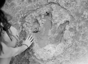
4.11 miAbout a half mile west from the Hwy 183 bridge that crosses the South Fork of the San Gabriel River lies approximately 12 dinosaur footprints embedded in the river bed. Not many people know about the dinosaur tracks just northwest of Austin in Leander, Texas. This is not a marked trail, there ar...Read more -
New Braunfels, Texas
Hike the Panther Canyon Nature Trail
1.7 mi / 131 ft gainThis trail is perfect for the whole family (including dogs)! The trail is shared by walkers and runners. The Panther Canyon Nature Trail is open for use year round, and is a great location for birding. The trail is a bit rocky in spots - so shoes with ankle support are recommended.Read more -
Burnet, Texas
Tour the Longhorn Caverns
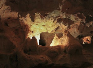
5.01.1 miThe Longhorn Cavern State Park is a hidden gem in the Hill Country. The caverns are breathtaking and some of the walls are completely covered in Quartz. During prohibition, bootleggers used the caverns as a speakeasy and there are remnants left from that era. In order to view the Caverns you must...Read more -
Liberty Hill, Texas
Hike the Good Water Trail
5.012.6 mi / 1270 ft gainThe Good Water Trail which is part of the larger Good Water Loop, is a 12.6 mile point-to-point hike. This trail is heavily trafficked by both hikers and mountain bikers alike. It's a great trail for scenic views, nature, and wildlife. Please be advised that the trail is severely rocky and uneven...Read more -
Cedar Creek, Texas
Pine Ridge Overlook
4.52.95 miPine Ridge Overlook is one of the longest hikes at McKinney Roughs Nature Area offering 2.7 miles through piney woods that overlook valleys and offer glimpses of the Colorado River. McKinney Roughs is considered a nature and learning park and requires a $5 entrance fee per-person at the Visitor ...Read more -
Georgetown, Texas
Good Water Loop
5.025.58 mi / 2241 ft gainThe Good Water Loop is a loop trail around the San Gabriel River through Russel Park and Sawyer Park. Just outside of Georgetown, Texas, this trail is perfect for a lengthy trail run or for an overnight backpacking trip. This trail is open year-round, and dogs are allowed to use this trail if kep...Read more -
Georgetown, Texas
Hike the San Gabriel River Trail
7.6 mi / 498 ft gainThe San Gabriel River trailhead is found within Cedar Breaks Park, just northeast of Georgetown, Texas. The trail is a 7.6 mile moderate out-and-back trail. The trail is heavily trafficked and even more so on weekends. There are several inclines and declines, but nothing too significant. The trai...Read more

