Spring City, Tennessee
Looking for the best photography in Spring City? We've got you covered with the top trails, trips, hiking, backpacking, camping and more around Spring City. The detailed guides, photos, and reviews are all submitted by the Outbound community.
Top Photography Spots in and near Spring City
-
Grandview, Tennessee
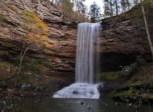
Hike to Piney Falls
5.01.5 mi / 500 ft gainThe gravel road heading to the trailhead is on the rougher side to take it slow. When you get to the trailhead it’s a small gravel pull off right off the road. There are no maps at the trailhead but there are only a few trails to take and they are marked with a blue marker. To get to the upper fa...Read more -
Spring City, Tennessee
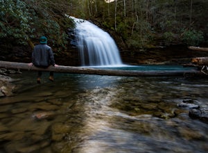
Hike to Stinging Fork Falls
3.53 mi / 400 ft gainThe trail begins on the right side of the parking lot. The first part is flat with no elevation change and easy walking. About half a mile in you will reach a trail split. The right trail will take you to the falls and the left trail will take you to an overlook of the gorge below. I was not able...Read more -
Rockwood, Tennessee
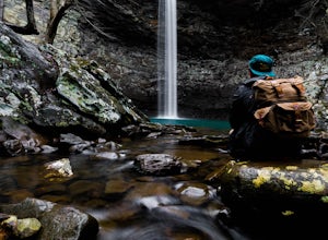
Ozone Falls
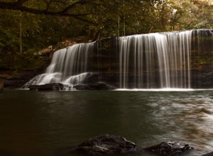
4.20.35 mi / 43 ft gainThis beautiful, 110-foot waterfall is an easy 15-minute walk from the parking area. Note that the walk down to the falls, although short, is steep and there isn’t a well-marked trail down. It’s more about choosing the path of least resistance. Also, it can get quite busy in the summer time espec...Read more -
Pikeville, Tennessee
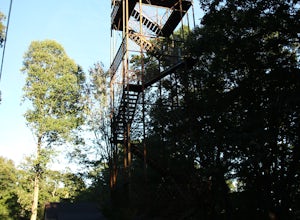
Hike to Fall Creek Falls Fire Tower
4.51 mi / 100 ft gainThe tower is located in the far northeast corner of Fall Creek Falls state park. The road to get there can be rough especially if it has rained recently but any 2 wheel drive vehicle should be able to make it. When you get to the trailhead it is a small gravel pull off with a gate. From the gate ...Read more -
Sparta, Tennessee
Virgin Falls State Natural Area Loop
5.04.46 mi / 400 ft gainBeginning at the Virgin Falls SNA parking area, the Virgin Falls trail is approximately a 9 mile round trip (excluding any side trails) which will allow you to experience three waterfalls: Big Branch Falls, Big Laurel Falls, and the namesake Virgin Falls. There is a fourth, Sheep Cave Falls, that...Read more -
Mooneyham, Tennessee
Welch's Point
5.00.3 mi / 79 ft gainThis location was recently opened back to the public by Tennessee Wildlife Resources Agency and the Tennessee Department of Conservation and Environment in the fall of 2014 after being closed for over a decade! It is one of the most spectacular spots to watch the sunset in east Tennessee. This o...Read more -
Scenic Loop Road, Tennessee
Hike to the Base of Fall Creek Falls
5.00.86 mi / 299 ft gainFall Creek Falls State Park hosts a variety of large waterfalls which can easily become confusing. The park's main attraction is the 256 foot waterfall dubbed "Fall Creek Falls." Fall Creek Falls is observable from a viewing platform less than a five minute walk from the Scenic Loop Road parking ...Read more -
Pikeville, Tennessee
Photograph Buzzard's Roost Overlook
5.00.04 mi / 10 ft gainLocated in the beautiful state park of Fall Creek Falls, you'll find this overlook along with Millikan's Overlook. Both overlooks showcase the views shown in my photos, however, Buzzard's Roost is a short walk down the side trail that gives a more solitude experience that you may be looking for. ...Read more -
Lancing, Tennessee
Camp at OBED Wild and Scenic River Area via the Point Trail
4 miYou will want to park at the Lilly Bluff parking lot. Your GPS won't know where this is, so here are the GPS coordinates N36° 06.162', W84° 43.280'.The trailhead is located on the North side of the parking lot. All you need to do is follow the sign for Point Trail. The trail culminates at an e...Read more -
Lancing, Tennessee
Take in the View at Lilly Bluff Overlook
5.00.6 mi / 0 ft gainHonestly this is hard to even call a trail, but that doesn't mean it lacks beauty. Once you take the right or left of off ridge Ridge Road make sure to go past the first parking lot and into the second larger parking lot. The trail starts near the front of the parking lot on the right side of the...Read more -
Lancing, Tennessee
Climb The Lilly Bluff Wall
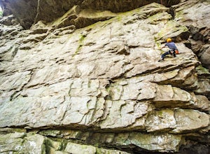
The Obed Wild and Scenic River is typically not found in the same conversations as Zion or Yosemite, but be assured this hidden gem of Tennessee is one of the East Coast's must climb destinations.There are a number of climbing areas within the Obed worth exploring, ranging from bouldering to mul...Read more -
Wartburg, Tennessee
Potter's Falls
0.1 mi / 50 ft gainPotter's Falls is a semi locally known area that is used for lots of different activities. To get there the roads are pretty simple and easy to follow the directions. The parking can be a bit tricky especially if its during the summer or extreme cold in the winter. There are only about 15 spots o...Read more -
Oak Ridge, Tennessee
Hike to North Boundary Quarry
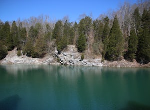
5.01 mi / 100 ft gainThe parking at the trailhead is right off of the Oak Ridge turnpike so its very easy to park and there are plenty of spots to park. The trail is very wide and is a great place for taking kids and riding your bike. There are more than one trail that you can take to get to the quarry from the trail...Read more -
Soddy-Daisy, Tennessee
Hike the Hogskin Upper and Lower Loop
5.01.4 miAfter an easy 25 minute drive from Chattanooga you will reach North Chickamauga Gorge on Montlake Road in Soddy Daisy. Park any where in the gravel loop just make sure other cars can get through. From the Montlake Road Trailhead Kiosk the trail begins on an old mining road. Hogskin Upper Loop Tr...Read more -
Soddy-Daisy, Tennessee
Hike the Hogskin Loop to Stripmine Falls
2.51.3 miStripmine Falls is not the biggest waterfall in the area, but it is both beautiful and accessible with just a short and easy out-and-back (or loop) hike. The additional attraction of cool swimming pools along Chickamauga creek make this an ideal destination for a day full of relaxation and adven...Read more -
Tellico Plains, Tennessee
Drive the Cherohala Skyway National Scenic Byway
5.0The Cherohala Skway is one of the National Scenic byways in America it spans over 43 curvy miles from Tellico Planes, Tennessee to Robbinsville, North Carolina. On the Skyway there are many overlooks ranging elevations from 2000-5200 feet all have beautiful views and different view points. The pa...Read more

