New Shoreham, Rhode Island
Looking for the best running in New Shoreham? We've got you covered with the top trails, trips, hiking, backpacking, camping and more around New Shoreham. The detailed guides, photos, and reviews are all submitted by the Outbound community.
Top Running Spots in and near New Shoreham
-
Montauk, New York
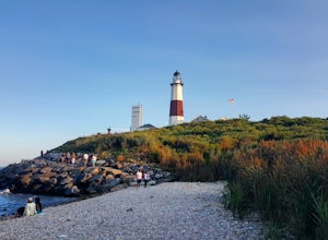
Stroll along the Montauk Point Lighthouse Cliff Walk
4.51 miThe Montauk Point Lighthouse is one of the main attractions of "The End" of Long Island, but I've only ever walked around it on the cliff walk.When you get to the lighthouse, you can park in the parking lot (depending on when you go there may be a $8 fee). Right along the edge overlooking the wa...Read more -
Westerly, Rhode Island
Grills Preserve
4.04.27 mi / 351 ft gainGrills Preserve is a loop trail that takes you by a lake located near Bradford, Rhode Island.Read more -
Montauk, New York
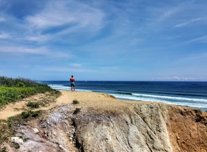
Climb the Bluffs of Shadmoor State Park
1.2 mi / 100 ft gainI've never actually been into the Shadmoor State Park, but you can climb up and onto the bluffs from the beach easily; well kind of easily.Most of the parking lots along the beach require Hamptons residency tags, so you can't park right next to beach entrances... bummer. We typically park along ...Read more -
West Greenwich, Rhode Island
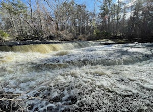
Stepstone Falls via Ben Utter Trail
5.02.64 mi / 125 ft gainStepstone Falls via Ben Utter Trail is an out-and-back trail that takes you by a waterfall located near West Greenwich, Rhode Island.Read more -
Shelter Island, New York
Hike through the Mashomack Nature Preserve
10 miJust a short ferry ride from the Hamptons, South Ferry Road is exactly where it sounds; very close to the South Ferry of Shelter Island. The parking lot of Mashomack Preserve is marked by a large sign. When you walk in, you'll see a large nature center. Sign in at a clipboard at the table out fro...Read more -
Franklin, Connecticut
Hike Baileys Ravine at Ayer's Gap Preserve
1.6 mi / 314 ft gainIt's steep and rocky in the beginning but it levels out after a while! When standing in the parking lot, the trailhead is hidden! Look to the right. The trail ends on Ayer's Road so you have to walk back a little ways on the road.Read more -
Chilmark, Massachusetts
Menemsha Hills Reservation Loop
5.02.98 mi / 344 ft gainGPS service in densely wooded areas on the Vineyard is hard to come by, so plugging in Menemsha Hills Reservation before getting on the road is advised. Traveling down N Road, you'll find an unmarked gravel road located between Turtle Cove and Trustees Lane. A short 400 meter drive will take you ...Read more

