Burrillville, Rhode Island
Top Spots in and near Burrillville
-
Bolton, Massachusetts
Fyfeshire is located in Bolton Massachusetts off "Wattaquadock Hill Road", near the "Fotini's Restaurant and Bar".
The trailhead begins at a small parking area with a stone gate that says Fyfeshire Conservation area on a wood plank. Once you are in the conservation area you will see an opening in...
Read more
-
-
-
Taunton, Massachusetts
Lake Rico is a decent sized lake located in East Taunton, MA. You can spend hours out kayaking and exploring. From the parking lot the lake looks pretty small but there is an opening towards the back that leads into three larger sections. There is also an island in the back that is great for sett...
Read more
-
-
Norwich, Connecticut
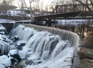
The Yantic Falls Historic District encompasses a historic mill and associated worker housing on Yantic Street in Norwich, Connecticut. The 10 acre area includes a complex of mill buildings arrayed along the Yantic River, and a group of three brick mill worker houses. Today, Yantic Falls is part d...
Read more
-
Jamestown, Rhode Island
Rhode Island isn't exactly on everyone's map, I've even met strangers in other parts of the U.S. who have no idea where the tiniest state in the country is. It's usually lumped in with Connecticut and Massachusetts, but for us locals from little Rhody, Rhode Island is it's own world of adventure ...
Read more
-
-
Boston, Massachusetts
Park in the lot off of Arborway to access the trail. This place is gorgeous year round. The winter offers a quiet solitude, fall boasts bright colors, spring is the most beautiful as the flowers start to burst and cherry blossoms take over, and summer is overwhelmingly green. There are dozens of ...
Read more
-
Newport, Rhode Island
Park at the Castle Hill Cove Marina and walk across the street. Follow the sidewalk left and you will see a small sign that states "Castle Hill Lighthouse" on your right. Follow the short well beaten path to the lighthouse. You will hear the waves crashing and smell the fresh ocean air.
The li...
Read more
-
Newport, Rhode Island
The 3.5 mile Cliff Walk is a National Recreation Trail in a National Historic District. I chose to start at the western end of Easton's or First Beach at Memorial Blvd. and walk south. The first two-thirds of the walk is very easy walking conditions. Parts of the southern half of the walk are...
Read more
-
Acton, Massachusetts
Park in the small parking area right before the trailhead. *Notice this parking area is small and only fits about 3-4 cars so prepare to find street parking on a busy day. You can punch in the coordinates to a GPS if you need help finding it: 42.4545482, -71.4358192.
The loop is very diverse wit...
Read more
-
Newport, Rhode Island
This drive encompasses all that is Newport, RI. Known for its rocky shores and numerous sea-side mansions, this drive allows you to both view it all from the safety of your car, and has several spots to pull off to get out and get a better view. There are grassy park areas as well that are perf...
Read more
-
Quincy, Massachusetts
4.0
12.7 mi
/ 2542 ft gain
Park in the lot across from Batterymarch Rd off of Willard St. Access the Skyline trail from here, it is marked blue. Follow the signs. The trails in Blue Hills are perfect for training for backpacking because they are so steep and rocky. I would fill up a big pack and take the skyline trail up t...
Read more
-
-
Concord, Massachusetts
Park in the lot ($8 for MA residents) by Walden Pond to access the trail, and head out either direction on the loop around the pond. Trail is accessible from April-October.
Read more

