Gettysburg, Pennsylvania
Top Spots in and near Gettysburg
-
Eldersburg, Maryland
Mineral Hill Trail
4.02.04 mi / 282 ft gainMineral Hill Trail is an out-and-back trail that takes you by a lake located near Finksburg, Maryland.Read more -
Parkton, Maryland
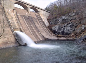
Photograph Prettyboy Dam
4.0Make sure you park in the designated spots located above the Dam. Walk across the Dam road bridge and about mid way stop and take a look over the edge. You will be greeted with the a beautiful view of the valley. To explore more keep walking over the dam bridge and walk down the stairs to view ...Read more -
Carlisle, Pennsylvania
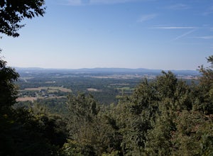
Hike to the Cumberland Valley Overlook
4.06 miThis hike is steep at points but the climb up the mountain has lots of switchbacks so it isn't just straight up. The hike is beautiful and during the summer there are lots of blackberry and raspberry bushes along the trail that we stopped to snack on. The Overlook is just before you crest the top...Read more -
Parkton, Maryland
Hike the Gunpowder Falls North and South Loop Trail
5.013.3 mi / 1180 ft gainPark in the lot on Bunker Hill Road and then continue a short ways to the trailhead (see map). There are no bridges for crossing the water so be prepared to pick your way across.Read more -
Marysville, Pennsylvania
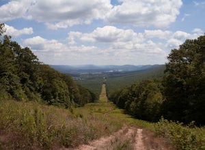
Hike to the Susquehanna Overlook
3.57 miOnce you reach the power lines, about a mile after cresting the top of the mountain you can look one way and you’ll see the Susquehanna River. Look the other way, and you’ll see beautiful woods and farm fields in Perry County. Return by the same route for a total of about 7 miles.Parking is at th...Read more -
Marysville, Pennsylvania
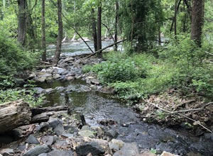
Hike Trout Run
1.01 miHike along the creek for about a half mile, we stop where the trail meets the stream and let the kids play in the water for a bit and then head back. There are 2 large pull-off parking areas alongside of the road. The spot is exactly 3.7 miles from Adventure Park in Mechanicsburg. If you are unfa...Read more -
Owings Mills, Maryland
Soldiers Delight Loop
4.75.33 mi / 466 ft gainFrom Deer Park Road, parking is available at the nature center or the scenic overlook (about 100 yards up the road). I typically park at the overlook as this affords the ability to hike trails on either side of the road, and always finish the hike back at the car. From the parking area you are ju...Read more -
Owings Mills, Maryland
Serpentine Trail
4.52.39 mi / 226 ft gainPark in the area off of Deer Park road to access the trail. Dogs are welcome on leash. Trail can get muddy in the spring, and there are some stream crossings.Read more -
Cockeysville, Maryland
Hike the Oregon Ridge Park Trail
4.04.02 mi / 475 ft gainPark in the lot as indicated on the map (see below). This trail is accessible year round, dog-friendly, and is great for families.Read more -
Sharpsburg, Maryland
Antietam National Battlefield Trail
3 mi / 358 ft gainAntietam National Battlefield Trail is a loop trail that takes you by a river located near Sharpsburg, Maryland.Read more -
Duncannon, Pennsylvania
Hike Hawk Rock, PA
4.02 mi / 750 ft gainThis is a steep and rocky hike, but is well worth the absolutely stunning view of Perry County - including Shermans Creek and the Susquehanna River.This particular trail is also part of the Appalachian Trail and the AT can be accessed part way up the trail if you wish to head north on the AT, oth...Read more -
Marietta, Pennsylvania
Climb At Chickies Rock
From parking at the fairly new lot on Furnace Road, head down river on the walking trail about a half mile to an obvious large face next to the train tracks. From here you choose from a variety of routes including some two pitch routes like Witches’ Brew 5.4 to Main Street 5.5 over to some of the...Read more -
Dickerson, Maryland
Hike the Sugarloaf Mountain Trail
4.76.05 mi / 1509 ft gainPark on Sugarloaf Mountain Drive (as indicated on the map below) to access the trail. It is open from March-November and is dog friendly.Read more -
Knoxville, Maryland
Explore Point of Rocks/ Potomac River Overlook
4.00.2 mi / 95 ft gainPark at the Chesapeake and Ohio Canal parking lot. Walk to the US 15 and cross the road. Trail is not marked, though its faint traces can be detected as you continue on. GPS is recommended. Enjoy the overlook and when you're ready to go back, retrace your steps.Read more -
Knoxville, Maryland
Hike the AT to Weverton Cliffs
4.93 mi / 1500 ft gainThe trailhead is located right off Weverton Cliff's Road in Knoxville, Maryland. Park at a Park and Ride on the right side of the road, then walk right out of the parking lot down Weverton Cliff's Road until you see the white blazes of the Appalachian Trail. Follow that trail for 1.5 miles along ...Read more -
New Bloomfield, Pennsylvania
Hike the Buffalo Ridge Trail
2.5 miThis hike is marked as one of the most difficult at Little Buffalo, but we didn't find it to be overly exhausting. For someone that is used to hiking, this trail is a breeze. There are a few semi-steep inclines, but for the most part the trail is easy to navigate. There are picnic tables located ...Read more


