Douglassville, Pennsylvania
Looking for the best photography in Douglassville? We've got you covered with the top trails, trips, hiking, backpacking, camping and more around Douglassville. The detailed guides, photos, and reviews are all submitted by the Outbound community.
Top Photography Spots in and near Douglassville
-
Walnutport, Pennsylvania
Lehigh Gap via Appalachian Trail
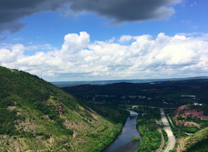
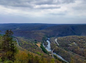
4.52.15 mi / 817 ft gainLehigh Gap was formed by the Lehigh River carving a large hole in the foothills of the Appalachian Mountains. One side is owned and operated by the Lehigh Gap Nature Center and has some great hikes, but this side is government-owned. Parking for this portion of the Appalachian Travel is up a litt...Read more -
Stockton, New Jersey
Explore Kugler Woods Waterfall
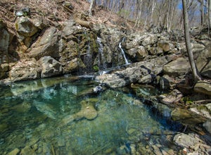
4.00.5 miDrive 5.2 miles north on Route 29 from the center of Stockton, NJ and you will come across a very small parking lot on the left side of the road. If you park your car there, walk back south on Route 29 about 50 feet, and cross over to the woods-side of the road. There you will find the trailhea...Read more -
Frenchtown, New Jersey
Hike to the Devil's Tea Table
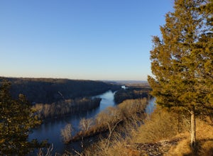
3.00.5 mi / 20 ft gainApart from the rock, there's more trail to follow for a stunning overview and a great spot to hang out and relax. The view is a must-see, it is so much better in person. The hike is not challenging at all, it is basically a straight trail. Climbing some medium sized rocks might be required, but i...Read more -
Philadelphia, Pennsylvania
Photograph the Benjamin Franklin Bridge
3.7Apart from Penn's Landing being a cool place for tourism or to hang out and visit, it's also quite a nice place to photograph. I've gotten the chance to take some shots while my friends were bugging me to leave, but it's still a must go to place for photographers no matter their skill level. Make...Read more -
Stockton, New Jersey
Hike to the Hidden Lockatong Waterfall
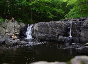
3.72 miIf you're on Kingwood Stockton Road, there will be a dirt road with a Lockatong Nature Preserve sign before it (going north on Kingwood Stockton Road, the sign will be on your left. If you're driving south, the sign will be on your right). Just drive all the way until the end of the dirt road and...Read more -
New Hope, Pennsylvania
Visit Bowman’s Hill Tower
4.0Right off of River Road (Rt. 32), Bowman's Hill is one of the best views in Bucks County. When driving on River Road, you will see a sign for Bowman's Tower that leads to the top, where there is an ample amount of parking. From there, walk a short distance and then climb the tower for the view. ...Read more -
Jim Thorpe, Pennsylvania
Bike the Switchback Trail around Mauch Chunk Lake Park
5.011 miThe trail entrance can be found by going up Broadway and taking Hill Road to the right at the Opera House. At the top of Hill Road will be the entrance to the trail; there is a nice little wooden sign so you don't miss it. This trail can be hiked or biked; we chose to do some mountain biking.Th...Read more -
Jim Thorpe, Pennsylvania
Bike the Lehigh Gorge Trail: Lock #2
4 miIt was a rainy day, which brings along mud (but I think mountain biking is better in the rain and mud anyways).Enter the trail by going through the county parking lot and to the left end under the bridge. The trail starts along the tracks and you can admire the restored old rail cars. Cross ove...Read more -
Lambertville, New Jersey
Hike the Goat Hill Overlook
1 miHike a short and easy path up a hill to the Goat Hill Overlook where you'll have a wonderful view of the Delaware River and New Hope, PA. Put 'Goat Hill Overlook' into your maps and you will be led right to the trailhead where you can easily park in the gravel parking lot or on the side of the pa...Read more -
Nazareth, Pennsylvania
Hike the Henry's Woods Loop in Jacobsburg State Park
5.01.9 mi / 200 ft gainOnly a short drive from the major Pennsylvania cities of Allentown, Bethlehem, and Easton lies Jacobsburg State Park and environmental center. The main feature of the park is most certainly the Henry's Woods loop. Although just under two miles, this trail encompasses a variety of terrain and ol...Read more -
Lambertville, New Jersey
Mountain Bike Dry Run Creek Trail
1 miThis short trail runs alongside a small creek, and is a perfect spot for mountain biking and running. There is a small parking lot right at the trailhead, making this spot very convenient to access. It is not a very challenging ride, although there are a few ruts that can be messy if it has recen...Read more -
Airville, Pennsylvania
Hike the Mason-Dixon Trail to Peavine Island
2 miThe Mason-Dixon Trail is a 200-mile trail that begins and ends in Pennsylvania, passing through Maryland and Delaware along the way. The trail connects the AT to the Brandywine Trail and spends considerable time adjacent to the wide and wondrous Susquehanna River. One of the Mason-Dixon trail's m...Read more -
Airville, Pennsylvania
Explore Mill Creek Falls
It's not too hard to find the Mill Creek Falls; you can see it from the parking lot. This is an ideal spot if you just need a quick fix of something beautiful. From the road, follow the blue blazes of the Mason-Dixon Trail up the hill. After you admire and photograph the falls, consider hiking t...Read more -
Lehighton, Pennsylvania
Hike the Falls Trail at Beltzville State Park
4.05.5 miAt the Christman Trailhead, hike a quick, flat 2.5 miles following the yellow trail markers through farm meadows and birch forests to the Falls Trail loop/intersection. Here hike the Falls trail which is a 0.5 mile loop that links back to the 2.5 mile section back to the parking area. Bridges and...Read more -
Pennsville, New Jersey
Paddle Mannington Meadow
Paddle out into the winding tributaries of Mannington Meadow, paddle past tall reeds, and plenty of wildlife! Access is a small lot capable of fitting roughly 15 cars at the end of the road. There is a concrete ramp, however due to low water levels paddle craft are best used. Once you get on the ...Read more -
Marietta, Pennsylvania
Climb At Chickies Rock
From parking at the fairly new lot on Furnace Road, head down river on the walking trail about a half mile to an obvious large face next to the train tracks. From here you choose from a variety of routes including some two pitch routes like Witches’ Brew 5.4 to Main Street 5.5 over to some of the...Read more

