Hood River County, Oregon
Top Spots in and near Hood River County
-
Cascade Locks, Oregon
2.0
0.65 mi
/ 308 ft gain
Start at the Wyreth Campground day-use area. If it's closed, park on the side of the road and walk in from the roadway. You'll see an intersection with a wooden bridge crossing the river.
Take a few pictures and continue straight on the trail. You'll go about 1/2 mile on the trail until you rea...
Read more
-
Cascade Locks, Oregon
1.0
12.36 mi
/ 4505 ft gain
Park at the Wyeth Trailhead parking lot and start hiking south along the old road bed. At the junction with the Gorge-Wyeth Trail, bear left and follow the Wyeth Trail as it goes beneath several power lines. Follow the trail as it goes back into the woods and crosses Harphan Creek. Continue on an...
Read more
-
Cascade Locks, Oregon
4.6
0.85 mi
/ 463 ft gain
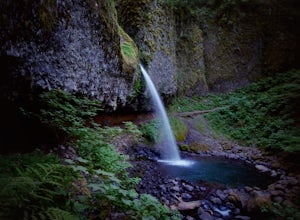
Ponytail Falls is an easy 0.8 mile hike located in the gorge that begins at Horsetail Falls. After hiking up mild switchbacks, continue to your right at the first trailhead intersection. The path levels out before coming around the mountain and opening up to the waterfall.
This is the easiest wa...
Read more
-
Stevenson, Washington
4.2
5.61 mi
/ 2336 ft gain
Hamilton Mountain has one of the best views in the Columbia Gorge. The hike starts out with a gradual uphill climb through an old-growth forest. After about a half-mile in you will come to a clearing where you can see the ridge line going up to the top of Hamilton Mountain. From there you'll pass...
Read more
-
Stevenson, Washington
4.0
2.17 mi
/ 699 ft gain
Located along the Hamilton Mountain Trail, the Hardy and Rodney falls out and back hike is a good alternative for those looking for a shorter hike compared to the 7.6-mile hike to the top of Hamilton Mountain.
From the Hamilton Mountain Trailhead, you will follow the trail through thick trees fo...
Read more
-
Cascade Locks, Oregon
4.5
2.56 mi
/ 610 ft gain
Start off on this loop from Horsetail Falls Trailhead. It never hurts to start a hike with a view of Horsetail Falls. This 2.5 mile loop will start you off on Gorge trail #400 up Horsetail Falls Trail. You’ll encounter a few switchbacks before the trail flattens out and leads you into the valley ...
Read more
-
Cascade Locks, Oregon
4.7
1.01 mi
/ 361 ft gain
The Gorton Creek Falls hike provides an excellent challenge for those who are searching for a bit of adventure. The trailhead starts at the Wyeth Campground day use area, and continues straight at the intersection. The first 2/3rds of the trail are relatively easy to traverse (depsite being rough...
Read more
-
National Forest Development Road 3550, Oregon
With easy parking right off Hwy 35 on the east side of Mt Hood, Bennett Pass is a perfect destination for a straightforward lap on cross country skis, snowshoes or accessing easy backcountry terrain for skiers and boarders.
Bennett Pass Road is a well-graded 5.1 mile out-and-back with several tr...
Read more
-
Cascade Locks, Oregon
4.8
0.92 mi
/ 531 ft gain
*Currently closed (except a small portion of the upper trail between Multnomah Spur and Trail #444 on Larch Mountain)...here
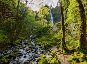
This hike is very short (1 mile roundtrip) but does take some time to do. The trail leads down from the road into a stream bed. You follow the stream bed upstream through ...
Read more
-
Corbett, Oregon
4.5
3.4 mi
/ 1168 ft gain
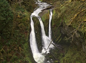
Access to Triple Falls is currently closed. Learn more on the Forest Service Site.
This hike, starting at the Oneonta Trailhead is a 3.2 mile roundtrip. You will gain approximately 600 feet in elevation as the trail often switches from moderate flat easy hiking to more difficult elevation gain a...
Read more
-
Government Camp, Oregon
4.9
1.89 mi
/ 108 ft gain
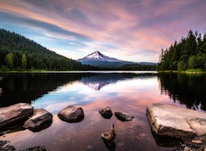
Trillium Lake is a popular camp spot at the base of Mount Hood. It's known for it's scenery, abundant recreational activities, and is family friendly. Boating, swimming and fishing are quite popular on the 63 acre lake. There is a small boat ramp within the campground and a larger ramp available ...
Read more
-
Cascade Locks, Oregon
The Starvation Creek Falls drops 141ft down into a naturally formed bowl, cascading past a wooded picnic area and onto the Columbia River. The falls are one of the easiest falls to access in the Columbia River Gorge along with Multnomah Falls, but are far less Crowded. The short 300ft walk from t...
Read more
-
Rhododendron, Oregon
3.0
8.26 mi
/ 1854 ft gain
The hike and possible rappel to Frustration Falls begins at the Salmon River trailhead right outside of Welches, Oregon. From the trailhead you follow the trail for about 4 miles at which point you reach Canyon View (Shown in pictures 5-6 above). From the main trail this is the only view of Frust...
Read more
-
Cascade Locks, Oregon
3.7
12.55 mi
/ 5167 ft gain
This hike starts at the Starvation Creek Rest Area. After parking, head west back along the shoulder of the freeway, where you’ll see a wooden sign stating “Mt. Defiance Trail.” Continue heading west along the abandoned Columbia River Highway. Keep going west as you pass the junction with the Sta...
Read more
-
Cascade Locks, Oregon
3.7
2.69 mi
/ 1001 ft gain
Starvation Creek Falls is an impressive 190 ft. waterfall just a few feet from the parking lot. If you don't know it's there, you'll miss it. Keep walking past the restrooms, away from the trail head to see this beautiful two-tiered waterfall. There are a couple of picnic tables near the creek to...
Read more
-
Cascade Locks, Oregon
4.5
1.89 mi
/ 571 ft gain
The hike along Mt. Defiance Trail to Warren and Lancaster Falls is great if you want to get away from some of the more crowded destinations in the gorge, or just want to catch some shade during the summer. The trail is fairly easygoing, though the last 1/4th of a mile to Lancaster Falls is a bit ...
Read more

