Falls City, Oregon
Top Spots in and near Falls City
-
Falls City, Oregon
Ride Black Rock Mountain Bike Trails
5.010 mi / 2000 ft gainBlack Rock Mountain Bike area is the perfect place to hone your MTB skills and take your riding to the next level. Black Rock offers clearly marked single track trails riddled with wooden ramps, berms and dirt features. There are trails ranging from "green" to "double black diamond", ensuring the...Read more -
Corvallis, Oregon
420, 300, and 400 Trails Loop
4.06.64 mi / 1043 ft gain420, 300, and 400 Trails Loop is a loop trail that takes you through a nice forest located near Corvallis, Oregon.Read more -
Polk County, Oregon
Walk the Valley of the Giants
5.0From the parking area, the Valley of the Giants trail crosses the Siletz River and passes a tranquil picnic spot before beginning a 1.3 miles loop trail through some of Oregon's oldest and largest Doug Fir trees. Many reach 500 years in age and heights exceeding 200 feet. In fall, vine maples exp...Read more -
Corvallis, Oregon
Lewisburg Saddle Upper Horse Trail Loop
4.53.17 mi / 630 ft gainLewisburg Saddle Upper Horse Trail Loop is a loop trail in McDonald-Dunn Forest located near Adair Village, Oregon. The trail is dog, horse, and Mountain Bike friendly. If bringing your pup, please be sure to keep in on-leash with horses and other wildlife potentially on the trail. The loop sin...Read more -
Corvallis, Oregon
Vineyard Mountain Loop
3.36 mi / 505 ft gainVineyard Mountain Loop is a loop trail located near Corvallis, Oregon.Read more -
Corvallis, Oregon
Dimple Hill Via Patterson Road 600
4.86 mi / 715 ft gainDimple Hill Via Patterson Road 600 is a loop trail where you may see local wildlife located near Corvallis, Oregon.Read more -
Corvallis, Oregon
Baker Creek Loop
9.42 mi / 1936 ft gainBaker Creek Loop is a loop trail that takes you by a river located near Adair Village, Oregon.Read more -
Corvallis, Oregon
McCulloch Peak Loop
5.07.17 mi / 1719 ft gainMcCulloch Peak Loop is a loop trail where you may see local wildlife located near Corvallis, Oregon.Read more -
Corvallis, Oregon
Hike the Fitton Green Natural Area Trail
5.05 mi / 1190 ft gainThis is a moderately trafficked trail near Corvallis, OR. It is great for rainy days as much of the trail is paved or has gravel. It is a popular spot for mountain bikers and hikers alike. Some parts of the trail have little shade. There are amazing views of the tall grassy hills and the town...Read more -
Corvallis, Oregon
Hike Bald Hill
4.02.7 mi / 452 ft gainThis is a short hike on the outskirts of Corvallis. It's a popular hiking/trail running destination. There are several vantage points that overlook the city of Corvallis and Willamette Valley. It's a great place to visit if you want to do a short hike in the town of Corvallis.Read more -
Corvallis, Oregon
Hike Woodland Meadow Park Loop
0.5 mi / 59 ft gainThis trail is perfect for jogging or walking, with your pup! The loop is located near a popular dog park in Corvallis, and so can get crowded in the evenings after work. There is ample room for you dog and you to get out and enjoy nature.Read more -
Otis, Oregon
Drift Creek Falls
4.92.98 mi / 449 ft gainThis hike down to Drift Creek Falls is more of an easy stroll. But before you reach the trail head, if coming from the north, make sure to stop at Oregon's oldest covered bridge off Bear Creek Rd. The trailhead to Drift Creek Falls will be farther south on Bear Creek Rd where you will branch off...Read more -
Corvallis, Oregon
Mary's Peak
4.452 mi / 4020 ft gainThis ride takes you from the banks of the Willamette River at the Corvallis waterfront to the top of Mary's Peak, 26 miles and 4,000 vertical feet away. While it starts out with a warm-up through the flats of the Willamette Valley, it quickly starts climbing up around the west side of Mary's Pea...Read more -
Beaver, Oregon
Hike to Pheasant Creek Falls
4.04 mi / 800 ft gainHike: The hike to Pheasant Creek Falls is just short continuation of nearby Niagara Falls. After reaching Niagara Falls, continue on the trail for about another 300 feet and you'll reach the more impressive, Pheasant Creek Falls.For more detailed information including a trail map and directions ...Read more -
Beaver, Oregon
Hike to Niagara Falls, OR
4.04 mi / 800 ft gainGetting There Get onto Highway 101. Between Tillamook and Lincoln City at the town of Beaver, turn east near mile marker 80 onto a paved road toward upper Nestucca River. Follow this scenic road 6.7 miles to the town of Blaine. Stay to the right and drive another 4.8 miles; between mile markers 1...Read more -
McMinnville, Oregon
Hike the Red Trail in Miller Woods
4.04 mi / 400 ft gainLocated three miles west of McMinnville and available for public hiking and activities, Miller Woods is owned and operated by Yamhill SWCD. You may choose different trails to take.From the parking lot the trails are marked by colors to go on the 4.0 mile loop go to the meadow and follow the red m...Read more
Top Activities
Camping and Lodging in Falls City
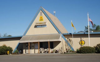
Albany, Oregon
Albany / Corvallis KOA Journey
At Albany/Corvallis KOA, you'll have easy access to area attractions. Visit the many wineries in Linn and Benton counties. You're within ...
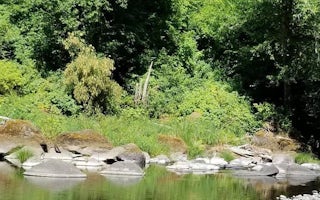
Beaver, Oregon
Rocky Bend Group Campground
Overview
Nestled on the banks of the Nestucca River, Rocky Bend Group Campground is ideal for family gatherings and group events. The si...

Otis, Oregon
Lincoln City KOA Holiday
Start with a hearty breakfast from Mel's Kamper Kitchen. Then hit the beach, Devils Lake or the Lincoln City Kite Festival (one in summer...
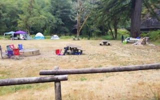
Cloverdale, Oregon
Castle Rock Group Campground
Overview
Located on Three Rivers, this group campground is ideal for family gatherings and group arrangements. Conveniently located off H...
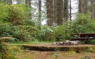
Beaver, Oregon
Hebo Lake Campground
Overview
Hebo Lake campground is ideal for those wanting a secluded, quiet camping getaway in the forest. Located on Mt. Hebo, this small...
Alsea, Oregon
River Edge
Overview
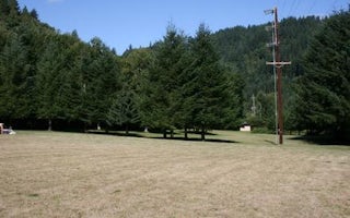
River Edge is a group campground nestled on the banks of the Alsea River, surrounded by large Sitka spruce, Douglas fir, alder t...


