Lake Toxaway, North Carolina
Looking for the best hiking in Lake Toxaway? We've got you covered with the top trails, trips, hiking, backpacking, camping and more around Lake Toxaway. The detailed guides, photos, and reviews are all submitted by the Outbound community.
Top Hiking Spots in and near Lake Toxaway
-
Clayton, Georgia
Camp at Tallulah River Campground
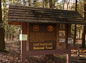
Tallulah River Campground is located in the Chattahoochee-Oconee national forest. It is just outside of Clayton, Georgia. The campground has about 15 spots that are big enough for a small to medium sized RV. Each camping spot also has a nice tent pad for a big tent. Most spots are also on the riv...Read more -
Bryson City, North Carolina
Explore Old 288 and the Lands Creek Bridge
2.51 miNC 288 was constructed in the 1920's, but did not last long with the construction of the Fontana Dam as the resulting lake covered the highway. The U.S. government entered an agreement in which they would provide a replacement road, but to this day it has not been completed and is know by locals ...Read more -
Tallulah Falls, Georgia
Camp at Tallulah Gorge State Park
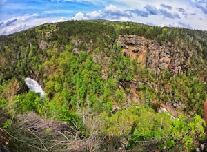
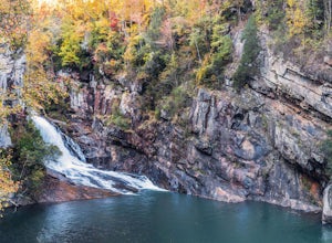
4.7Tallulah Gorge is a must-see feature of Georgia. Campers can lay low and experience the gorge from its floor, engaging in river activities such as kayaking or swimming. Those seeking a thrill can hike the rim trails of the gorge, and even cross an 80' high suspension bridge. (Hikers who may be fe...Read more -
Tallulah Falls, Georgia
Hike to Hurricane Falls, Tallulah Gorge SP
4.41.85 mi / 564 ft gainThe trail is located in Tallulah Gorge State Park which is about 1 ½ hours northeast of Atlanta, off of Highway 441. There is a $5 per car entry fee into the park and they prefer the use of cash. From there, follow the signs to the Jane Hurt Yarn Interpretive Center, where there is parking and pl...Read more -
Saluda, North Carolina
Hike Bradley Falls
4.82.3 mi / 312 ft gainThis is a really nice hike along Cove Creek that leads to a beautiful, 100 foot waterfall. While most of the trail is a relaxing stroll, the end of the hike provides a little adventure for those who feel up for it. Starting from the parking lot, follow the main trail into the woods. Early in the ...Read more -
Tiger, Georgia
Hike to Glassy Mountain
5.01 mi / 3415 ft gainIn order to find this hidden gem, you'll have to drive quite a ways up the mountain first, otherwise it is a very steep incline. There will be limited parking at the gate that stops you from driving the whole way up. You will turn onto a road called "Glassy Mountain Rd" and that will be the road ...Read more -
Hendersonville, North Carolina
Hike to the Top of Bearwallow Mountain
5.02 mi / 583 ft gainOnce you have parked along the roadside near the trailhead, pass through the big gate on the right side of the road and take the trail off to the right. The trail winds up the mountain for a mile before it empties out onto the bald atop Bearwallow. Once on the bald, you can follow the gravel road...Read more -
Fairview, North Carolina
Hike the Trombatore Trail to Blue Ridge Pastures
5.05 mi / 1350 ft gainPark along the road at Bearwallow Gap - this is also the parking area for Bearwallow Mountain. Starting at a little over 3600ft, the Trombatore Trail has been well marked by the Carolina Mountain Land Conservancy with red blazes. Parts of the trail border private land, so pay attention to the sig...Read more -
Bryson City, North Carolina
Charlies Bunion via Kephart Loop
14.14 mi / 3671 ft gainCharlies Bunion via Kephart Loop is a loop trail located near Cherokee, North Carolina. This is a longer version of the Charlies Bunion hike starting from the Newfound Gap parking lot. The added benefit of this longer loop is the opportunity to see more of the Great Smokey Mountains! You'll pass ...Read more -
Bryson City, North Carolina
Kephart Prong Trail, Great Smoky Mountains NP
5.03.92 mi / 850 ft gainKephart Prong is a pretty easy hike in close proximity to the Visitor Center on the North Carolina Side of GSMNP. 2 miles up the trail, you'll arrive at Kephart Shelter, where you can rest and enjoy vies of the Kephart Prong. Once you've had your fill, head back down the way you came. During th...Read more -
Bryson City, North Carolina
Southern Smokies: Fontana Lake to Clingman's Dome
4.520.39 mi / 5750 ft gainThis is a strenuous (though not technical) hike that really showcases the forests, creeks, and (eventually) the highest point of Great Smoky Mountains National Park. As this is a point-to-point route, you will want to have two vehicles - one that you can leave at Clingman's Dome and one that you ...Read more -
Lakemont, Georgia
Minnehaha Falls
4.20.39 mi / 98 ft gainDespite their beauty, not many hikers know about Minnehaha Falls. Even more shocking, these are some of the most accessible falls in all of North Georgia. Round trip, the hike to the falls will only take about a half a mile. Hikers can park along the side of the road at the trailhead. Follow the ...Read more -
Clarkesville, Georgia
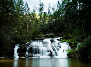
Panther Creek Falls
3.77.27 mi / 659 ft gainPark at the Panther Creek Recreation Area. The fee to park here is $4. There is extra parking alongside the road if the parking lot is full. The trail begins opposite the parking area, noted by a wooden sign. The trail gains elevation here and there with several drop-offs secured by cable cord f...Read more -
Greenville, South Carolina
Lake Conestee Nature Park Loop
2.39 mi / 194 ft gainLake Conestee Nature Park Loop is a family-friendly loop trail located near Greenville, South Carolina. This trail makes for a great stroll and opportunity to do some birdwatching along the route. There are plenty of insects in the warmer months, so you may want to consider packing repellent.Read more -
Hendersonville, North Carolina
Hike along The World's Edge
0.7 mi / 40 ft gainPark at the end of The World's Edge Road, but be aware that parking is very limited. There is a private residence up to the right so do not block their driveway/gate. Begin your hike by going through the leftmost gate, and continue straight until you reach the first view less than half a mile in....Read more -
Bryson City, North Carolina
Hike Ledbetter Creek
5.0Leaving the Nantahala Outdoor Center, drive upriver for 6.5 miles until you see a pull off on the right. Walk past the picnic tables, cross the railroad tracks, then follow the trail to arrive at the creek. Once you're there, it's up to you on what to do next.One of the most popular activities he...Read more

