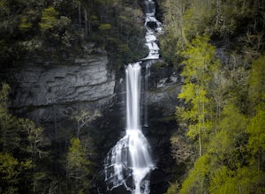
Lake Toxaway, North Carolina
Looking for the best hiking in Lake Toxaway? We've got you covered with the top trails, trips, hiking, backpacking, camping and more around Lake Toxaway. The detailed guides, photos, and reviews are all submitted by the Outbound community.
Top Hiking Spots in and near Lake Toxaway
-
Cullowhee, North Carolina
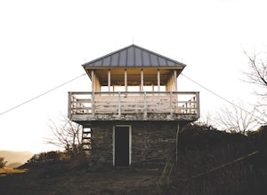
Hike to Yellow Mountain Fire Tower via Cloud Catcher Lane
5.01.5 mi / 700 ft gainYellow Mountain Fire Tower features some of the best views, looking out over both the Northern Georgia mountains as well as seeing the flat-lands of South Carolina past the mountain ranges. This hike is pretty well known for its 12-mile round trip trek, starting in Cashiers, NC, however, there's ...Read more -
Pickens, South Carolina
Hike to Table Rock Mountain
4.57.2 mi / 2433 ft gainWhile the Piedmont Foothills may sound deceptive, this is no easy trail. The first two miles of the Table Rock Trail take you soaring through the trees at a rapid pace. The trail is extremely well kept, but harsh and tough. A little before the two mile marker is a wooden shelter which is a great ...Read more -
Pickens, South Carolina
Backpack the Foothills Trail through the Southeastern Appalachian Mountains
5.076.2 mi / 11036 ft gainStarting at Table Rock State Park (South Carolina) and working your 76.2 miles way towards Oconee State Park (South Carolina) is the most popular route, with a few spur trails that lead to places like Raven Cliff Falls in Cesar's Head State Park. The trail gains ~11,036 feet in elevation with ano...Read more -
Pickens, South Carolina
Summit Sassafras Mountain
5.017.2 mi / 5041 ft gainPinnacle Trail begins by the Nature Center in Table Rock State Park. Keep left at the first three splits in the trail. You will make some creek crossings, gain elevation through the forest, and pass by Mills Creek Falls (25 ft). At Bald Rock Overlook, you can catch some nice views of Table Rock M...Read more -
Mountain Rest, South Carolina
Hike along the Chattooga River to Spoonauger Falls
1 mi / 100 ft gainSpoonauger falls housed in Sumter National Forest, received its name after the Spoonauger family which historically lived above the falls. From Walhalla SC, drive north on Highway 28 until it meets SC 107 (right under 10 miles). Take a slight right onto SC 107 and drive another 10 miles until yo...Read more -
Brevard, North Carolina
Moore Cove Falls
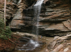
4.31.28 mi / 223 ft gainThe hike relatively quick and has minimal elevation gain, making it a great hike for the family or a quick stop off if you're planning to do another hike in the same day. This part of the Pisgah National Forest is filled with scenic hikes. Once you've parked your car, cross over the stream via a...Read more -
Mountain Rest, South Carolina
Hike to Kings Creek Falls
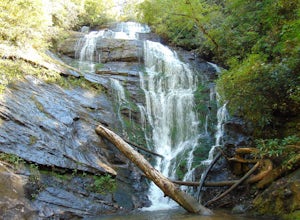
4.80.5 miThe trail to Kings Creek begins behind the bulletin board in the Burrells Ford primitive campground parking lot. It is an easy .5 mile trail to the falls. The falls are only 70ft high but they are beautiful, there is an area to the side of the falls with some nice sitting rocks and the area under...Read more -
Mountain Rest, South Carolina
Hike to King Creek Falls
0.6 miVery nice dog-friendly and family-friendly adventure! The hike is not long at all and the end result is a beautiful 70 ft waterfall with a pooled area at the bottom! Old logs are around for sitting on and relaxing while enjoying your lunch or snacks...Read more -
Cullowhee, North Carolina
Exploring two legendary Cherokee sites: Judaculla Rock and Devil's Courthouse, North Carolina
5.00.9 mi / 258 ft gainJudaculla was an ancient Cherokee spirit being and giant. He ruled in western North Carolina in the traditional Cherokee homeland. Once while chasing some hunters, when he jumped to the ground, his hand hit a rock. You can still see the print on Judaculla Rock. It is the most elaborate piece of r...Read more -
Mountain Rest, South Carolina
Hike to Big Bend Falls
5.06.5 miThe hike to Big Bend Falls begins on the Chattooga River Trail at the Burrell's Ford Campground. To get here you take Burrell's Ford Road off of SC 107. There will be a good sized gravel parking area off to the left about 3 miles down Burrell's Ford Road. When you park the car you can walk down t...Read more -
Brevard, North Carolina
Art Loeb Trail
4.830.07 mi / 7467 ft gainStart at The Davidson River Campground just outside of Brevard, NC (276 Pisgah Ranger District). Have a shuttle car or a friend waiting at the Daniel Boone Boy Scout camp for the finish line. Hop on the 30.1 mile long Art Loeb Trail at the trailhead in the Davidson River Campground. Pull into th...Read more -
Brevard, North Carolina
Camp at Davidson River Campground in the Pisgah National Forest
4.5Pisgah National Forest, in my opinion, is one of the best national forests in the United States. Being just a short drive from Great Smokey Mountain National Park it has all the feel of being in the smokies with more to explore. Pisgah has anything you could want to see or do from tens of water...Read more -
Pisgah Forest, North Carolina
Drive the Forest Heritage National Scenic Byway
5.076 mi / 1000 ft gainYou can drive this highway getting different views during the different seasons. Along the drive, have your camera ready for beautiful vistas, Looking Glass Falls, and many adventures along the highway. The views are especially beautiful in the autumn with the leaves changing colors. This route d...Read more -
Cleveland, South Carolina
Hike to Jones Gap Falls
8.2 mi / 1200 ft gainFor Caesar's Head State Park access, head North from Pickens on HWY 178 until it intersects with HWY 11. Turn right onto HWY 11 North and continue for 10 miles until the 276 intersection where you veer off to the left. Follow 276 to the top of the mountain. 1 miles past the Caesars Head Visitors ...Read more -
Cleveland, South Carolina
Raven Cliff Falls
4.57.76 mi / 2185 ft gainLocation: From the intersection of US276 & SC11, head Northwest on US276. Drive to the top of the mountain, 1 mile past the visitor's center, and The Raven Cliff Falls Parking Area and trail head will be on your right. After parking in the Raven Cliff Falls Parking Area, the trailhead is l...Read more -
Canton, North Carolina
Shining Rock via Shining Creek Trail
4.38.69 mi / 2569 ft gainThere are several ways to access the Shining Rock Wilderness Area, but go for the main trail head off of Hwy 276. The trail is split by the Pigeon River, providing a seemingly infinite combinations of trails and routes, keeping in mind that this area intersects often with the well known Art Lobe ...Read more

