
Southern Smokies: Fontana Lake to Clingman's Dome
Bryson City, North Carolina
Details
Distance
20.39 miles
Elevation Gain
7083 ft
Route Type
Point-to-Point
Description
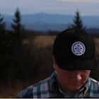
Added by Andrew Todd
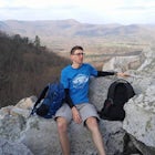
A 2-3 day backpacking route from the southern-most point of Great Smoky Mountains National Park at Fontana Lake to the highest point in the park, Clingman's Dome.
This is a strenuous (though not technical) hike that really showcases the forests, creeks, and (eventually) the highest point of Great Smoky Mountains National Park. As this is a point-to-point route, you will want to have two vehicles - one that you can leave at Clingman's Dome and one that you can leave at the beginning of the route to come back for later.
This trip begins at the Noland Creek Trailhead (actually a mile away from Fontana Lake, but this is the best place to park). You'll walk down from the parking area to the actual trail, turn right, and hike 4.1 miles to the Springhouse Branch Trail and backcountry campsite #64. This stretch from the Noland Creek Trailhead to Springhouse Branch is a steady gain of about 600 feet, with a wide, well-maintained trail. This segment of the route will take you 1-2 hours to hike.
At this point, you can either spend the night at campsite #64 (a great spot by the creek) or continue on the trail to campsite #71, though you'll need an early start to make it to #71 in one day!
From the beginning of the Springhouse Branch Trail, hike 2.8 miles (and roughly 1500 feet) to the intersection with the Forney Ridge Trail. Stay to the left and stay on the Springhouse Branch Trail (turning right will shortcut you along the ridge straight to Clingman's Dome).
Continue on (now you'll begin descending) for 4.2 miles until you reach the Forney Creek Trail and campsite #71. Your hike for this stretch will take you up to about 4000 feet at the intersection with the Forney Ridge Trail before plummeting back down to about 2000 feet at campsite #71. This segment will take you anywhere from 3-5 hours depending on how fast you hike, and as with most of the trails in this area, you'll be following a creek.
Campsite #71 is a fairly large clearing alongside the creek with tall trees and an old stone chimney. You'll turn right once the trail dead-ends at the creek (and the campsite) to continue on. Head north (to the right) and follow the trail along Forney Creek for 1.2 miles and a gain of 100 feet or so until you reach the intersection with the Jonas Creek Trail (and campsite #70 over the creek) - bear right and continue on the Forney Creek Trail.
From this point on, you'll need to cross creeks around 10 different times - some are simply small streams that won't even get your boots wet, but 5 or 6 are large and you'll need to do a mix of wading and rock-hopping.
Additionally, this last segment of the route gets steeper and steeper as you go, initially starting out around 5% gradient, and increasing to 15-20% for the last few miles. It's a beautiful section of trail that winds higher and higher through different types of forest and past some great small waterfalls. This final bit of the route (from Jonas Creek), is about 7.5 miles and will take 4-6 hours. The mixture of steep grades and rocky ground makes this a very strenuous climb, but it's a worthwhile achievement! About a mile from the end, you'll reach an intersection with the Forney Ridge Trail - turning right will take you out to Andrew's Bald, and turning left will take you up to the Clingman's Dome parking area.
If you're a strong hiker and want a challenging few days in the more secluded and peaceful part of Great Smoky Mountains National Park, plan to give this route a try!
Head to the NPS.gov website for more information on backcountry permits.
Download Outbound mobile app
Find adventures and camping on the go, share photos, use GPX tracks, and download maps for offline use.
Get the appFeatures
Southern Smokies: Fontana Lake to Clingman's Dome Reviews
This is a great weekend trip depending on how fast you can hike. The hike is tough but is do able by anyone experienced in backpacking.
5.0
My friends and I made this a 3-day, 2-night long weekend trip and had a great time. This route is fairly peaceful and secluded, and while you don't really get any amazing views until you arrive at the end (Clingman's Dome), it's a great time of quietly enjoying the forests and creeks. It is indeed a difficult hike, especially the last section after Jonas Creek, though this is also the best part of the trail with small waterfalls, rock faces jutting out along the trail, and beautiful pines. On a final note, when you're looking up campsites, #64, #70, & #71 are excellent options, just be sure to get your permits!
4.0
Leave No Trace
Always practice Leave No Trace ethics on your adventures and follow local regulations. Please explore responsibly!
Nearby

Explore Old 288 and the Lands Creek Bridge

Hike to Lonesome Pine Overlook

Hike Three Waterfalls Loop

Deep Creek Loop

Hike the Juney Whank Falls Loop

Tom Branch and Indian Creek Falls
Discover
Community
Mobile Apps

© 2026 The Outbound Collective - Terms of Use - Privacy Policy