Cataloochee, North Carolina
Top Spots in and near Cataloochee
-
Mountain Rest, South Carolina
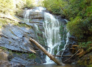
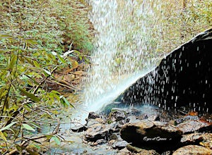
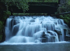
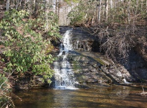
Very nice dog-friendly and family-friendly adventure! The hike is not long at all and the end result is a beautiful 70 ft waterfall with a pooled area at the bottom! Old logs are around for sitting on and relaxing while enjoying your lunch or snacks...
Read more
-
Robbinsville, North Carolina
4.0
15.42 mi
/ 3694 ft gain
Gregory Bald via Twentymile is a loop trail where you may see beautiful wildflowers located near Robbinsville, North Carolina.
Read more
-
Franklin, North Carolina
Begins at the parking lot for the Standing Indian Campground. (No permits are needed to park here) For the first 3.7 miles, take Kimsey Creek Trail, which runs along the water, until you meet up with the AT at Deep Gap. Rolling hills and lots of foliage throughout, leading up to Standing Indian M...
Read more
-
Mountain Rest, South Carolina
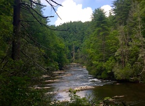
The hike to Big Bend Falls begins on the Chattooga River Trail at the Burrell's Ford Campground. To get here you take Burrell's Ford Road off of SC 107. There will be a good sized gravel parking area off to the left about 3 miles down Burrell's Ford Road. When you park the car you can walk down t...
Read more
-
150 Asbury Drive, South Carolina
The trail to the Matthews Creek cable bridge crossing is easy. The cable crossing is fine - fun for some and a do-able challenge for others.
After the creek, to get to Moonshine Falls, turn RIGHT at the post which indicates a trail both left and right. This is the Naturaland Trail in Caesars Hea...
Read more
-
Burnsville, North Carolina
5.0
8.24 mi
/ 2310 ft gain
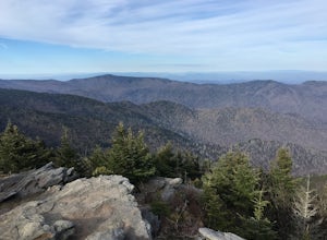
I personally find this trail to be more difficult and have more rewarding views than the Mt. Mitchell summit trail.
The Deep Gap Trail starts near the Mount Mitchell summit and heads into a forest of spruce and balsam fir trees. The trail then climbs along the ridgeline to neighboring summits. E...
Read more
-
Pickens, South Carolina
4.5
7.2 mi
/ 2433 ft gain
While the Piedmont Foothills may sound deceptive, this is no easy trail. The first two miles of the Table Rock Trail take you soaring through the trees at a rapid pace. The trail is extremely well kept, but harsh and tough. A little before the two mile marker is a wooden shelter which is a great ...
Read more
-
Pickens, South Carolina
5.0
76.2 mi
/ 11036 ft gain
Starting at Table Rock State Park (South Carolina) and working your 76.2 miles way towards Oconee State Park (South Carolina) is the most popular route, with a few spur trails that lead to places like Raven Cliff Falls in Cesar's Head State Park. The trail gains ~11,036 feet in elevation with ano...
Read more
-
Pickens, South Carolina
5.0
17.2 mi
/ 5041 ft gain
Pinnacle Trail begins by the Nature Center in Table Rock State Park. Keep left at the first three splits in the trail. You will make some creek crossings, gain elevation through the forest, and pass by Mills Creek Falls (25 ft).
At Bald Rock Overlook, you can catch some nice views of Table Rock M...
Read more
-
Rutledge, Tennessee
Buffalo Creek is located near Rutledge, Tennessee and Cherokee lake. It is a wilderness area with a fish hatchery run by TWRA and a few acres of game land. You can drive straight up to the falls then hike around a little bit through the river to see the rest of the river and fishing areas. The be...
Read more
-
Otto, North Carolina
From the parking area (fits about 6 cars) follow the trail on the same side of the road up the ridge through dense rhododendron. Several spur trails branch off of the main trail and lead to rock outcroppings with excellent views. Getting to the parking area is slow. The narrow gravel road winds...
Read more
-
Burnsville, North Carolina
The Black Mountain Crest Trail is legendary among hikers in the southeast. It is the highest trail east of the Mississippi, as it traverses the summit of several peaks over 6,000 feet. It is also widely acknowledged as one of the premier hikes on the east coast. To whit, the trail immediately asc...
Read more
-
Cleveland, South Carolina
3.0
1.03 mi
/ 266 ft gain
Wildcat Wayside Nature Trail is a loop trail that takes you by a waterfall located near Cleveland, South Carolina.
Read more
-
Old Fort, North Carolina
4.8
2.19 mi
/ 394 ft gain
Please note, Catawba Falls is temporarily closed. You can learn more about updates at www.fs.usda.gov.
This quick and relatively easy hike is located close to Asheville, NC. If you're looking to have the trail to yourself, it can be a little tough. It's best to get there as early as possible or ...
Read more
-
Salem, South Carolina
To avoid the regret of cutting your trip too short, go ahead and book a campsite. Come as a walk-in or reserve your site. Either way, you will have to check in at the Park Office. Upon check-in, you will receive your map and general information. Check-in time for camping is 2PM.
The only publi...
Read more
-
Dillard, Georgia
Starting at the trailhead you begin by following the yellow blazes. The trail isn't well marked so keep an eye out for the blazes you see. The trailhead starts at the dead end of Kelsey Mountain Trail. The path immediately starts to incline and doesn't stop. A few minutes in you will come to a fo...
Read more

