Cataloochee, North Carolina
Top Spots in and near Cataloochee
-
Sunset, South Carolina
A moderate to advanced 2.6 mile hike has many stairs and a lot of ascents and descents along the way. The hike may not be the easiest but the payoff is worth it. The trail is easily marked so no need to worry about getting lost.
Read more
-
Tallassee, Tennessee
4.8
4.96 mi
/ 625 ft gain
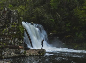
One of the biggest perks of hiking Abrams Falls is the drive to get there. The trailhead is located approximately 5 miles into the scenic Cades Cove Loop. Cades Cove is an adventure in itself. Keep your eye out for black bears, deer and wild turkey. If you are taking the self guided auto tour, Ab...
Read more
-
Franklin, North Carolina
5.0
3.66 mi
/ 1060 ft gain
The Appalachian Trail does not need a lot of hype beyond its existing legendary status. However, there are certain parts of it that do stand out as being a little extra special. Siler Bald is one of those spots. A large clearing starting from Snowbird Gap and going all the way up to Siler Bald...
Read more
-
Cleveland, South Carolina
For Caesar's Head State Park access, head North from Pickens on HWY 178 until it intersects with HWY 11. Turn right onto HWY 11 North and continue for 10 miles until the 276 intersection where you veer off to the left. Follow 276 to the top of the mountain. 1 miles past the Caesars Head Visitors ...
Read more
-
Cleveland, South Carolina
4.5
7.76 mi
/ 2185 ft gain
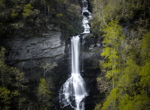
Location: From the intersection of US276 & SC11, head Northwest on US276. Drive to the top of the mountain, 1 mile past the visitor's center, and The Raven Cliff Falls Parking Area and trail head will be on your right.
After parking in the Raven Cliff Falls Parking Area, the trailhead is l...
Read more
-
Montreat, North Carolina
Nestled in the Blue Ridge Mountains is Montreat, North Carolina. Just down the road from Asheville, it neighbors Black Mountain and doesn't disappoint for views. Montreat itself houses a plethora of hiking trails, but the cream of the crop HAS to be Lookout Mountain. After a weekend of checking o...
Read more
-
Cleveland, South Carolina
Getting there
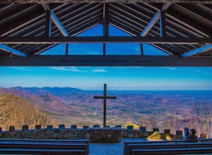
Fred W. Symmes (aka Pretty Place) Chapel is perched near the
top of Standing Stone Mountain at 3000 feet above sea level. That being said,
expect a long and winding drive up the mountain. It takes about 30 minutes
starting from the bottom of the mountain to arrive to the chapel.
Th...
Read more
-
Franklin, North Carolina
4.0
27.11 mi
/ 5420 ft gain
Winding Stair Gap on Highway 64 is the starting point for this spectacular backpacking trip through the Nantahala National Forest. It's right outside the hiker friendly town of Franklin, NC, so the town is your last chance for a hot meal and any last minute supplies. There is a parking lot at the...
Read more
-
Cleveland, South Carolina
5.0
0.27 mi
/ 144 ft gain
The Drive: Head North on SC Highway 11 "Cherokee Foothills Scenic Highway" towards Table Rock State Park. Follow SC 11 past Table Rock approximately 8 miles where it will merge with SC 8 at Pumpkin Town. Follow SC 8 for another 3-4 miles until you see the intersection for SC Highway 276 on the le...
Read more
-
Burnsville, North Carolina
5.0
3.74 mi
/ 1194 ft gain
After arriving in the park off of the beautiful Blue Ridge Parkway, park at the first parking lot you encounter on the righthand side of the road. There is a visitor's center there where you can inquire about the park and pick up a park map. Once you do that walk outside and look to the left of t...
Read more
-
Greenville County, South Carolina
5.0
5.5 mi
/ 2000 ft gain
Start on the Jones Gap Trail (blue), which will lead you alongside the Saluda River. After 2.5 miles, take the Old Springs Branch Trail (orange) to loop back to the lot.For a challenging, more strenuous hike, with great views of the Gap, check out Rim of the Gap Trail. It is not advised to take c...
Read more
-
Greenville County, South Carolina
The Trailhead: Located at Jones Gap State Park in Marietta, SC of northern Greenville County. Follow the trail across an iron bridge that crosses the Middle Saluda River, and be sure to register at the Ranger’s Station/Gift Shop on the far side of the gap. The trail head(s) are located directly o...
Read more
-
Greenville County, South Carolina
5.0
5.96 mi
/ 1844 ft gain
Jones Gap State Park in the Upstate of South Carolina is one of the most beautiful parks in the state offering a good range of moderate and challenging hiking and backpacking trails through the Mountain Bridge Wilderness Area. Jones Gap also provides superb primitive camping sites along the rocky...
Read more
-
Sunset, South Carolina
Once you get to the destination there should be a small parking area. At the end of this parking area you will see the start of the Twin Falls trail that will be mostly a flat walk. Follow this trail approximately 0.5 miles to the falls. You will know you are in the right place if the creek is r...
Read more
-
Mountain Rest, South Carolina
Spoonauger falls housed in Sumter National Forest, received its name after the Spoonauger family which historically lived above the falls.
From Walhalla SC, drive north on Highway 28 until it meets SC 107 (right under 10 miles). Take a slight right onto SC 107 and drive another 10 miles until yo...
Read more
-
Mountain Rest, South Carolina
The trail to Kings Creek begins behind the bulletin board in the Burrells Ford primitive campground parking lot. It is an easy .5 mile trail to the falls. The falls are only 70ft high but they are beautiful, there is an area to the side of the falls with some nice sitting rocks and the area under...
Read more


