Brevard, North Carolina
Looking for the best hiking in Brevard? We've got you covered with the top trails, trips, hiking, backpacking, camping and more around Brevard. The detailed guides, photos, and reviews are all submitted by the Outbound community.
Top Hiking Spots in and near Brevard
-
Old Fort, North Carolina
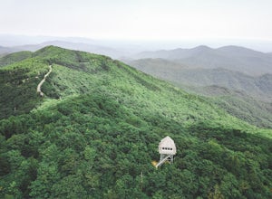
Green Knob Lookout Tower
4.80.76 mi / 292 ft gainGreen Knob Lookout Tower is an abandoned fire tower near Mt. Mitchell and located directly off the Blue Ridge Parkway. The tower boasts a full 360-degree, unobstructed view of Mt. Mitchell, Craggy Mountains, Table Rock, Grandfather Mountain, and the Parkway. Unlike most fire towers, this tower is...Read more -
Clayton, Georgia
Hike the James E. Edmond trail to Lookoff Mountain Overlook
4.07.5 mi / 2378 ft gainBlack Rock Mountain State Park is Georgia's highest elevation State Park. It is adorned with several waterfalls, sweeping overlooks, blooming Rhododendron's, and plenty of miles of trail. The James E. Edmond trail is the longest and by far most challenging hike in the park. Its medium-long dis...Read more -
Bryson City, North Carolina
Explore Old 288 and the Lands Creek Bridge
2.51 miNC 288 was constructed in the 1920's, but did not last long with the construction of the Fontana Dam as the resulting lake covered the highway. The U.S. government entered an agreement in which they would provide a replacement road, but to this day it has not been completed and is know by locals ...Read more -
Cosby, Tennessee
Hike to the Mount Cammerer Lookout Tower
4.510.99 mi / 3040 ft gainMost visitors have a vision of how they'd like to see Great Smoky Mountains National Park, and it typically involves climbing to the top of a mountain like 4,928-foot Mount Cammerer. This is a very strenuous hike involving a breathtaking amount of elevation gain along the rugged Low Gap and Appal...Read more -
Cosby, Tennessee
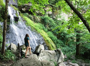
Hike to Hen Wallow Falls in Great Smoky Mountains NP
5.04.57 miStart your adventure by parking in the Cosby Picnic Area Parking Lot near the entrance of the Cosby Campground. (127 Cosby Picnic Area Rd, Cosby, TN 37722.) Then backtrack through the parking lot about 100 yards until you see the sign marking the start of Gabes Mountain Trail. The trek to Hen W...Read more -
Burnsville, North Carolina
Deep Gap Trail at Mt. Mitchell State Park
5.08.24 mi / 2310 ft gainI personally find this trail to be more difficult and have more rewarding views than the Mt. Mitchell summit trail. The Deep Gap Trail starts near the Mount Mitchell summit and heads into a forest of spruce and balsam fir trees. The trail then climbs along the ridgeline to neighboring summits. E...Read more -
138 Silver Mine Road, North Carolina
Hike the Lovers Leap Loop Trail
5.01.8 mi / 472 ft gainLovers Leap Loop trail is a 1.8 mile loop in Hot Springs, NC. The address of the trailhead is 138 Silver Mine Rd, Hot Springs, NC 28743. Once you arrive at the parking lot, you will see a trail leading up into the mountain with a post next to it. This is where you want to begin. It is part of the...Read more -
Franklin, North Carolina
Backpack the Standing Indian Loop on the Appalachian Trail
24 miBegins at the parking lot for the Standing Indian Campground. (No permits are needed to park here) For the first 3.7 miles, take Kimsey Creek Trail, which runs along the water, until you meet up with the AT at Deep Gap. Rolling hills and lots of foliage throughout, leading up to Standing Indian M...Read more -
Franklin, North Carolina
Nantahala National Forest via the Appalachian Trail
4.027.11 mi / 5420 ft gainWinding Stair Gap on Highway 64 is the starting point for this spectacular backpacking trip through the Nantahala National Forest. It's right outside the hiker friendly town of Franklin, NC, so the town is your last chance for a hot meal and any last minute supplies. There is a parking lot at the...Read more -
Gatlinburg, Tennessee
Hike to the Jump-Off
4.36.2 mi / 1079 ft gainThis trail starts at the Newfound Gap parking lot. Newfound Gap is situated on the border of Tennessee and North Carolina. The views from Newfound Gap overlook North Carolina and are worth the trip in their own right. The restroom facilities are clean and have flushing toilets. Follow the crowds ...Read more -
Gatlinburg, Tennessee
Hike to Clingman’s Dome via Newfound Gap
4.516.6 mi / 1600 ft gainThis route to Clingmans Dome is available throughout the year. But during the winter months from December 1 through March 31, the 7-mile Clingman’s Dome Road that branches off Highway 441 at Newfound Gap, stays closed. This means the usual drive to the parking area located just a half mile below ...Read more -
Gatlinburg, Tennessee
Mount LeConte Lodge via the Boulevard Trail
15.95 mi / 3000 ft gainBegin your adventure by arriving at the Newfound Gap parking lot - before first light. Why? Because you won't want to miss the incredible sunrise from the parking lot - even before you step foot on the trail! It is said that a hiker will never get overly warm hiking the Boulevard to Leconte due ...Read more -
Gatlinburg, Tennessee
Charlies Bunion via Appalachian Trail
5.04.32 mi / 1640 ft gainFrom the Sugarlands Visitor Center near Gatlinburg, drive approximately 13 miles south on Newfound Gap Road to reach the Newfound Gap Parking Area (it'll be on your left). The parking area is free and there are bathrooms. Follow the Appalachian Trail towards Katahdin, Maine (1972 miles away, woah...Read more -
35.610235,-83.426410
Myrtle Point via Alum Cave
5.015.43 mi / 3100 ft gainThis hike can be started at the Alum Cave trailhead or the Boulevard Trailhead. For this particular adventure, the starting point is Alum Cave. If you're lucky enough to stay the night at the backcountry shelter on top of Mt. LeConte, (add 0.2 miles if coming from the Lodge), head east on the Bou...Read more -
Franklin, North Carolina
Photograph Wayah Bald Lookout Tower
0.1 mi / 0 ft gainThe Wayah Bald Lookout Tower is located in Nantahala National Forest in one of the oldest part of the protected land. It was first built in the 1920s then it was rebuilt throughout the years until it was finally made out of stone and concrete. The current tower that stands offers great views of t...Read more -
Bryson City, North Carolina
Southern Smokies: Fontana Lake to Clingman's Dome
4.520.39 mi / 5750 ft gainThis is a strenuous (though not technical) hike that really showcases the forests, creeks, and (eventually) the highest point of Great Smoky Mountains National Park. As this is a point-to-point route, you will want to have two vehicles - one that you can leave at Clingman's Dome and one that you ...Read more

