Brevard, North Carolina
Looking for the best hiking in Brevard? We've got you covered with the top trails, trips, hiking, backpacking, camping and more around Brevard. The detailed guides, photos, and reviews are all submitted by the Outbound community.
Top Hiking Spots in and near Brevard
-
Barnardsville, North Carolina
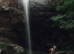
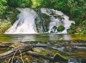
Douglas Falls
5.01.11 mi / 125 ft gainThe trail begins at the back of the parking area and is marked by a trail sign. Once on the trail, it is a straight shot to the waterfall with no turnoffs. Overall the trail is very easy and is a slight descent all the way down. Around .3 miles into the trail you enter a forest of now-dead hemloc...Read more -
Del Rio, Tennessee
Max Patch Mountain
5.01.51 mi / 315 ft gainMax Patch Mountain was once cleared for pasture land, leaving an expansive flat summit that now serves as the ideal location for a picnic hike, flying a kite, or laying in the sun surrounded by the Great Smoky Mountains. With little elevation gain and a short distance it is also very family (and ...Read more -
Newport, North Carolina
Hike to Mt. Sterling's Fire Tower
4.012 mi / 4200 ft gainOn your way in, stop at the ranger station parking lot to use the outhouses and grab a map for $1. Once at the Baxter Creek trailhead you have two options: 1. The Out and Back (12.2 miles) 2. The Loop (17 miles)Out and Back: Start on the Baxter Creek Trail and continue up for 6.1 miles until you...Read more -
Newport, North Carolina
Hike to Mouse Creek Falls
5.04.2 mi / 605 ft gainFollow Big Creek Trail on a moderate climb to this 45-foot waterfall. Around 1.3 miles in, you will begin to hike alongside Big Creek, and shortly afterwards you will pass Midnight Hole, a particularly deep pool. There are a number of other small falls en route. In spring you should see a number ...Read more -
Clayton, Georgia
Hike to Martin Creek Falls
5.00.6 miThere are two different ways to get to this waterfall.The easiest way is through a trail in the Warwoman Wildlife Management Area. To get to this trail head, drive east on Warwoman Road from Clayton, GA. At approximately 3.5 miles, take a left onto Finney Creek Road (FS 152). You will see a sign ...Read more -
Bryson City, North Carolina
Deep Creek to Clingmans Dome Loop
32.82 mi / 7400 ft gainThis is a ~36 mile loop that goes up Clingman's Dome (the tallest point in Tennessee). Pretty challenging, not for the novice backpacker. Park at Deep Creek campground in Bryson City, NC. We did it as a 3-day, 2-night camping at sites 53 and 61. As it is a loop it could easily be done in reverse....Read more -
Del Rio, Tennessee
Max Patch to Hot Springs, N.C. via Appalachian Trail
3.014.06 mi / 2966 ft gainMake a weekend trip from Max Patch to Hot Springs N.C., and be sure to soak in the natural hot springs at the old inn after your hike! This is an incredible, relatively easy hike with the reward at the end being hot springs on the French Broad River. You can break this up however you like, this i...Read more -
Bryson City, North Carolina
Tom Branch and Indian Creek Falls
4.51.76 miFrom the Deep Creek Trailhead, you can hike to both waterfalls heading up the Deep Creek Trail. You will come across Tom Branch Falls quickly, after 0.2 miles. Once you've had your fill of Tom Branch, head further along the Deep Creek Trail for another 0.5 miles. Turn right on the Indian Creek Tr...Read more -
Bryson City, North Carolina
Hike the Juney Whank Falls Loop
4.00.65 mi / 150 ft gainStarting at the Deep Creek Trailhead, take a short walk until the trail meets up with Juney Whank Falls Trail. From here, hang a left and head onto the Juney Whank Falls Trail. Once you've reached the falls, continue the loop to get back to the trailhead. The falls are said to be named after Mr...Read more -
Bryson City, North Carolina
Deep Creek Loop
5.05.01 mi / 892 ft gainAfter parking in the Deep Creek Campground parking lot follow the signs for the Deep Creek Trailhead. The Tom Branch waterfall is just .3 miles on the right side. Hike another .5 miles, at the next intersection stay right, and you will approach Indian Creek Falls. After viewing the falls you ca...Read more -
Bryson City, North Carolina
Hike Three Waterfalls Loop
5.02.4 mi / 450 ft gainStart the loop by hiking the Juney Whank Falls Trail to Juney Whank Falls. The footbridge across the creek makes an excellent place to rest and take in the falls. Follow the trail across the bridge and up the bank. After about 300 feet take a right and follow Deep Creek Horse Trail towards Deep C...Read more -
Bryson City, North Carolina
Hike to Lonesome Pine Overlook
5.07 mi / 2300 ft gainTo start the hike to Lonesome Pine Overlook begin from the Noland Divide Trailhead in Deep Creek. The trail is a steady climb with an average gain of 700 ft. every mile. Approaching the top you'll walk along a rocky ridge line where you are able to see the overlook. As you continue, be sure to lo...Read more -
Bryson City, North Carolina
Charlies Bunion via Kephart Loop
14.14 mi / 3671 ft gainCharlies Bunion via Kephart Loop is a loop trail located near Cherokee, North Carolina. This is a longer version of the Charlies Bunion hike starting from the Newfound Gap parking lot. The added benefit of this longer loop is the opportunity to see more of the Great Smokey Mountains! You'll pass ...Read more -
Bryson City, North Carolina
Kephart Prong Trail, Great Smoky Mountains NP
5.03.92 mi / 850 ft gainKephart Prong is a pretty easy hike in close proximity to the Visitor Center on the North Carolina Side of GSMNP. 2 miles up the trail, you'll arrive at Kephart Shelter, where you can rest and enjoy vies of the Kephart Prong. Once you've had your fill, head back down the way you came. During th...Read more -
Otto, North Carolina
Hike to and Climb Pickens Nose
4.81.5 mi / 200 ft gainFrom the parking area (fits about 6 cars) follow the trail on the same side of the road up the ridge through dense rhododendron. Several spur trails branch off of the main trail and lead to rock outcroppings with excellent views. Getting to the parking area is slow. The narrow gravel road winds...Read more -
Burnsville, North Carolina
Mount Mitchell via the Old Mitchell Trail
5.03.74 mi / 1194 ft gainAfter arriving in the park off of the beautiful Blue Ridge Parkway, park at the first parking lot you encounter on the righthand side of the road. There is a visitor's center there where you can inquire about the park and pick up a park map. Once you do that walk outside and look to the left of t...Read more

