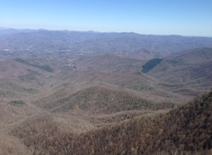
Balsam Grove, North Carolina
Top Spots in and near Balsam Grove
-
Flat Rock, North Carolina
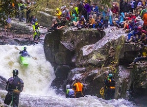
On the first Saturday of November the best creek boaters in the world gather at the Green River in North Carolina to see who can storm the Narrows and claim the top title (at least for the next year!). For paddlers, creek boating is a pursuit along tight and narrow steeps that most of us have ne...
Read more
-
Bryson City, North Carolina
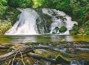
From the Deep Creek Trailhead, you can hike to both waterfalls heading up the Deep Creek Trail. You will come across Tom Branch Falls quickly, after 0.2 miles. Once you've had your fill of Tom Branch, head further along the Deep Creek Trail for another 0.5 miles. Turn right on the Indian Creek Tr...
Read more
-
Bryson City, North Carolina
4.0
0.65 mi
/ 150 ft gain
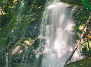
Starting at the Deep Creek Trailhead, take a short walk until the trail meets up with Juney Whank Falls Trail. From here, hang a left and head onto the Juney Whank Falls Trail. Once you've reached the falls, continue the loop to get back to the trailhead.
The falls are said to be named after Mr...
Read more
-
Bryson City, North Carolina
5.0
5.01 mi
/ 892 ft gain
After parking in the Deep Creek Campground parking lot follow the signs for the Deep Creek Trailhead. The Tom Branch waterfall is just .3 miles on the right side. Hike another .5 miles, at the next intersection stay right, and you will approach Indian Creek Falls. After viewing the falls you ca...
Read more
-
Bryson City, North Carolina
Start the loop by hiking the Juney Whank Falls Trail to Juney Whank Falls. The footbridge across the creek makes an excellent place to rest and take in the falls. Follow the trail across the bridge and up the bank. After about 300 feet take a right and follow Deep Creek Horse Trail towards Deep C...
Read more
-
Bryson City, North Carolina
To start the hike to Lonesome Pine Overlook begin from the Noland Divide Trailhead in Deep Creek. The trail is a steady climb with an average gain of 700 ft. every mile. Approaching the top you'll walk along a rocky ridge line where you are able to see the overlook. As you continue, be sure to lo...
Read more
-
Asheville, North Carolina
If you're in Asheville, it'll be quite difficult to miss out on going to or at least hearing about Pack Square Park. The park is bustling with activity as it's a common, middle ground place for people to meet up, to take a lunch break, or to catch some rays of sun on a warm day. It's also a commo...
Read more
-
Asheville, North Carolina
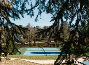
Close to downtown and in between several bed and breakfasts in Montford, NC, you'll find Montford Park. Though you may not expect it, the park boasts a couple of tennis courts, a basketball court, and some green space for picnicking, relaxing with friends, or getting lost in a good book.
People...
Read more
-
Asheville, North Carolina
The Martin Luther King Jr Park includes a large multi-purpose field as well as a playground that's great for kids. It's the perfect place to go solo to clear your head and chill with a book or with family and friends for an outdoor game.
Right at the entrance to the Park stands a statue of Mart...
Read more
-
Bryson City, North Carolina
NC 288 was constructed in the 1920's, but did not last long with the construction of the Fontana Dam as the resulting lake covered the highway. The U.S. government entered an agreement in which they would provide a replacement road, but to this day it has not been completed and is know by locals ...
Read more
-
Bryson City, North Carolina
Charlies Bunion via Kephart Loop is a loop trail located near Cherokee, North Carolina. This is a longer version of the Charlies Bunion hike starting from the Newfound Gap parking lot. The added benefit of this longer loop is the opportunity to see more of the Great Smokey Mountains! You'll pass ...
Read more
-
Bryson City, North Carolina
5.0
3.92 mi
/ 850 ft gain
Kephart Prong is a pretty easy hike in close proximity to the Visitor Center on the North Carolina Side of GSMNP. 2 miles up the trail, you'll arrive at Kephart Shelter, where you can rest and enjoy vies of the Kephart Prong. Once you've had your fill, head back down the way you came.
During th...
Read more
-
Clayton, Georgia
4.0
7.5 mi
/ 2378 ft gain
Black Rock Mountain State Park is Georgia's highest elevation State Park. It is adorned with several waterfalls, sweeping overlooks, blooming Rhododendron's, and plenty of miles of trail. The James E. Edmond trail is the longest and by far most challenging hike in the park. Its medium-long dis...
Read more
-
Fairview, North Carolina
Park along the road at Bearwallow Gap - this is also the parking area for Bearwallow Mountain. Starting at a little over 3600ft, the Trombatore Trail has been well marked by the Carolina Mountain Land Conservancy with red blazes. Parts of the trail border private land, so pay attention to the sig...
Read more
-
Hendersonville, North Carolina
Once you have parked along the roadside near the trailhead, pass through the big gate on the right side of the road and take the trail off to the right. The trail winds up the mountain for a mile before it empties out onto the bald atop Bearwallow. Once on the bald, you can follow the gravel road...
Read more
-
Franklin, North Carolina
Begins at the parking lot for the Standing Indian Campground. (No permits are needed to park here) For the first 3.7 miles, take Kimsey Creek Trail, which runs along the water, until you meet up with the AT at Deep Gap. Rolling hills and lots of foliage throughout, leading up to Standing Indian M...
Read more

