Balsam Grove, North Carolina
Top Spots in and near Balsam Grove
-
Gatlinburg, Tennessee
5.0
4.32 mi
/ 1640 ft gain
From the Sugarlands Visitor Center near Gatlinburg, drive approximately 13 miles south on Newfound Gap Road to reach the Newfound Gap Parking Area (it'll be on your left). The parking area is free and there are bathrooms. Follow the Appalachian Trail towards Katahdin, Maine (1972 miles away, woah...
Read more
-
35.610235,-83.426410
5.0
15.43 mi
/ 3100 ft gain
This hike can be started at the Alum Cave trailhead or the Boulevard Trailhead. For this particular adventure, the starting point is Alum Cave. If you're lucky enough to stay the night at the backcountry shelter on top of Mt. LeConte, (add 0.2 miles if coming from the Lodge), head east on the Bou...
Read more
-
U.S. 441, Tennessee
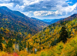
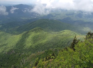
The Morton Overlook is one of the Great Smoky Mountains National Parks most well known and visited overlooks. Morton offers a wide view of the Great Smoky Mountains and is a perfect spot for some really good photography opportunities. Coming from Gatlinburg, TN it is roughly 13 miles from the vis...
Read more
-
Hendersonville, North Carolina
Park at the end of The World's Edge Road, but be aware that parking is very limited. There is a private residence up to the right so do not block their driveway/gate. Begin your hike by going through the leftmost gate, and continue straight until you reach the first view less than half a mile in....
Read more
-
35.556724,-83.495827
4.5
19.04 mi
/ 3500 ft gain
This is an overnight loop hike that is built around one night in the back country. It can be done as an ambitious day hike. Be advised that permits are required by the NPS for all overnight stays in Great Smoky Mountain National Park.
The hike begins at the Clingman's Dome parking lot at the For...
Read more
-
Bryson City, North Carolina
The drive to Clingmans Dome is miles of scenic overlooks that provide endless views of ridges and valleys. Clingmans Dome Road comes to a parking lot from which you follow a .5 mile paved trail to the summit.
There are also several trails that start on Clingmans Dome Road. Most notably The Appal...
Read more
-
Bryson City, North Carolina
5.0
3.55 mi
/ 1200 ft gain
The trail begins at the Clingmans Dome parking lot, just to the left of the paved walkway up to Clingmans Dome. You will start the hike at an elevation of 6130 feet which is only 334 feet less than Clingmans Dome which is the highest point in The Great Smoky Mountain National Park, and the second...
Read more
-
Bryson City, North Carolina
The first day of the hike is either 12.3 miles or 10.5 miles (depending on the campsite) almost all downhill, and the second half of the loop is 13.3 miles or 11.5 miles, again depending on the campsite, almost exclusively uphill. Just as a reference the first day took us about 6 and a half hours...
Read more
-
Gatlinburg, Tennessee
5.0
16.84 mi
/ 4429 ft gain
Appalachian Trail: Charlie's Bunion and Kephart Loop is a loop trail that takes you by a waterfall located near Cherokee, North Carolina.
Read more
-
Del Rio, Tennessee
5.0
1.51 mi
/ 315 ft gain
Max Patch Mountain was once cleared for pasture land, leaving an expansive flat summit that now serves as the ideal location for a picnic hike, flying a kite, or laying in the sun surrounded by the Great Smoky Mountains. With little elevation gain and a short distance it is also very family (and ...
Read more
-
Cosby, Tennessee
4.5
10.99 mi
/ 3040 ft gain
Most visitors have a vision of how they'd like to see Great Smoky Mountains National Park, and it typically involves climbing to the top of a mountain like 4,928-foot Mount Cammerer. This is a very strenuous hike involving a breathtaking amount of elevation gain along the rugged Low Gap and Appal...
Read more
-
Cosby, Tennessee
Start your adventure by parking in the Cosby Picnic Area Parking Lot near the entrance of the Cosby Campground. (127 Cosby Picnic Area Rd, Cosby, TN 37722.) Then backtrack through the parking lot about 100 yards until you see the sign marking the start of Gabes Mountain Trail.
The trek to Hen W...
Read more
-
Clayton, Georgia
Tallulah River Campground is located in the Chattahoochee-Oconee national forest. It is just outside of Clayton, Georgia. The campground has about 15 spots that are big enough for a small to medium sized RV. Each camping spot also has a nice tent pad for a big tent. Most spots are also on the riv...
Read more
-
Long Creek, South Carolina
These waterfalls are absolutely beautiful during the summer greenery and fall foliage, but open to access year around.Driving Directions: From Westminister, follow US 76 West for 11.8 miles and turn left onto Brasstown Road. Follow this road 4.1 miles to FS 751. (The pavement ends in 2.6 miles.) ...
Read more
-
Lake Lure, North Carolina
Chimney rock is a beautiful slab of weather granite that is visible from miles around. To get to this hike you'll want to head to Lake Lure in North Carolina, a beautiful lake located in the mountains of western North Carolina. Follow the signs for Chimney Rock and take the switchback road up t...
Read more
-
Lake Lure, North Carolina
5.0
2.98 mi
/ 1204 ft gain
Exclamation Point and Skyline Trail to Hickory Nut Falls is an out-and-back trail that takes you by a waterfall located near Chimney Rock, North Carolina.
Read more

