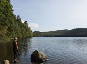
Wilmington, New York
Looking for the best camping in Wilmington? We've got you covered with the top trails, trips, hiking, backpacking, camping and more around Wilmington. The detailed guides, photos, and reviews are all submitted by the Outbound community.
Top Camping Spots in and near Wilmington
-
Lake Placid, New York
Hike Wright, Algonquin, and Iroquois Mountains
5.0Although a bit strenuous this loop climb up the MacIntyre Range is one of the most beautiful climbs in all the High Peaks. I suggest that you travel past Marcy Dam to Avalanche Lake and ascend the range in that direction as the trail from Lake Colden up to the ridge is very steep and best climbed...Read more -
Lake Placid, New York
Hike Phelps and Tabletop Peaks
12.6 mi / 3300 ft gainThe Adirondack Loj is a BEAUTIFUL place to go to, even if you do not plan on hiking. Located just ten minutes outside of the famous Lake Placid, you do not want to miss visiting this alluring Loj in the woods.Starting from Lot number 1 from the Adk Loj, begin hiking the 2.1 miles to Marcy Dam. Th...Read more -
Lake Placid, New York
Hike Mount Jo
4.8This short hike offers exceptional views, perfect for late night sunsets and early morning sunrises. Take a lunch date to the summit and enjoy overlooking Heart Lake and New York's highest peak, Mt. Marcy. The trail to Mt. Jo trailhead is located at the enterance station near the parking lot at t...Read more -
Keene Valley, New York
Nippletop, Indian Head, Gothics
5.021.55 mi / 7631 ft gainWe completed this loop over the course of 3 days in late June, however for those who pack extraordinarily light and/or travel extraordinarily fast, this loop could be completed in 2 days. There are also a plethora of trail intersections to either extend or shorten your loop to different preferenc...Read more -
Ausable Chasm, New York
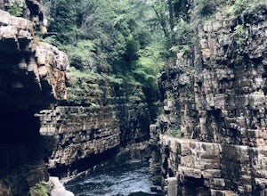
Ausable Chasm
1.84 mi / 210 ft gainAusable Chasm is a loop trail that takes you past scenic surroundings located near Peru, New York.Read more -
Keene Valley, New York
Backpack the Dix Range
4.517 miDay 1The trail begins about a mile past the intersection of Rt. 73 and Rt. 9 just east of a bridge over the North Fork Boquet River. Note: this trail is unmarked, so be sure to have an accurate map of the area. I recommend going to The Mountaineer store in Keene Valley and asking one of the cler...Read more -
Lake Clear, New York
Relax at Ampersand Beach
1.1 mi / 20 ft gainLocated across from the Ampersand Mountain trailhead on NY Route 3, a trail will take you a short walk (about a half mile) to this beautiful, quiet beach on the shores of Middle Saranac Lake. Starting at the trailhead, you will continue along an unmarked but clear footpath that trails through the...Read more -
Saranac Lake, New York
Camp at Fish Creek Pond
4.7Located in the Saranac Lake region there is a natural sand shoreline and water access for most campsites. There are countless rivers and ponds which allow use of motorized and non-motorized boats. The campsites are ideally located on Fish Creek Pond and Square Pond. The campsite offers a beac...Read more -
Long Lake, New York
Camp along Section 2 of the Northern Forest Canoe Trail
The Northern Forest Canoe Trail is a 740-mile paddling trail with the western terminus located in Old Forge, New York and the eastern terminus in Fort Kent, Main. Section Two is a 42.4 mile journey in the Adirondacks of New York from Long Lake to Saranac Lake. There are primitive campsites and ...Read more -
Long Lake, New York
Canoe from Long Lake to Tupper Lake in the Adirondacks
This is a 3-4 day adventure that begins with part of the Northern Forest Canoe Trail. Rent a canoe at a local outfitter and make arrangements for your vehicle shuttle. They will drive your car to the end point of the adventure. A couple of options include St. Regis Canoe Outfitters and Raquette...Read more -
Newcomb, New York
Paddle the Essex Chain of Lakes
Beginning in the Town of Newcomb, there is a sign for the Essex Chain of Lakes at the intersection of Route 28N and Pine Tree Road. Follow Pine Tree Road until you see a right for Goodnow Flow Road. Follow this road for 4.3 miles then take a right on Woody's Road. Take this road for 1.5 miles u...Read more -
Duxbury, Vermont
Camel's Hump Summit via Monroe Trail
4.86.22 mi / 2572 ft gainYou'll begin your Monroe Trail hike at approximately 1500', parking in one of three designated gravel lots along Camel's Hump Road in Duxbury. This trail is 6.8 miles round trip, and gains approximately 2583' in elevation. It is located on the east side of the mountain. Much of your hike will ...Read more -
Salisbury, Vermont
Camp at Lake Dunmore
The campground office for Branbury state park is on the opposite side of Route 53 from the pin on the map here, but the best campsites are where the pin is. Start by going and talking to the rangers at the office, they are super friendly and very helpful for recommendations of hikes or things to...Read more

